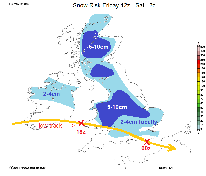
A fairly widespread risk of seeing some snow over the next few days across the UK.
A fairly widespread risk of seeing some snow over the next few days across the UK, some may get a covering - especially higher ground, some quite a good covering across parts of Wales, The Midlands, southern half of northern England in the next 12-24 hrs as we see a low scoot SE across Wales and southern England later today, bumping into cold air in place and also sucking in colder air with lower thicknesses and dew points behind it to bring snow to lower levels across England and Wales this evening/tonight - I have done a snow risk map below based on UKMet, NetWx-SR and GFS snow predictions.
Snow showers for Scotland and NW England too later today and through Saturday before easing in the evening.
Once the low clears, risk of some wintry showers for eastern England tomorrow, turning increasingly to snow I should think, by Saturday night, these sleet and snow showers perhaps keeping going across Kent and Sussex on Sunday morning before easing. Otherwise, Sunday's looking fairly dry.
Looking further ahead, high pressure rules right through to New Year's Day, then the big three hint at the high getting pushed away to the E/SE with pressure falling from the NW by Friday, but some uncertainty over the flow beyond that. 00z GFS op wanted to have block over Baltic and eastern Europe with the Atlantic shortwave troughs disrupting into Europe, whilst ECMWF and GFS para seem keen to have a more zonal progressive flow from the far North Atlantic in across Nern UK and on into Scandi with the high supressed into central Europe. Though potential even from this more progressive regime of some cold zonality- particularly in the north.
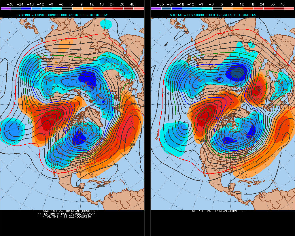
Despite the flatter ECM, it and GFS op in the end of the 'medium' range t+216-240 has a strong ridge building north across Alaska toward the North Pole (below), so a signal of waves from the trop starting up a renewed atttack on the Polar Vortex, perhaps helping to distort and disrupt it as we head into early Jan - which could bring a pattern change with a more sustained risk of cold/wintry weather later in January.