The Bank Holiday weekend offers a mix of sunshine and showers across the UK, not the complete washout some forecasting models were suggesting earlier this week. Next week, high pressure arrives on the scene, but only for a relatively brief stay.
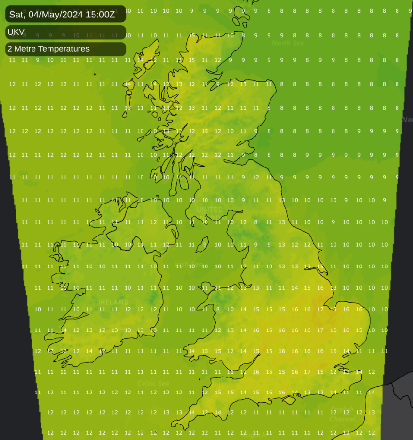
The weather has been somewhat warmer than of late since May got underway. Still, on Friday, it was mainly western Scotland that saw temperatures into the low 20s Celsius, with most of England experiencing somewhat cooler temperatures due to an area of cloud and rain, which prevented daytime temperatures from rising substantially. This is not that unusual at this time of year - mid to late spring and early summer quite often see blocking anticyclones to the north of Britain, giving easterly winds and sometimes bringing western Scotland the warmest and sunniest weather. The far northwest of Scotland looks set to continue to be among the warmest and sunniest parts of the UK over the Bank Holiday weekend. However, the jet stream will push northwards over the next few days, bringing a more traditional outlook with the warmest and sunniest weather generally towards the southeast.
The Bank Holiday weekend is a mixed bag, but not quite the washout some earlier model runs had forecast. For most of Scotland and Northern Ireland, it will be predominantly cloudy with some showery rain at times. In contrast, most of England and Wales can expect some warm sunshine but also some showers and occasional longer spells of rain.
Next week, unusually for recent months, we will see an area of high-pressure build across the British Isles, promising plenty of dry weather. It probably won't be consistently sunny in the north, where some areas of cloud will keep moving in from the North Atlantic into the area of high pressure. However, significant rainfall will tend to be confined to northwest Scotland. However, for most of England and Wales, especially in the south, a fair amount of dry, sunny weather can be expected next week. The high pressure looks likely to be short-lived, with the forecast models currently suggesting a breakdown sometime around next weekend with low pressure pushing back in from the west. However, the high could potentially hang on into next weekend in eastern parts of Britain.
Today, the weather has started cloudy for most of the country, but we have some sunshine, especially in parts of northwest Scotland and southern England. During the rest of today, a band of mainly light rain will affect Northern Ireland, southwest Scotland and northwest England, gradually pushing northwards and clearing away from northwest England. Northern Scotland will continue to see some sunny intervals, especially in the far north, and many places in the north of Scotland will remain dry, although some sharp showers will be set off over the Scottish Highlands. For England and Wales, the bright weather in the south will gradually push northwards, with south Wales and the English Midlands brightening up somewhat during the day. This brighter weather will probably not reach as far north as Cumbria and Northumberland. When the sun gets out, it will set off a scattering of sharp showers, mainly in southeast England.
In the cloudy areas, it will be relatively cool for the time of year, with much of Northern Ireland, Scotland, and northern England seeing highs of just 12 to 14C. In the sunnier areas, including northwest Scotland and the southern half of England and Wales, temperatures will climb to between 16 and 19C, and we may see 20C at some spots.
It will be a mild night tonight in Scotland, Northern Ireland, and northern England, with minimum temperatures mostly around 10C. However, in Wales, the Midlands, and southern England, it will be rather cooler due to clear skies and light winds, with some places dropping to between 3 and 5C.
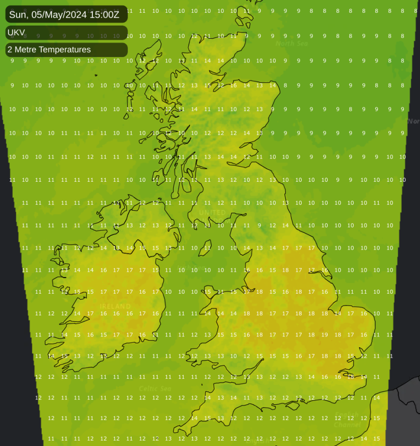
Sunday will be similar to today, with mainly cloudy weather for Scotland and Northern Ireland, except for the far northwest of Scotland, which will remain warm and sunny. Showers in the Scottish Highlands are likely to be more numerous than today, with potential for some thunder. For England and Wales, there will be sunshine and scattered showers. However, cloudier weather will push into southern areas during the afternoon and evening, with some showery rain mainly for the southwest.
Sunshine and showers will dominate the weather on Monday. Some showers will be heavy and thundery, especially in western Britain. Still, most places will also see some warm sunshine, with temperatures reaching between 16 and 19C. The exception will be the northern half of Scotland, where it will be generally cloudy and cooler.
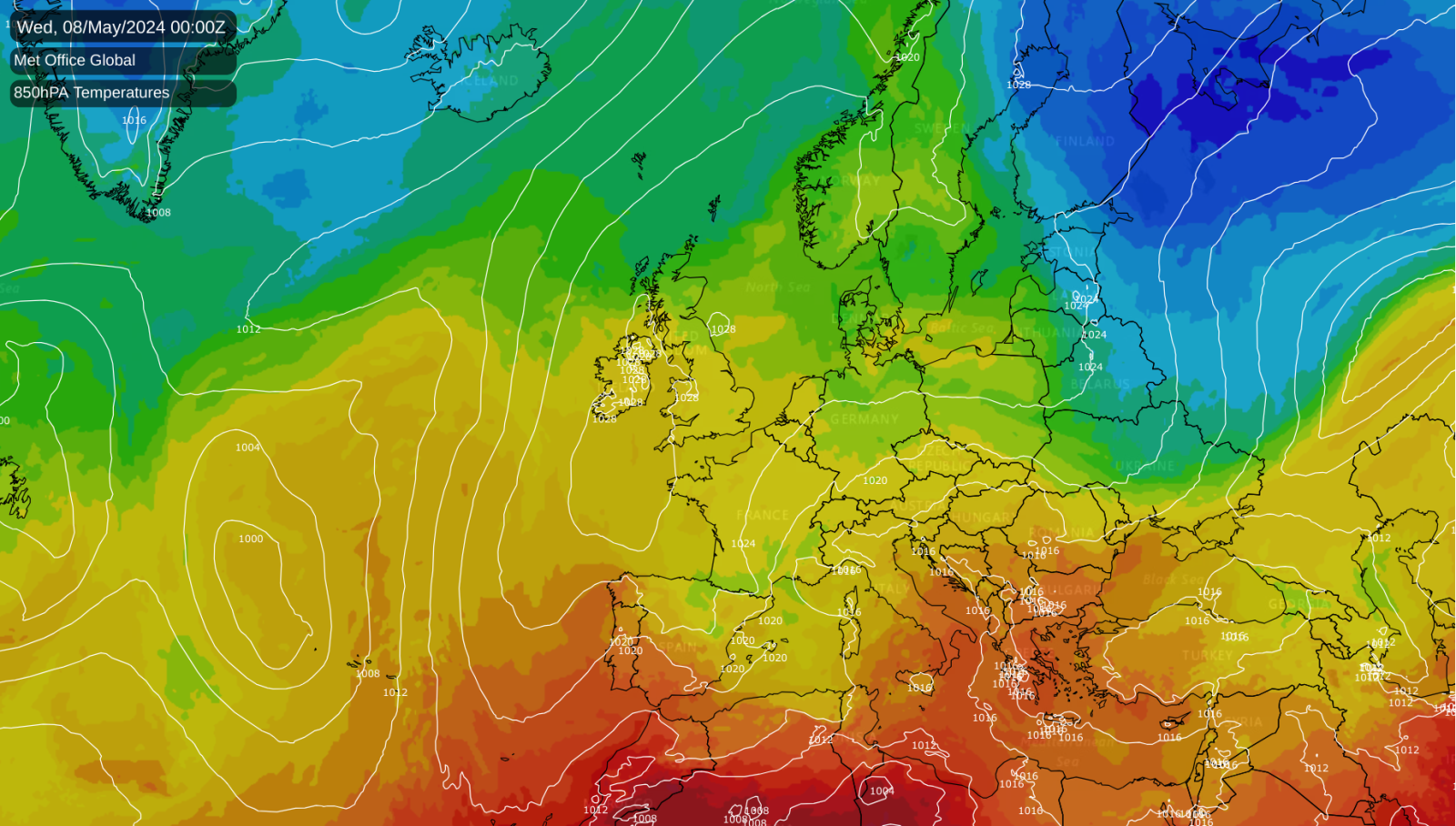
High pressure will build through Tuesday and Wednesday, bringing warm and sunny weather to most of England and Wales and temperatures into the low 20s Celsius. However, on Tuesday, there will still be a scattering of sharp showers, which are most likely to especially affect the Midlands and the north of England. It will generally be cloudier in Scotland and Northern Ireland, but with some brighter spells, and rain will affect the north and northwest of Scotland on Wednesday.