


The gales are already affecting life on the Western Isles, with strong winds and rain turning to severe gales and snow showers by Wednesday for NW parts of the UK
14:27
Wind day (not a Snow day yet) as all schools and nurseries will be closed on the Western Isles on Wednesday
SEPA have now issued Flood warnings for For William and Lochaber.
Some Ferry services to Shetland have been cancelled for Wednesday, others under review
10:00
The Met Office has just issued an Amber alert due to the strength of the winds forecast for the middle of the week. This covers western and northern Scotland, the Islands and parts of N.Ireland.
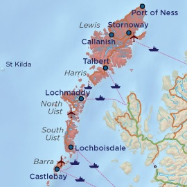
Western Isle ferries are already facing disruption with warnings of cancellations in the very rough seas and stormy weather. Schools have been closed and police are beginning to close some of the causeways which link the islands. Stornoway has already recorded a gust of nearly 70mph. Trains and buses are now being cancelled for Weds, in the NW Highlands.
SEPA have issued an Amber alert for coastal flooding across the whole of the Western Isles. Very high waves are expected to affect the area from Tuesday morning. Exposed coastal areas including roads, causeways and low lying properties may be at risk from flooding due to wave overtopping particularly during periods of high tide. There is another high tide on Tuesday evening at Leverburgh at 8pm.
SEPA also have coastal flood alerts for Western SCotalnd and the far north of the mainland and the Norhtern Isles due to these very large waves
Wednesday will see the worst of the winds with snow showers adding to the dangerous conditions, especially for higher level routes. Very large waves will continue to smash in from the Atlantic.
The Environment Agency for England and Wales have also updated their alerts for Weds 10th with coasts of NW England being identified. "Gale or severe gale force westerly winds and large waves will develop along western coasts this evening and through Wednesday. This may cause some localised spray and waves to over-top coastal promenades and possibly affect individual properties."
Wind South veering west or southwest, gale 8 to storm 10. Sea state Very rough or high, becoming very high or phenomenal.
Even the inshore waters forecast for coastal areas up to 12 miles offshore
Wind West gale 8 to storm 10, occasionally violent storm 11.
Sea state Very high, becoming phenomenal for a time.
Weather Squally wintry showers.
Visibility Moderate or poor.
Douglas Sea states page 17
For the northern half of the UK, this stormy weather will ease through Thursday morning
Links Facebook page for Western Isles WIEPCG (Western Isles Emergency Planning Coordinating Group)
SEPA - Flood alerts and Warnigns in Scotland


