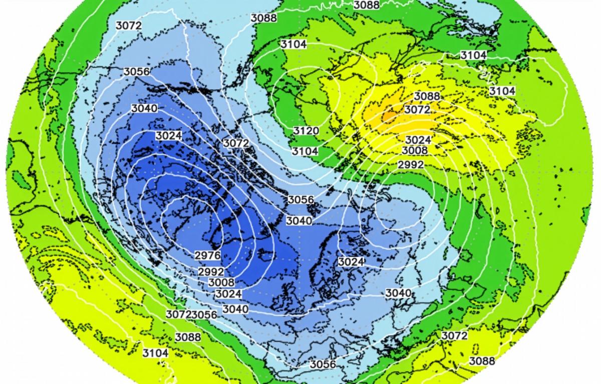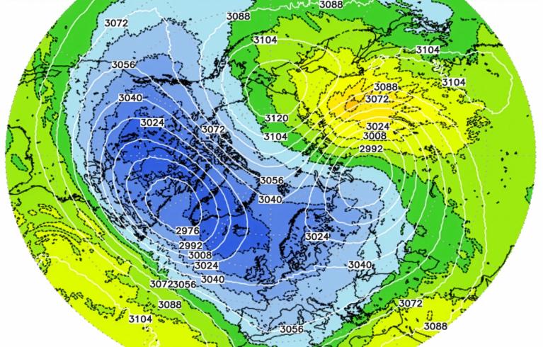


Since the beginning of the satellite era, no major sudden stratospheric warming (SSW) has ever been observed in early November. But this could change with a SSW likely from around November 5th over the Arctic. Before the satellite observation era, for which data is less reliable, only two such events had been documented.
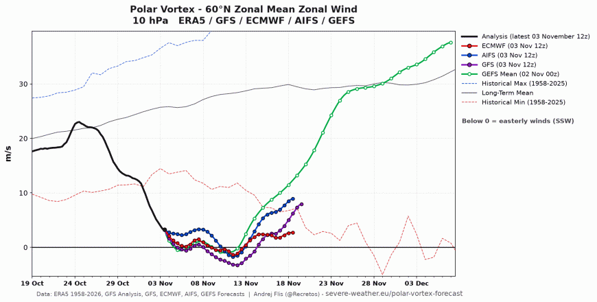
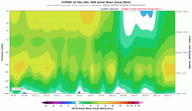
SSW, where westerly winds at 10 hPa 60N reverse (fall below 0 m/s), is forecast from 5th of November
A SSW is more common in January and February. It has occasionally occurred in December, but never since the beginning of this century. Models now predict a disturbance that would occur nearly three weeks before the earliest known major SSW.
The polar vortex is a vast, low-pressure, cold-air circulation that rotates counterclockwise around the North Pole. It forms each autumn in the stratosphere and has a significant influence on winter weather patterns in the Northern Hemisphere. When the polar vortex is strong, it remains concentrated around the North Pole, helping to keep cold air trapped in the Arctic regions. Conversely, when it weakens, it can shift and allow masses of frigid air to descend southward into the mid-latitudes.
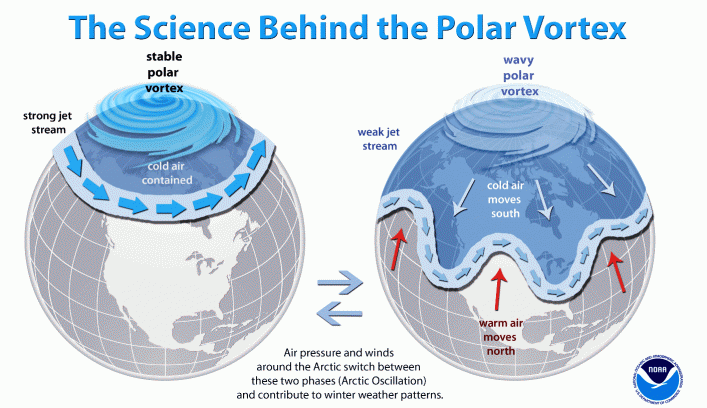
Large atmospheric waves that propagate from the troposphere to the stratosphere weaken the polar vortex when they collide with it. If these waves are powerful enough, the vortex can weaken to the point of causing a temporary reversal in wind direction.
The current strong El Niño could be a factor weakening the polar vortex by creating these atmospheric waves propagating upward into the stratosphere.
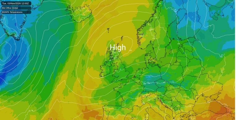
But also a strong blocking high pressure system over the Urals and Scandinavia has also been propelling large atmospheric waves into the stratosphere and thus contributing to weakening the polar vortex.
When the vortex weakens, the reversal of westerly winds in the stratosphere to easterly can propagate down towards the troposphere, causing greater dips in the jet stream, which can allow Arctic air to spill farther south into the mid-latitudes of Europe and North America, including the UK, though there are no signs of this happening at the moment.
This year’s record-breaking El Niño makes the possibility of a weakened polar vortex more likely, the event becoming the strongest observed in the modern observational record. Although the El Niño is in the tropical Pacific, a major event can alter atmospheric circulation patterns much farther away.
The seasonal forecasts released in October signalled an increased likelihood of wetter than average and stormy conditions in November, which would be consistent with the historical influence of El Niño events. The C3S multimodel forecast updated last month low pressure dominating this month, but that doesn't look the case so far for the first half of this month, with high pressure dominating.
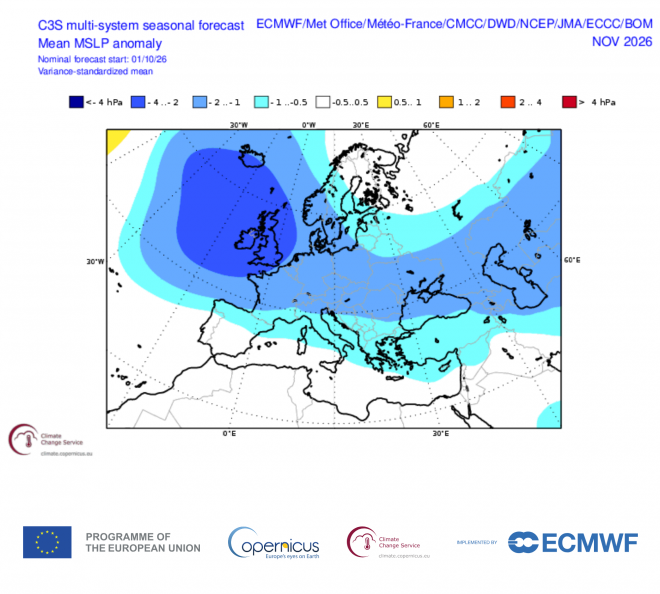
However, El Niño is only one of several factors affecting the UK’s weather and the wind reversal from SSW, should it propagate downward, could promote high latitude blocking that fends off Atlantic lows and the stormy weather they bring. Though the impacts of the ongoing stratospheric warming on the troposphere remain highly uncertain. The forecast impacts look quite weak at the moment and are unlikely to impact the troposphere, where our weather happens, in November, and its impacts are very uncertain in December.
The ECWMF forecast chart below for 60N zonal mean zonal winds shows the reversal high up in the stratosphere (whites/blues) not really propagating downwards towards the troposphere
There are drivers to consider too that may also have impacts on the weather patterns this month. A large-scale, eastward-moving atmospheric disturbance in the tropics, marked by enhanced tropical convection over the Indian Ocean, known as the Madden Julian Oscillation, may also shape weather patterns over the mid-latitudes. It is currently over the Indian Ocean and moving slowly towards the western Pacific.
For now, a Sudden Stratospheric Warming (SSW) looks to occur from later this week, with westerly winds at 10 hPa 60N falling to and below 0 m/s on Thursday 5th and perhaps not recovering above this until after Friday 13th.
However, at the moment, the reversal looks unlikely to impact the troposphere, where our weather happens, in November, and its impacts are very uncertain in December.
So there will continue to be a disconnect between what is happening in the stratosphere and the troposphere. The troposphere patterns will continue to be determined by other drivers, such as the MJO and super El Nino.
Loading recent activity...