Storm Barbara has moved away from the UK and is now over the Norwegian Sea. The highest wind gusts from Barbara on Friday were across northern and western areas.
In the wake of Barbara there is a strong westerly wind – which is dragging in a cold polar maritime airmass sourced from the southern tip of Greenland and Canadian maritimes. So northern areas, generally northern England northwards, will see lots of wintry showers packing in from the west during Christmas Eve, falling a snow over the hills and mountains of Scotland but also to lower levels in heavier bursts. Some places may even see some thundersnow too, with thunder and lightning being detected this morning from heavier wintry showers across northern Scotland. The strong westerly wind will gust to 55-65mph through Christmas Eve too, particularly across western Scotland, with higher gusts with exposure, particularly across the Northern Isles.
Blowing cold Christmas Eve as Barbara departs, then mild for Christmas Day ahead of Storm Conor, then cold as Conor departs
A change in airmass Saturday night into early Christmas Day, as milder air behind a warm front sweeps northeast ahead of the next named storm Conor out in the Atlantic arriving to the north of Scotland later on Christmas Day. It will be an exceptionally mild start to Christmas Day, perhaps record-breaking, with temperatures reaching 12-14C widely in the morning, perhaps 15C in a few spots. So any snow over northern hills from Christmas Eve will rapidly melt apart from over the highest mountains tops.
Warm front ahead of Conor ushers in a mild start for Christmas Day
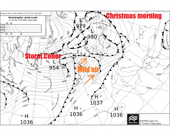
Storm Conor sweeps northeast to the north of Scotland later tomorrow and into Boxing Day morning, bringing a risk of wind gusts reaching 80-90mph to the far north of Scotland and the Northern Isles, gusts of 50-70mph further south towards the central belt of Scotland. It will also turn colder too across Scotland Christmas evening, as winds turn westerly, behind a cold front sweeping southeast, with showers turning increasingly wintry, with snow falling from heavier showers accumulating above 200m overnight into Boxing Day. Mild but cloudy and drizzly throughout Christmas Day across southern areas, before the cold front with a band of rain clears SE England early hours of Boxing Day.
Colder conditions arriving Christmas night into early Boxing Day:
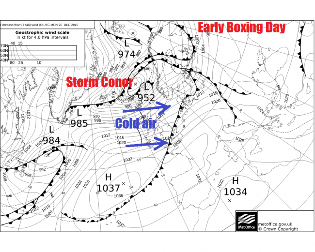
Colder for all parts on Boxing Day, especially across the north – where gales or severe gales will bring frequent wintry showers, with further snow over the hills of Scotland, Conor still close enough to bring winds gusting to 70-80mph across the far north. Dry, bright and less windy across the south.
High pressure builds in for next week
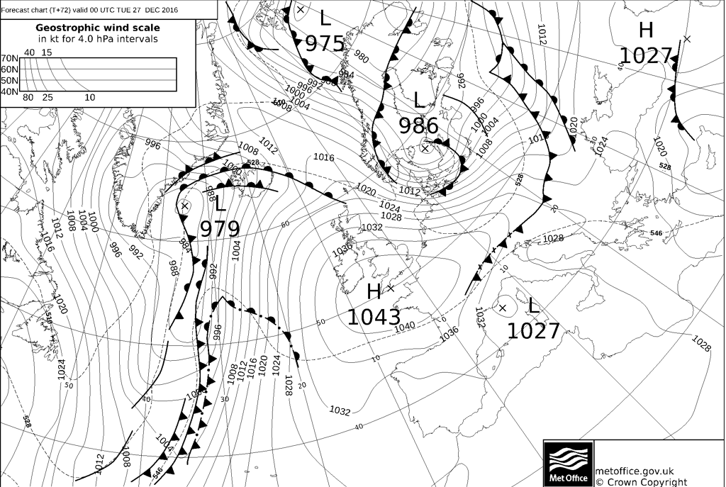
As Conor moves away towards the Norwegian coast, pressure will rise rapidly from the southwest, so by Tuesday lunchtime, GFS model has pressure as high as 1044mb across southern England. This high building across the south will be a dominant feature for the rest of the week, bringing mostly dry and sunny conditions for the rest of the week away from the far northwest
The centre of the high over southern England on Tuesday ends up on the near continent later in the week, but nearer the centre of the high across central, southern and eastern England – where winds will be lighter, there will be a risk of frost and fog forming overnight and day time temperatures will struggle too, especially where fog lingers, with temperatures staying in low single figures.
Towards the northwest, more of an Atlantic influence away from the centre of the high, especially later in the week, with a southwesterly breeze developing across northern and western Scotland along with Ireland and N. Ireland, turning into a brisk southwesterly wind later in the week – which will drag in milder air, cloudier skies and some rain or drizzle off the Atlantic for these areas later in the week.
Cold northerly for New Year's Day?
Confidence naturally falls by next weekend for New Years Eve and Day which is 7 days away, but the medium range model output of GFS and ECMWF are in broad agreement for the high pressure influence over southern parts to retreat into the near continent while out west the upper flow amplifies downstream from N America over the Atlantic to build a ridge of high pressure north mid-Atlantic toward southern Greenland. This pushes a wedge of cold upper air and low pressure southeast towards the UK over the weekend then a cold northerly flow by New Years Day. Though it’s too far away to say whether snow is likely. Some uncertainty how long the cold northerly will last, though models suggest a brief cold snap for now.
Loading recent activity...