The fine and settled period of weather that has arrived over the last few days is due to the development of high pressure. However, in keeping with the summer overall the development of this more summer-like period of weather will be relatively short-lived. The high pressure that is producing the warmer and sunnier conditions at the moment will begin to decline to the east and north-east of the UK in the coming days and returning from the west will be lower pressure. The primary reason for this is the continued development of what is quite an active jet stream pattern across the North Atlantic.
Amongst a number of reasons for development, one of the primary reasons for a more pronounced jet stream is a temperature (thermal) gradient, in which temperature changes quickly over quite a short distance. The more pronounced this gradient is then, more often than not, the more substantial the jet stream is.
As we continue to progress through this coming week, this is exactly what is expected to happen, and you can see that on the below weather charts. Note how temperatures within the atmosphere (850mb level or 4500ft up into the atmosphere), to the west of the UK, change significantly over a short distance. Temperatures to the South of Greenland are near 0C, but follow this southwards, and temperatures soon rise to near 15C.
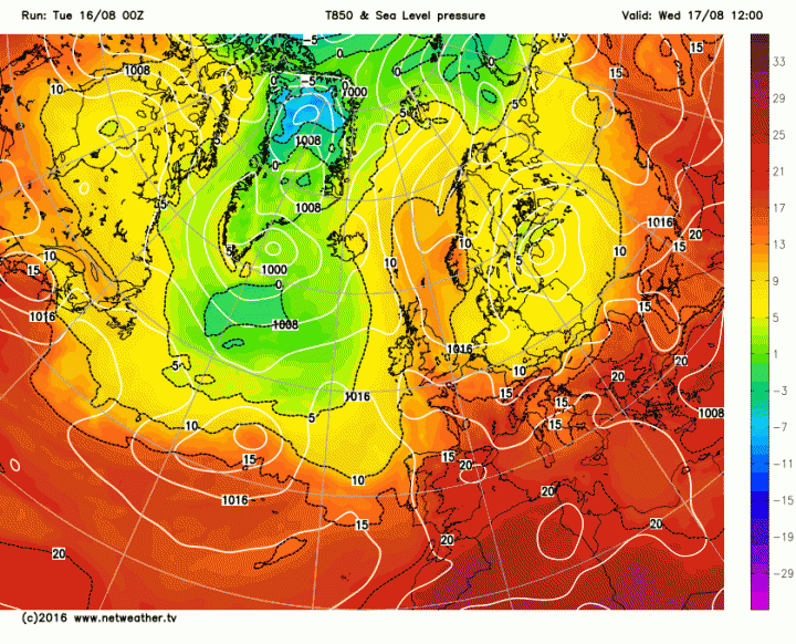
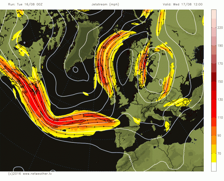
This then coincides with the location of what is quite a pronounced jet stream for the time of year. Whether it is August or January, having this type of jet stream pattern across the North Atlantic usually only leads to one setup and that is low pressure and more unsettled conditions.
The breakdown to more unsettled weather will begin to take place though within the shorter term. Weather fronts trying to move into the UK will make some progress later today and through into Wednesday but, overall, will still be held at bay by the high pressure bringing the fine weather. However, parts of Ireland, Wales and SW England will see an increasing risk of some locally heavy and perhaps thundery showers later today and overnight into Wednesday, whilst longer spells of rain may then develop, in places, during Wednesday too. This evolution can be seen on our high-resolution 4KM model, with some evidence for heavy precipitation across the west and south-west of the UK in the coming 24 to 36 hours.
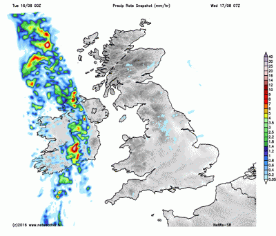
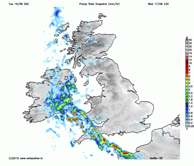
In contrast to this though will be more northern and eastern areas of the UK. These areas of the UK will still be in closer proximity to the high pressure that will be declining away to the east and north-east. As a result parts of Scotland, N and E England will maintain a lot of dry and fine weather up to and beyond mid-week, with rain and showers not expected here until the end of the week.
As we approach the end of the week and move into the weekend, the jet stream will allow for the development of an area of low pressure to move into the UK from the south-west. Seeing that the jet stream is forecast to be well organised for the time of year then this will allow the surface low pressure to become quite deep, bringing more prolonged spells of rain, in association with its weather fronts, along with some potentially unseasonably windy weather too. Never a good thing at this time of year.
The latest model runs from the GFS and the UKMO, for example, highlight this evolution well. Clearly noting that by the time we get to the start of Saturday a noteworthy area of low pressure is situated over or just to the west of Ireland with some particularly strong winds too, this exampled by the close proximity of the white lines (isobars) which indicate wind strength and direction. Parts of Wales, Ireland and SW England may well be at risk of strong or even near-gale force wind gusts, especially around coasts and hills as we move into Saturday, something for holiday-makers to be aware of given the time of year.
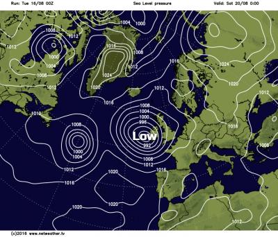
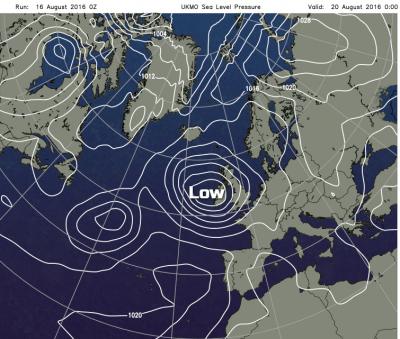
In summary, whilst the current fine and settled period of weather is indeed welcomed by many. Unfortunately, the evolution through the next 5 to 7 days is back to lower pressure and more unsettled conditions. Those initial changes will be experienced across parts of the west and south-west of the UK in the coming days, whilst a more pronounced change and breakdown in the weather then arrives from the west and south-west late in the week and into the weekend. This, unfortunately, means a very different weekend coming up than compared with the weekend just gone, with spells of wet and windy weather on the way along with cooler temperatures too, so make the most of the fine weather of present.
Loading recent activity...