At one time it looked as if Britain's weather was going to be dominated by high pressure for much of the second half of October, but - rather going against the trend of 2026 since early spring - the high now looks to have been overdone by most of the forecast models last weekend, and is looking set to move away through Monday and Tuesday next week. This will allow a changeable westerly type to develop. The weather looks set to become rather wet, though not exceptionally so, with the usual pattern of rain bands crossing the country, interspersed with brighter, showery weather.
Many areas of southern and eastern Britain could do with substantial rainfall after a long dry spell since early spring, although much of north-western Britain has had plenty of rain for much of this year. There are hints, particularly on the extended runs from the GFS model, that the weather may temporarily turn drier and more settled again towards the end of October and into the first week of November, particularly in eastern Britain, with high pressure developing close to the east and south-east of Britain. However, the majority of signals point towards generally wet weather for the rest of this year, with a likelihood of an Atlantic trough developing by early November and pushing eastwards towards the British Isles towards midmonth.
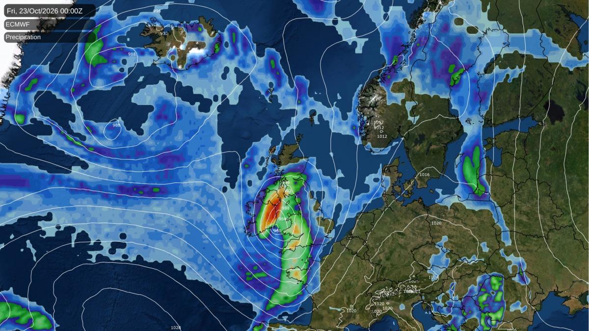
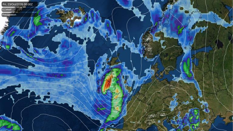
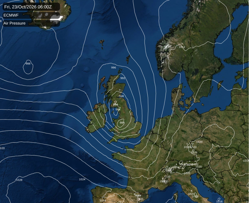
There is potential for damaging winds late next week, which is worth keeping an eye on. The latest ECMWF run has an intense secondary low crossing southern Britain next Friday. This has potential to bring severe gales, although at this range there is still plenty of uncertainty over the track and intensity of the system.
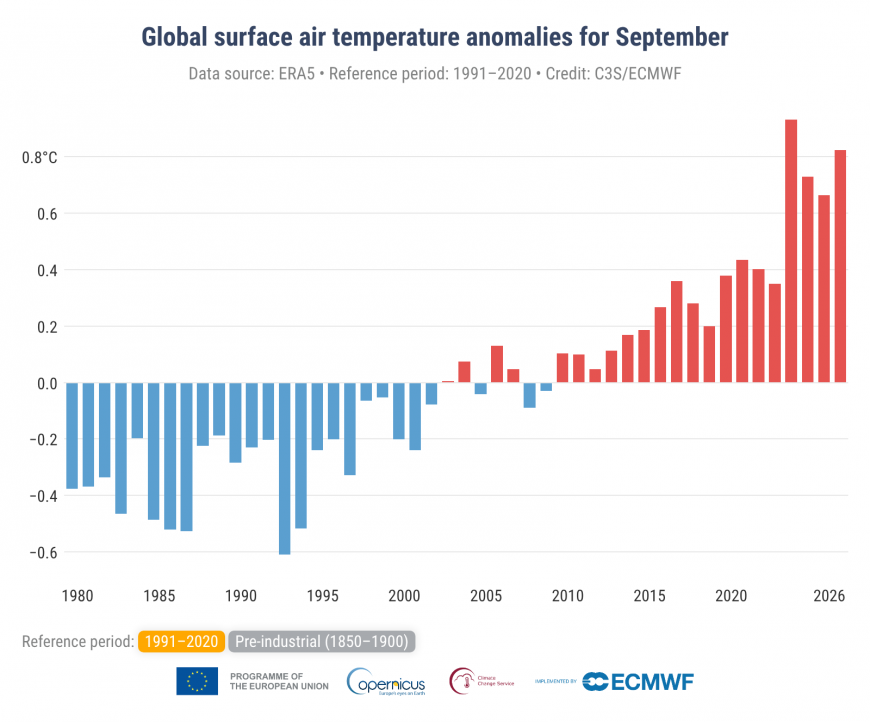
According to the latest Copernicus climate bulletin, which is based on the ERA5 reanalysis product, September 2026 was not quite as warm globally as September 2023, but it was warmer than any other September. September 2023 was a particularly anomalously warm month globally, and also had an exceptional hot spell in Britain early in the month. September 2026 fell behind purely because of cooler temperatures over the land masses, while the oceans remained record warm by a fair margin, assisted by the record breaking El Nino event in the Pacific.
According to the Climate Reanalyzer, global temperatures during early October have been roughly tied with October 2023. Generally in the last three months of the year, 2023 was not as anomalously warm globally as during September, which gives 2026 a greater chance of setting new record warm months globally in the last three months, particularly with the El Nino continuing to strengthen. But so far the mean global temperatures are yet to jump up to the extent that we saw in mid to late 2023 with the 2023/24 El Nino event.
While the Atlantic hurricane season has been relatively modest so far this year, the Pacific one has proved to be the strongest on record, likely boosted by the record breaking El Nino event in the Pacific Ocean. Back on 10 October, Hurricane Simon came very close to making landfall as a hurricane in south-western Mexico, reaching Category 4, with sustained wind speeds of 155 mph. It quickly dissipated when it hit the land mass, but is currently estimated to have caused about $10 million damage and to have killed 5 people.
In terms of financial costs, the most damaging Pacific hurricane of the season so far was Hurricane Lowell, which escalated to a Category 5 hurricane for a time, and made a direct hit on the western Hawaiian Islands. Although it was downgraded to a Category 2 hurricane by the time it hit the islands, it is estimated to have caused around $400 million in damage, as well as killing three people. Scientific researchers have suggested that the warming climate has assisted the unusually warm sea surface temperatures along Lowell's path.
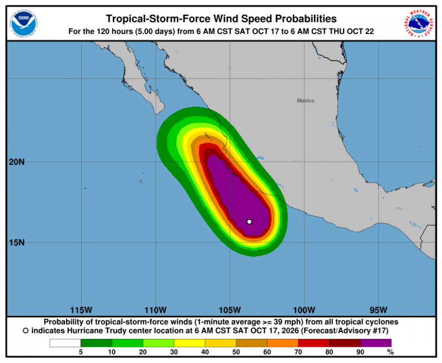
The currently active Pacific hurricane has been named Trudy. Hurricane Trudy is currently fading, but is looking set to come very close to the west coast of Mexico, with wind gusts of up to 100 mph forecast and potential for very heavy rain.
Loading recent activity...