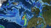
A band of rain crossing England and Wales in the small hours of Monday is expected to stretch from the south-east and East Anglia to Yorkshire and Lancashire. It is heaviest for a time over the Fens and south Lincolnshire. The rain should clear most of Wales and the west Midlands by breakfast time, but is likely to hang on over mid-Wales, Cornwall and the North Pennines into late morning.
Monday afternoon then looks mostly dry across England and Wales, with a low risk of a shower, highest in Devon and the north-east, and temperatures of 11 to 15C, about average for late October.
Under clear skies, Scotland and Northern Ireland start Monday with a frost. Air temperatures will fall to around -2 to -3C in upper Clydesdale near Biggar, Highland Perthshire around Pitlochry, upper Deeside and inland County Down near Banbridge. There will be a hard ground frost in rural parts, and Perth should get down to about -1C. A sunny day follows, with a 30 to 40% chance of rain on Monday evening, mainly over the Grampians and the Southern Uplands. A second, lighter frost, mainly on the ground, is likely on Thursday morning in the Southern Uplands, the Eden valley, Highland Perthshire and County Antrim, with temperatures near 0 to 2C.
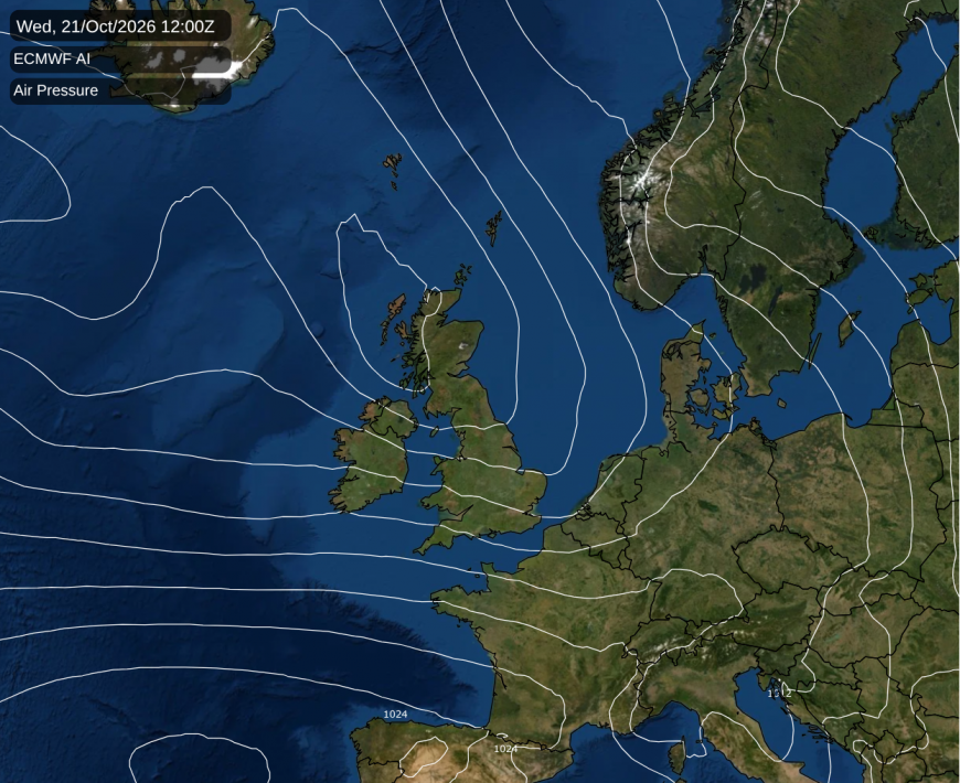
High pressure drifts away to Scandinavia on Tuesday, leaving slack pressure over the country and a grey, damp day. Patchy rain and drizzle are expected across much of eastern and central Britain, with a 70 to 80% chance of some from Scotland down to the south coast and in Wales. Exactly where the steadiest of it sets up is uncertain. An Atlantic cold front brings rain to Northern Ireland and western Scotland on Tuesday evening. On Wednesday morning the front clears south-east, while low pressure moves east across northern Scotland into the North Sea.
A blustery west to north-westerly follows on Wednesday, with gusts of 40 to 50mph around the Irish Sea coasts in the morning, strongest on Anglesey. Showers are likely almost everywhere, most frequent in Scotland, Northern Ireland and north-west England. Wednesday should feel chilly in the west, about 8 to 10C across mid Wales, the west Midlands and Lancashire, against 14 to 15C in Essex and Kent. The Met Office's global model, which our figures follow, keeps Wednesday's low shallow, but ECMWF, the American GFS and ECMWF's AI model make it deeper, so Scotland and northern England could be windier and wetter than described here.
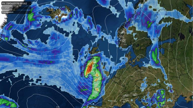
Thursday is likely to be quieter, with lighter winds, after a spell of heavy rain along the south coast counties before dawn. There is disagreement over whether that rain comes ashore over Sussex and Surrey or stays just offshore. Showers should keep going in western Scotland on Thursday. Meanwhile, a wave on the trailing Atlantic cold front is expected to deepen rapidly south-west of Ireland into a vigorous low. Its rain should reach Cornwall, Devon and south Wales on Thursday evening, perhaps a few hours sooner, heavy over Dartmoor. By midnight it is likely to have spread across southern England, Wales and the Midlands, and there is a 50 to 70% chance of rain reaching northern England, East Anglia and Northern Ireland by then.
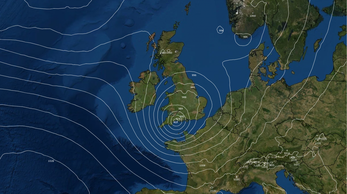
The low is currently expected to cross Wales and southern England overnight and on Friday morning before heading out into the North Sea by evening, although its exact track and the timing is still uncertain. Friday looks wet across much of England, Wales and southern Scotland, with heavy rain likely near the centre of the low. Where the heaviest bursts end up will depend on the track it takes, but north-west England, north Wales, Yorkshire and the Midlands look most at risk later in the day. Northern Ireland and northern Scotland are likely to see some rain too, though probably less.
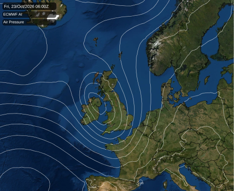
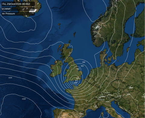
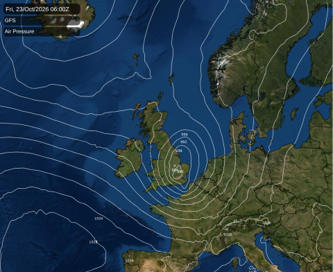
Strong winds are likely to accompany the low, bringing a risk of gales or severe gales, but where and when the strongest winds occur will depend on its track and depth. Southern and western coasts look most exposed, and the strongest gusts could spread inland across parts of Wales, southern England and the Midlands at times on Friday, with blustery conditions possible further north too. Combined with the heavy rain, this could make for a disruptive day in places, but with the models still disagreeing, it is too early to say how strong the winds will be or which areas will see the worst of them. Friday afternoon is expected to be chilly, around 7 to 10C across most of England and Wales.
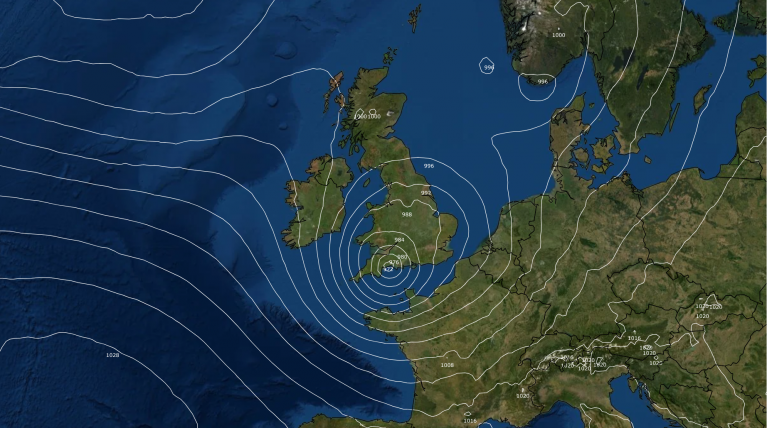
Friday's detail is far from settled. Our figures take the low from the Bristol Channel across Hampshire and out through Essex and Suffolk, near ECMWF's track but less deep. ECMWF makes it deeper, which would mean stronger winds along the Channel coasts, while the American GFS runs it a little further north across the Midlands. ECMWF's own AI model takes it 200 miles further north-west, across Northern Ireland and south-west Scotland, which would spare southern England the worst of the wind and push the heaviest rain further north.
Loading recent activity...