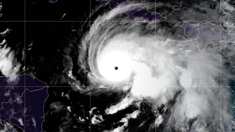
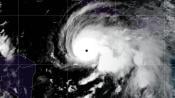
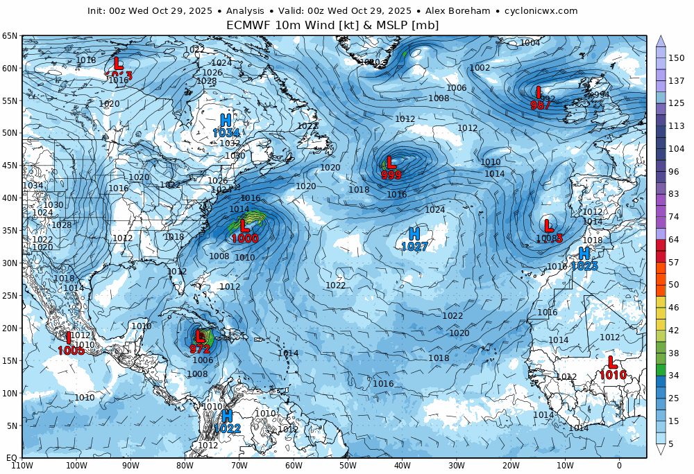
Melissa made landfall along the southwestern coast of Jamaica near New Hope as a powerful category 5 hurricane early Tuesday evening, early afternoon local time. The strongest hurricane to hit the island in recorded history. The likely minimum central pressure of 892mb at landfall with max sustained winds of 185mph ties Melissa with the Labor Day hurricane of 1935 as the strongest landfalling hurricane on record in the Atlantic, and tied third strongest hurricane over the Atlantic basin. The strength of the hurricane aided by anomalously warm SSTs in the region.
Melissa has left a trail of destruction in its wake across Jamaica, after the hurricane made landfall with 185mph winds and storm surge from the sea - bringing destruction to property, while extreme rainfall brought life-threatening flash-flooding. About three-quarters of the island is without power, and many parts of the western side of the island are either under water or have homes destroyed by the strong winds.
Melissa weakened after landfall across Jamaica as its slow track across land took away its fuel source of the warm ocean, with the eye collapsing. However, it reorganised again as left Jamaica’s north coast and moved out over open water, the storm restrengthening as it approached eastern Cuba, category 4 for a time with 130mph winds, then making a 2nd landfall over the southern coast of eastern Cuba near Chivirico at around 3am local time as a category 3 hurricane with 120mph max sustained winds.
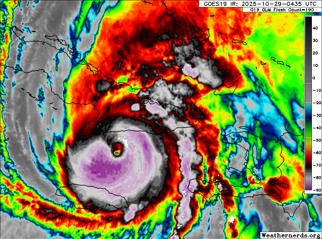
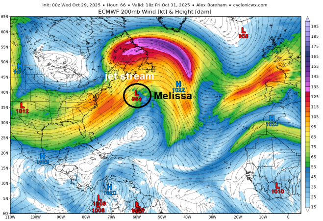
Melissa will continue northeast inland over Cuba, fortunately at a quicker speed than over Jamaica, and perhaps weakening somewhat, but still a powerful major hurricane with 115mph max sustained winds and heavy rainfall bringing the threat of life-threatening flash-floods. After crossing eastern Cuba this morning, Melissa is expected to continue accelerating northeastward over portions of the southeastern and central Bahamas this afternoon. Then, the models consensus is for the centre of Melissa to pass to the west of Bermuda late Thursday and into Friday.
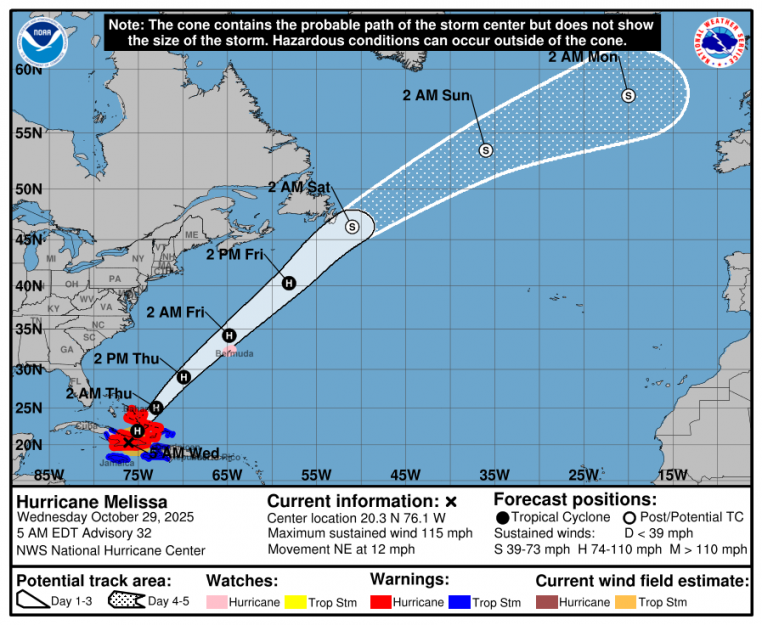
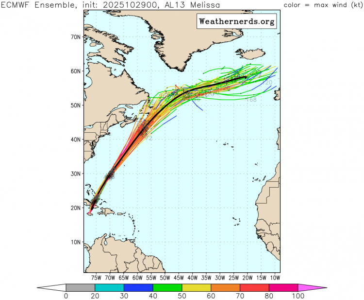
From then on, Melissa continues northeast over the open NW Atlantic, eventually losing tropical characteristics Friday night or early Saturday, becoming an extratropical cyclone southeast of Nova Scotia, eastern Canada. Around here, it will be picked up by a fast jet stream coming out of North America and out over the NW Atlantic and the extratropical cyclone containing the remnants of Melissa then carried northeast towards the NE Atlantic between Scotland and Iceland into early next week. Though models diverge on the track and depth of cyclone / low as it approaches the NE Atlantic.
Nevertheless, Melissa and its remnants will likely inject alot of energy into the jet stream, bringing heat and moisture along the polar front jet stream, with the contrast against polar air spilling south along the jet stream strengthening it and keeping a mobile and unsettled pattern continuing across the UK through next week, with spells of wet and windy weather at times.
Loading recent activity...


.png?w=1200)

.png?w=767)