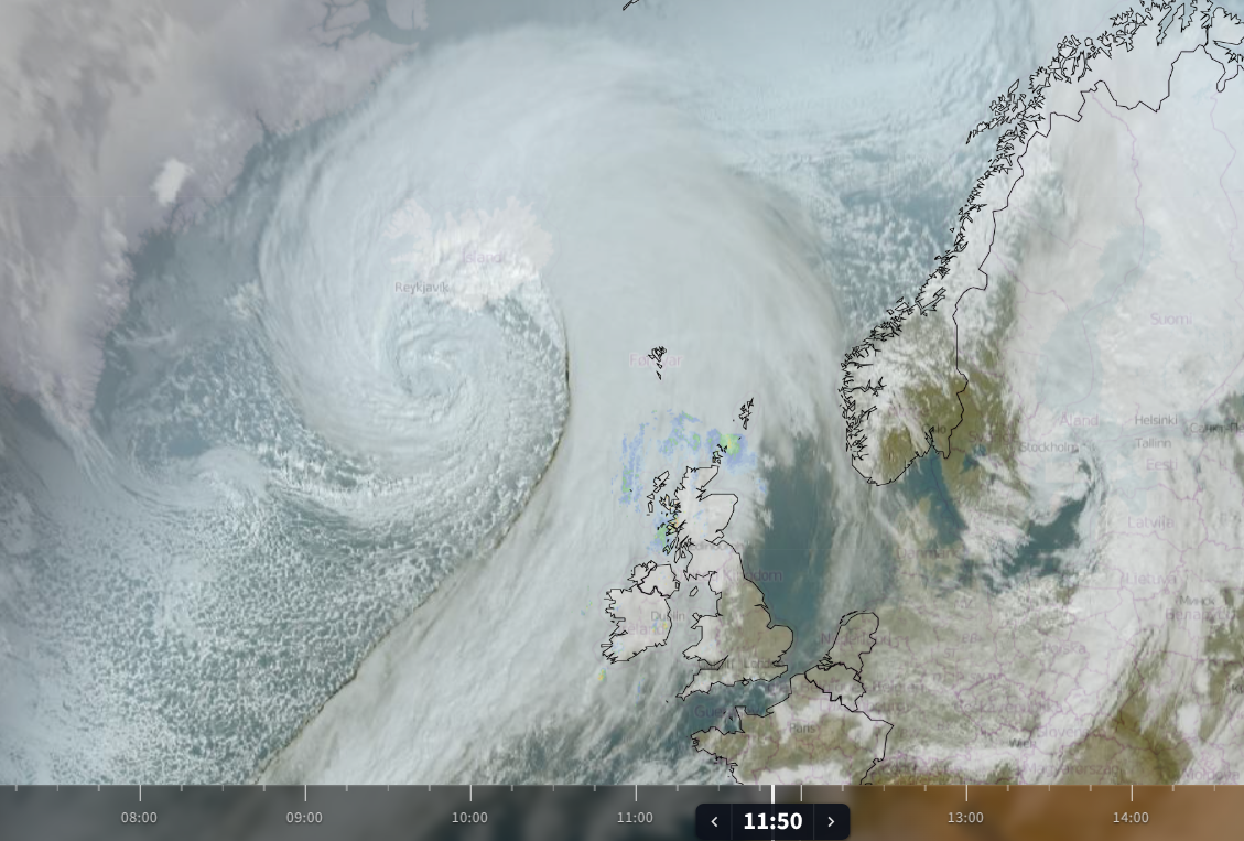
Satellite imagery from Wednesday 14th October shows an incredible swirl of cloud over the north Atlantic. A significant area of low pressure close to Iceland has brought storm force winds and blizzard conditions there, with travel disruption and damage in this autumn storm. In the south, a gust of 57m/s (127.5mph) was recorded according to RÚV, The Icelandic National Broadcasting Service, with potentially records falling for the strongest gust in October, and the lowest pressure value in October. We await updates.
The Icelandic Met Office “Unusually low pressure (down to 934 hPa) is forecast over Iceland today. Also, high waves are expected near the coast. Chances of high sea states tomorrow [15th] and possibly localised coastal flooding at the south, east and north coasts.”
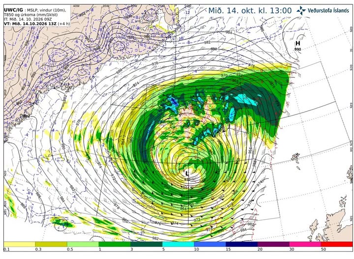
This low pressure has also influenced our UK weather with a windy day for Scotland and Northern Ireland. A gust of 108mph was recorded early afternoon at Bealach na Bà, a winding mountain pass through the Northwest Highlands on the way to Applecross.
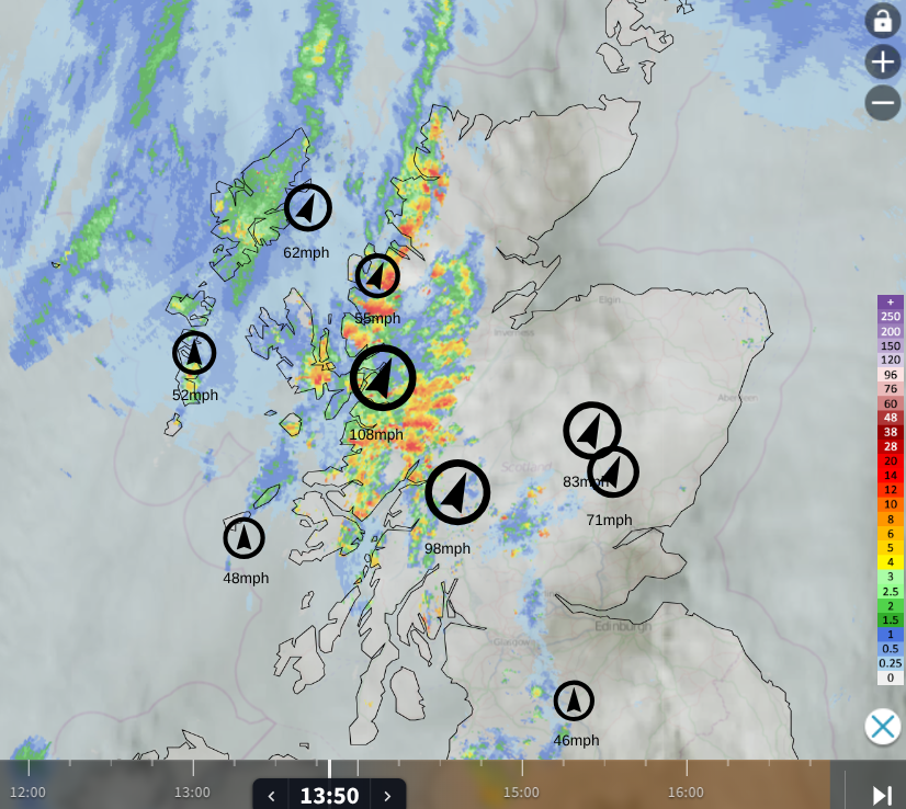
Netweather Radar showing cloud cover, rain before 2pm and top ten highest gusts
The yellow wind warning for the far northwest of Scotland lasts until Wednesday evening. On the warning matrix it highlights the new categories of Likelihood and Impacts which are used to decide the warning colour level. Today the likelihood of severe weather (wind) was High (50 to 75%) with Moderate impacts.
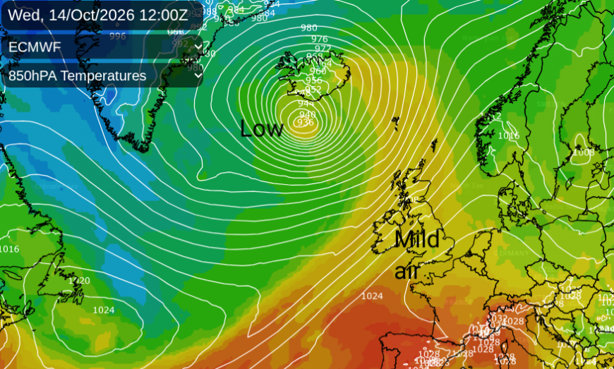
The deep low also directed a surge of fairly mild air from the southwest. Where any sunshine managed to get through temperatures have reached 17 to 20C from Moray to Edinburgh, Cardiff and London.
Through the week cooler air will edge in from the northwest as the mild conditions slowly fade away to the southeast. By the weekend we will be under an area of high pressure with cooler air, clear skies, light winds and frost starts.
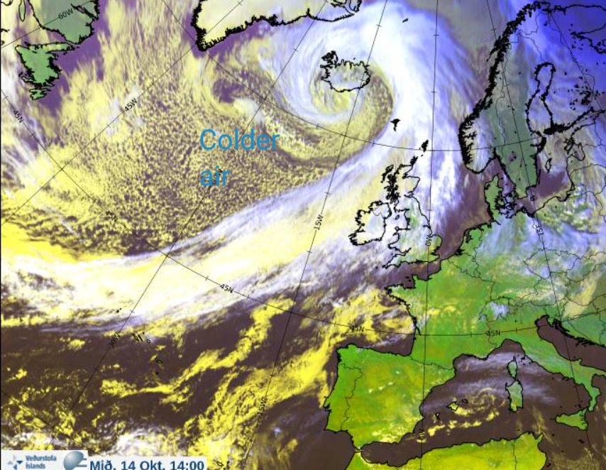
This gradual change to colder and more settled conditions follows the cold front from the Icelandic low pressure. This band of rain will move from the NW Highlands on Wednesday evening over NW Ireland and more of western Scotland. Line convection bringing intense rain and sudden gusty winds is expected so it will sound noisy outside as this moves by. This rain will waver over Fife, the Central Belt and Northern Ireland in the small hours as temperatures fall away behind the front over NW Scotland. Ahead of the frontal rain, it will be a quieter and mild night although windy in the Irish Sea and over the Cumbrian Fells.
As the deep low swings northeastwards over the Norwegian Sea, the trailing cold front will grind to a halt at times. It is the divide between the colder air to the northwest and the remaining milder air with pulses of rain along it. Although Thursday will be blustery for Wales and England with a fresh SW wind, it will be mild with temperatures of 18 to 22C in any sunny spells. A fine and warm day.
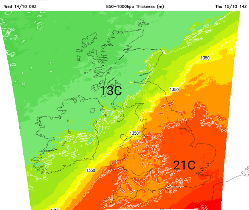
As the frontal rain edges into western Wales and NW England there will be a cool, westerly flow with more sunshine appearing. However temperatures in this airmass will only be 12 to 14C, quite the difference.
The frontal band of cloud and rain will creep slowly southeastwards during Thursday and overnight. There won’t be much rain for eastern England, but some heavier bursts for the high ground in western Wales. Southeastern Britain will have a mild night but elsewhere it will feel cooler with light winds.
Friday will feel cooler everywhere with a chilly start for Scotland, Northumberland and Northern Ireland.
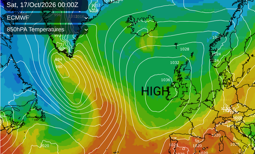
Much of the UK will see a fine but cool Friday with lighter winds and sunshine. The last of the frontal rain will clear from Kent on Friday morning and there will be a scattering of showers on the northwesterly flow, mainly for north and west Scotland, Northern Ireland and north Wales. Once it goes dark on Friday you will really feel the difference with an autumnal chill.
Loading recent activity...