It’s raining over England as a cold front pivots away to the southeast on Wednesday. Good news for gardeners and growers, not so great for those on their way to work or school.
Temperatures are shifting to where they should be in early October. It has been so warm for so long we have forgotten that October should be a month of mist, fog and frost.
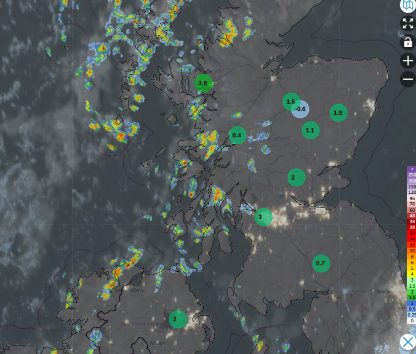
Netweather Radar at 0815 Weds 7th showing ten lowest UK temperatures
It feels more autumnal in the north. Colder air from the Arctic, along with clear skies overnight, has brought a chilly start for Scotland, Northern Ireland, Cumbria and Northumberland. More leaves will be changing colour in the coming week. We have a NW/SE divide across the UK. Sunshine, cooler air and a scattering of showers from the west for Northern Ireland, northern Britain and Wales, with temperatures around 12 to 14C.
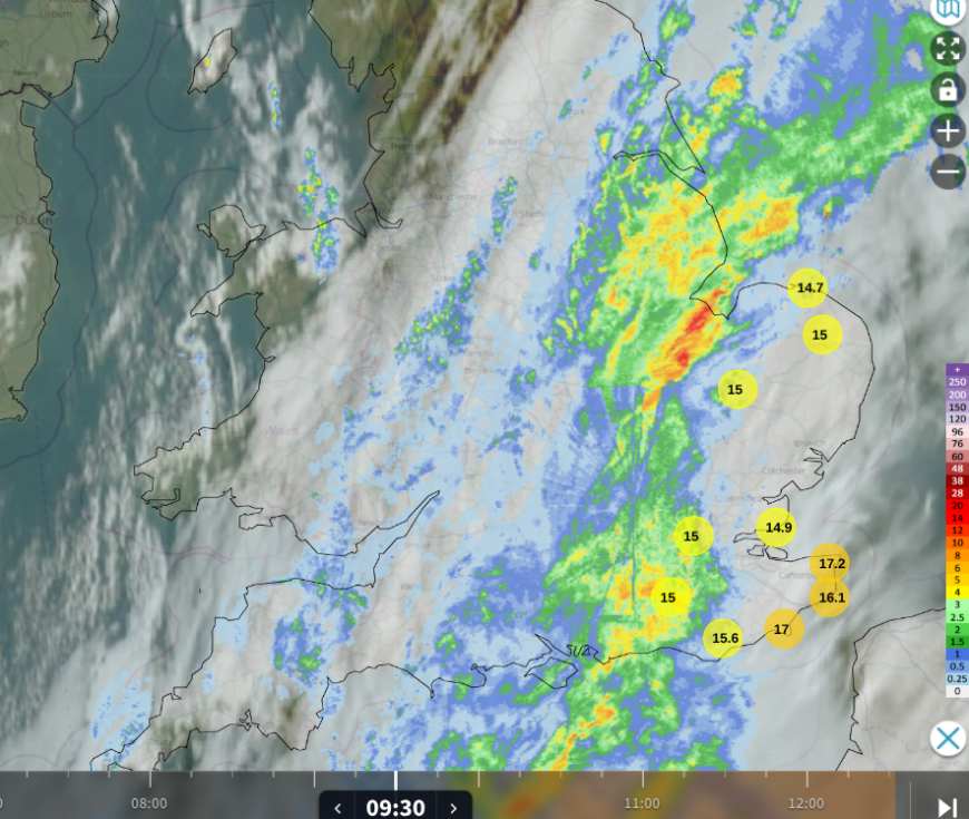
Netweather Radar at 0930 Weds 7th showing ten highest UK temperatures
Suffolk and Essex have managed a fine start for Wednesday but there is a frontal band of cloud and rain stretching from the Channel Islands over England, just clearing from southeast Wales. There will be rain for East Anglia by lunchtime into the early afternoon, with heavy downpours passing over the Home Counties. Kent could see some heavier rain by mid-afternoon as the frontal band heads off to the Low Countries.
Ahead of the front, temperatures could be around 16 to 18C, which is still a drop from the highs of 20 to 24C seen already this week. For much of England, temperatures will be in the mid-teens by Wednesday afternoon.
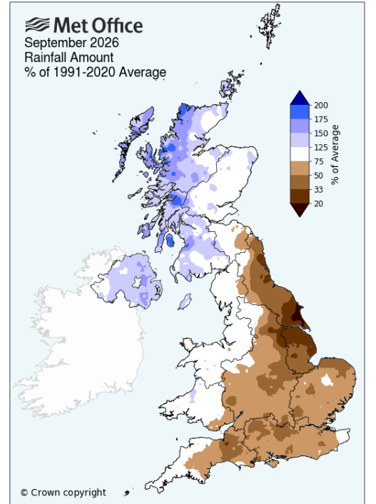
Although this rain is welcome, it is not enough. England’s reservoirs “continue to feel drought strain after the sixth dry month of 2026”. Much of England, and Wales, have been in drought this year and there was below average rainfall in September which “compounds drought issues in southern and central England”. GOV.UK
Most of England’s reservoirs are now classed as notably or exceptionally low after another dry month. Supplies need to be protected.
“At this time of year, the Environment Agency would expect England’s overall reservoir storage to be almost three-quarters (74.3%) full.”
“The Environment Agency has given a drought permit to South East Water to help secure the public water supply at Ardingly Reservoir.”
Southeast of Crawley, Ardingly Reservoir is near Haywards Heath in West Sussex and is exceptionally low for this time of year. Near the end of September, Ardingly Reservoir's total storage capacity was 23% and this is the reservoir’s lowest level on record at this time of year.
“The Environment Agency has warned the permit will not be enough to improve security of water supply and the company needs to pursue further steps in its drought plan.”
Remember, in the UK Government “Get prepared for emergencies” campaign, part of the suggested emergency stores for three days would be 5 to 10 litres per person per day of bottled water to "make you comfortable by providing for basic cooking and hygiene needs. Additional water might be needed to make up baby formula, for medical devices and for pets." Other governments in mainland Europe are also highlighting preparing a 72-hour emergency kit.
This is not tied to a specific issue or threat; it is just national resilience and preparation. As our climate continues to change, resulting in extreme weather events, along with political concerns nationally and globally, and any other disruption that may occur.
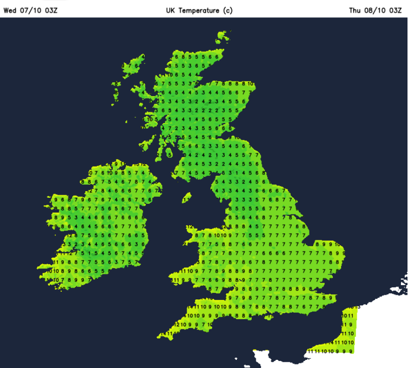
Tonight
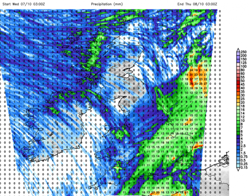
Showers will run down the east coast of Britain tonight and others will reach through Wales on a north to northwesterly flow. You might hear the rain in the night along North Sea coasts. For most of the UK, it will be a cold and clear night. A good night for stargazing with only a sliver of a moon. There will be a touch of frost inland for northern Britain and Northern Ireland with only light winds.
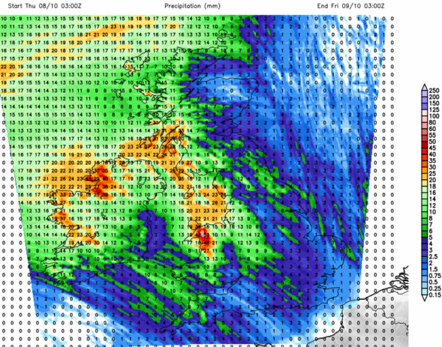
24 hour rainfall forecast from UKV
Thursday
You might need a coat or a big jumper for Thursday morning, although it will look lovely out of the window. There will still be a few showers close to the east coast of Britain, and a scattering for western Wales but for most it will be dry, sunny and crisp. A super autumn morning. In the south it will feel different, fresher, especially in the moderate NW wind. Across the UK, temperatures will be 12 to 16C, maybe 17C in London.
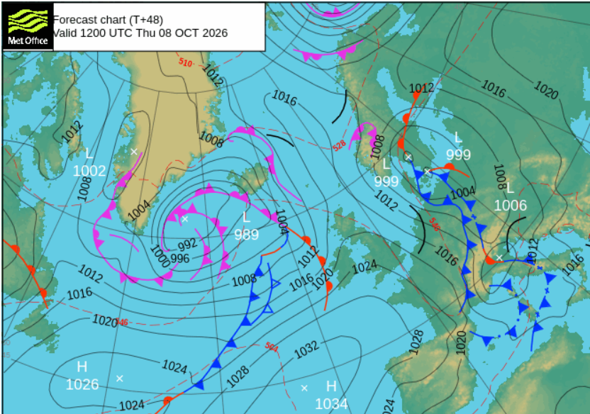
High pressure will bring a settled, fine day for much of Britain on Thursday, but a new Atlantic system will run in from the west, bringing light rain to Northern Ireland through the morning. Southerly winds will pick up as the frontal rain becomes heavier during the day. The wind and rain will reach western Scotland in the afternoon as the fine weather continues over the rest of Britain.
During Thursday night, there will be blustery winds and outbreaks of rain slowly moving eastwards. Although it will turn colder over northern Britain in the evening, mild air will accompany the weather system. Again this is welcome rain, but we continue to use water each week, and the seasonal topping up is not enough.
It will be noticeably milder for England and Wales by Friday morning. Cooler air will follow the frontal rain as it heads southeastwards over Britain once more.
Loading recent activity...