For those in southern UK, make the most of today through to Tuesday, which will be sunny and unusually warm for early October across England and Wales, thanks to high pressure in charge, though watch out for fog in places first thing. Northern areas will be cloudier with outbreaks of rain across the northwest through to Tuesday, which will turn heavy and persistent at times across western Scotland.
Wednesday will be the day that a brolly will be most needed across the UK, as rain develops more widely across England and Wales as a cold front moves southeast and showers spread across Scotland. Temperatures will drop sharply from the north across all parts after the rain clears SE England Wednesday evening.. Drier but cooler on Thursday, chilly overnight too, but then turning unsettled from the Atlantic from Friday, with spells of rain and stronger winds sweeping east.
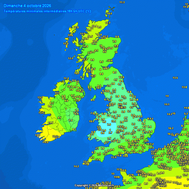
For now, it’s a cold start across Wales, Midlands & N England, thanks to high pressure keeping skies clear across the southern half of the UK overnight. The temperature fell as low as 0.9C at Sennybridge in Powys, Wales. Cloudier skies spilling southeast further north keeping temperatures up across Scotland and Northern Ireland - preventing a frost.
Cold overnight across Wales, Midlands and N England
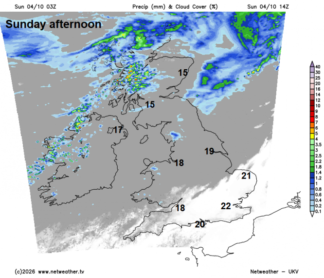
Cloudy across Scotland and N. Ireland through much of the day, with outbreaks of rain across western Scotland turning persistent and heavy over high ground, patchy light rain or drizzle elsewhere. The cloudy skies gradually spilling further southeast across northern England, north Midlands and Wales. The south Midlands, southern England and East Anglia staying dry and sunny, where it will feel warm for early October, with temperatures reaching 22C in SE England this afternoon, about 5C above the average high.
Monday brings more dry, warm and sunny weather for southern and eastern England once the morning fog clears, temperatures reaching 20-22C. Elsewhere it's cloudier, with drizzle in Wales and patchy rain becoming more widespread across N. Ireland, western Scotland and Cumbria through the afternoon and evening.
On Tuesday, generally cloudy across SW England, Wales and northern England, with a band of patchy rain along a cold front slow-moving through much of the day across northern England and north Wales. Brighter conditions feeding in from the northwest across Scotland and N. Ireland, though with showers toward western and northern coasts. Still warm and sunny across SE England and East Anglia, with temperatures reaching the low 20s again.
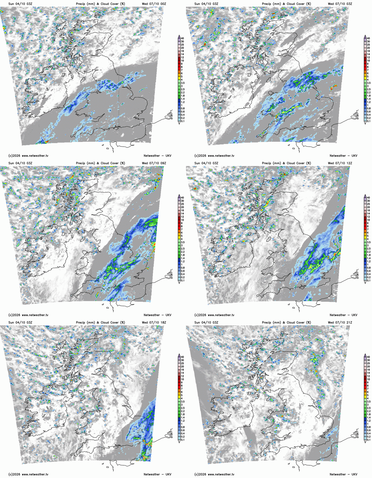
On Wednesday, rain moves south-east along a cold front and could turn heavy across parts of southern and eastern England, before clearing east in the evening. Brighter but cooler conditions following the rain moving southeast from the northwest across northern and western areas, but with scattered showers. A brisk north to northwesterly wind developing too across all parts through the day, gusty over hills and coasts.
Thursday should offer a brief day of drier and sunnier weather, as a transitory ridge of high pressure builds in, though rain looks to arrive off the Atlantic across N. Ireland and the far west during the evening.
Turning unsettled off the Atlantic from Friday
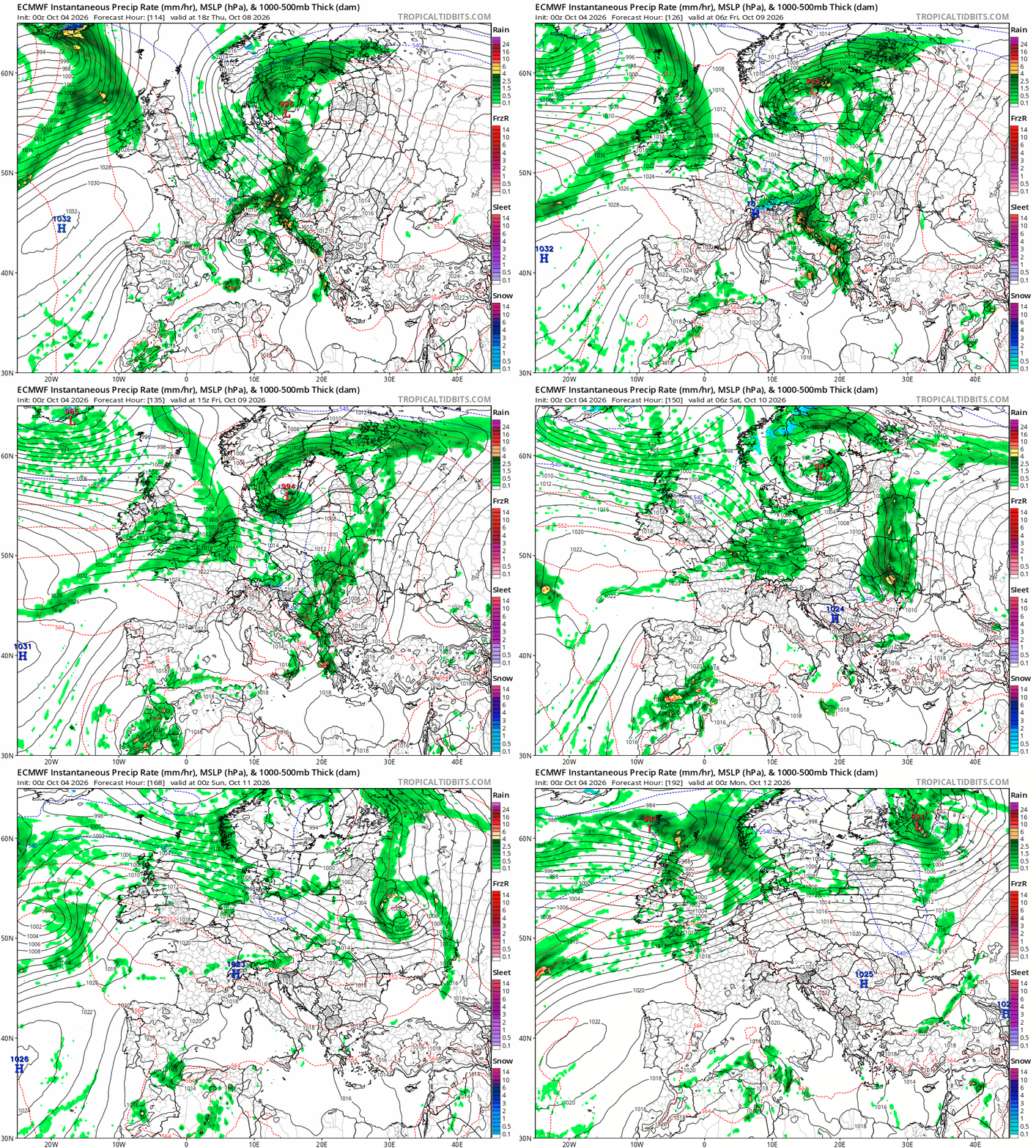
From Friday through to Sunday, a generally more unsettled picture across the UK looks likely, with rain and showers spreading in from the west, heavy at times in the northwest and with stronger winds. An Atlantic frontal system looks to bring outbreaks of rain across most areas on Friday, perhaps drier in the south on Saturday and Sunday, sunshine and blustery showers in the north, merging into a longer spell of rain later on Sunday.
Loading recent activity...