We have a cold week coming up. It will be quite a shock after such a mild November. There will be a lot of dry and sunny weather inland as showers hit the far north and windward coasts on their way southwards, often in a chilly north wind.
This run of mostly dry weather will come as a relief for flood-hit areas from last week, such as Monmouthshire. The cleanup continues as businesses and people consider their losses. At least there is some dry weather until the weekend when an Atlantic front moves by.
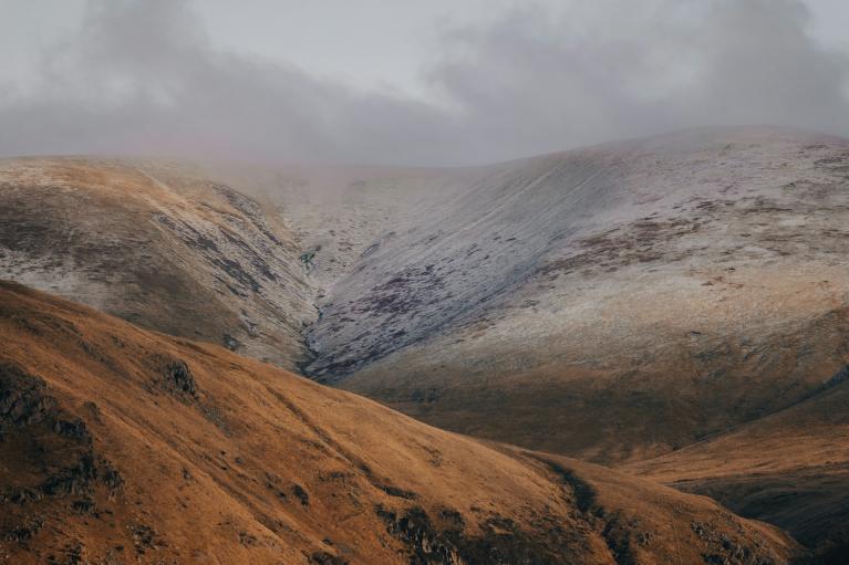
There will be snow for some this week, northern Scotland looks prone, Northern Ireland, western Wales and NE England could also get caught in a wintry flow of showers. However, here we will look at the overall picture for this week. The next update will take a closer look at possible snow areas.
Things to think about today, if you own a vehicle- have you got de-icer and do you need to change your screenwash to a winter ratio liquid, rather than just water? Yes, this will be the week for scarf, hat, gloves and the big coat, especially if you encounter the northerly wind midweek. Wednesday looks properly cold.
Monday
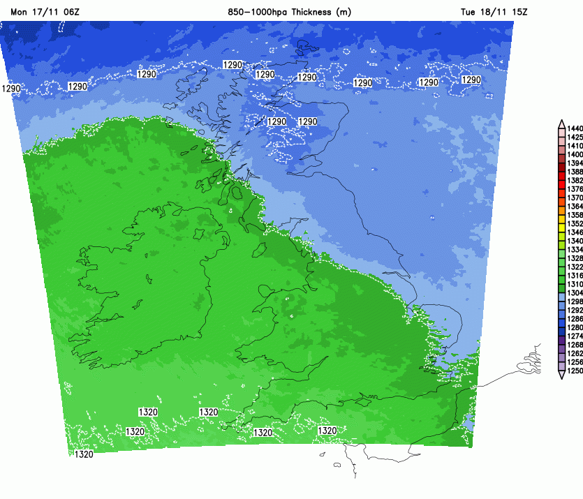
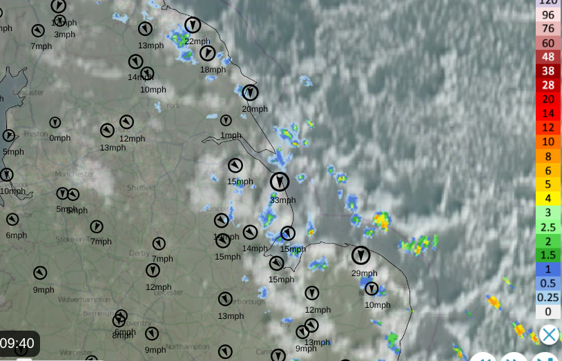
High pressure is out of the Atlantic with patchy cloud over Northern Ireland and hardly any breeze. For the North Sea, there has been a brisk NNW wind adding to the chilly start on Monday morning. This flow has brought some showers to eastern Britain, which have been of rain from NE England down to East Anglia. With a NNW flow, most areas will stay dry and the showers pestering the east coast will diminish as the cold wind eases down today.
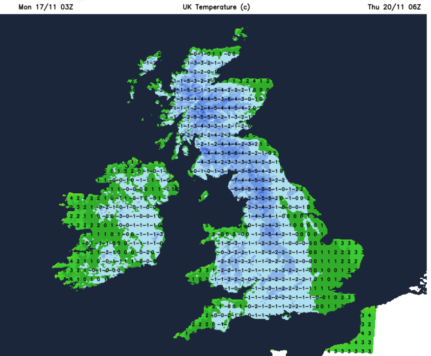
Temperatures will be 4 or 5 in Scotland 7 C in Northern Ireland and around 6 to 8C in England and Wales.
There will be some wintry showers for the far north and northeast of Scotland today but they will be well scattered and mostly of sleet, hail and mountain snow. Northern Scotland will see several days of showers in the northerly flow and snow even to lower levels through this week.
Overall, there will be a deepening cold from the north with the wind just backing to the northwest at times. This northerly flow will direct any wintry showers in a wishbone pattern, with one interruption on Tuesday. A small low caught in the flow will move down across the UK with a mix of rain, sleet and snow.
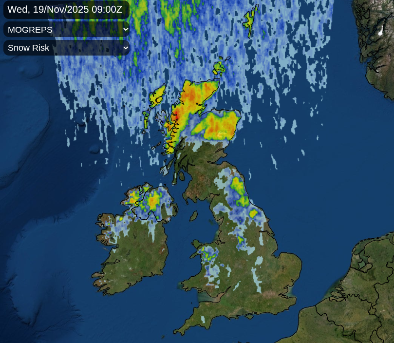
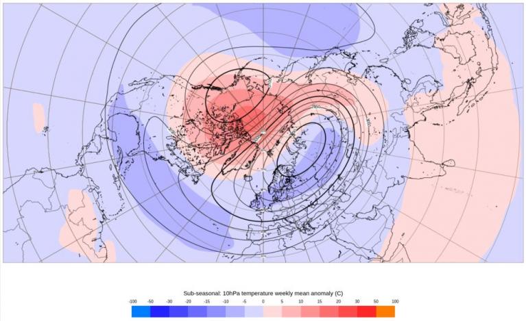
This will bring more cloud, blustery winds to western areas but will be followed by the deeper cold from the Arctic. An Arctic Maritime airmass. As this arrives, any precipitation is more likely to fall as sleet or snow on Wednesday and Thursday.
Daytime temperatures will be around 3 to 6C and at night they will be below freezing with the risk of frost and ice. Again, something we haven’t encountered in a long while.
If you are looking for a change in the cold flow, it should come at the weekend. An Atlantic system should manage to disrupt the high pressure, which will anchor the northerly flow aimed at the UK and the North Sea. As the frontal bands reach the UK, there will be a shift in the wind direction to the west and then a southerly. So losing the chill through Saturday.
Loading recent activity...