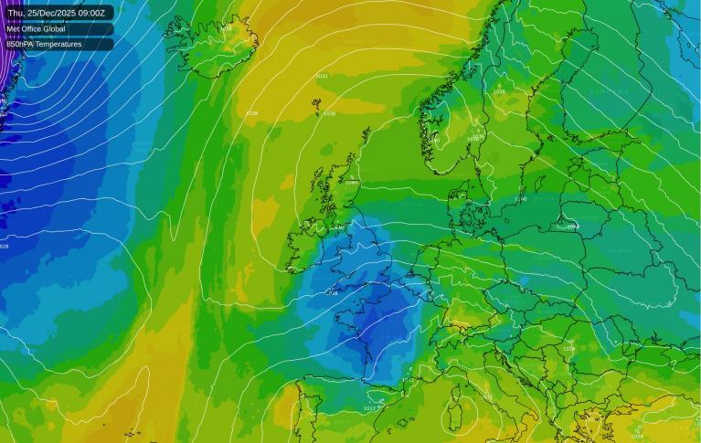
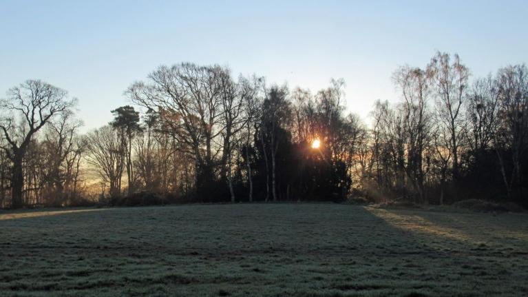
The current outlook for Christmas Day has easterly winds covering the British Isles, and there is a general consensus among the medium range forecast models that these easterly winds, while bringing in some colder air, won't be cold enough for snow in lowland parts of Scotland and probably northern England as well. The snow line will typically be around 300-400m in these regions, and in any case most places will be dry, with just a scattering of showers possible near eastern coasts.
But further south, there is considerable divergence among the models. At the time of writing, the ECMWF model is persisting in showing an easterly that keeps a 300-400m snow line for all parts of the country. But the GFS model has increasingly been showing a pool of much colder air coming into the south of Britain, extending into the northern half of England on some runs, which would bring potential for enhanced showery activity over the North Sea and sleet and snow showers pushing inland at low levels. There is also potential for some longer outbreaks of wintry precipitation to affect the south-east. In this scenario, substantial accumulations of snow are still set to be restricted mainly to high ground, but a fair number of us could end up seeing falling snow on Christmas Day and maybe a dusting on the ground for a time.
Often I would be inclined to reject this as an outside possibility because the GFS often overdoes cold air outbreaks at this range, but the latest runs of the Met Office model have also started to show this outcome. It is worth stressing that this is still currently looking less likely than not, and that the most likely outcome sees snow on Christmas Day restricted to above 300-400m even in the south, so those hoping for a white Christmas should not get too excited at this stage. But it is worth monitoring, as occasionally these sort of snowy easterly scenarios turn out to be right (I remember one in late December 2005 for instance, which most of the models only picked up on at short notice).
High pressure looks set to dominate Britain's weather after Christmas, and regardless of how Christmas Day pans out, by Boxing Day it looks like most areas will be predominantly dry and cloudy, with some scattered light rain showers near North Sea coasts, but some sunshine for sheltered western areas and more widely in the north and west of Scotland.
With high pressure generally centred over north-western Britain, there will be a possibility of further cold blasts from the east and north-east. Although these will be short lived and probably won't produce much precipitation due to high pressure being dominant, the near Continent will be cooling down during the coming fortnight as we lose the conveyor belt of mild south-westerly winds, so there is an increasing possibility of them bringing some wintry showers into eastern areas.
The largest potential for wintry weather looks to be into the New Year, as there is a general signal for the high pressure to push further north-west, possibly extending into Iceland and Greenland, leaving Britain exposed to northerly outbreaks with the winds coming down from a long way north. There is a possibility that high pressure may stay too close by to allow the coldest air to reach us, mostly being shunted out into the North Sea and into central Europe, but if the high moves far away enough into the New Year, then some substantially cold northerlies are a possibility.
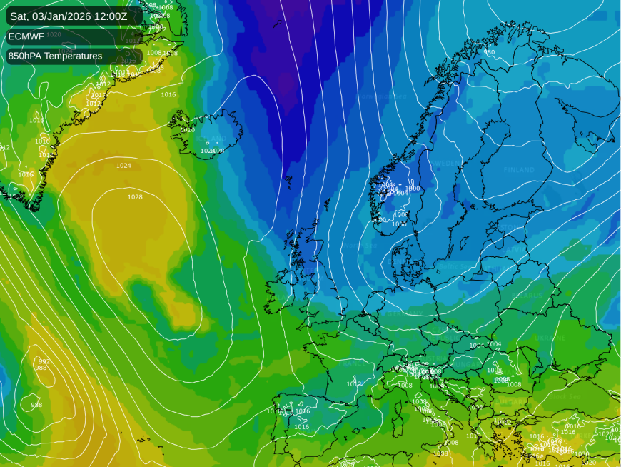
This is all in line with Nick Finnis's winter 2025/26 forecast, which indicated a greater chance of cold dry weather and possibly wintry outbreaks during the second half of December and especially into early January. If the forecast comes off, then early January will see the main "window of opportunity" for cold air outbreaks, with a greater chance of mild and changeable west to south-westerly types returning in late January and February. But recent winters often haven't followed the usual "scripts", possibly as a consequence of us having moved into a warmer climate, so it will be interesting to see if this winter reverts back to following the usual patterns given the weak La Nina event.
Loading recent activity...