


Issued 2024-05-18 06:22:06
Valid: 18/05/2024 0600 - 19/05/2024 0600
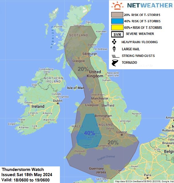
Upper lows will be centred over Bay of Biscay/N Spain and N Germany on Saturday – with shallow low pressure covering much of mainland Europe, with centres over Germany and Spain. A moist airmass covers much of the UK, surface heating combined with breeze convergence and lift from a weak trough moving west from the near continent will trigger heavy showers and some thunderstorms this afternoon across NW England, Wales, Midlands, SW & S England – where breeze convergence zones are forecast to develop. These showers and storms will drift southwest. Scattered heavy showers and isolated thunderstorms may also develop across Scotland. There a risk of hail and localised flash-flooding with stronger cells, also there is a chance of some funnel clouds given favourable conditions of light winds aloft and surface breeze convergence.
Issued by: Nick Finnis
Issued by the Netweather forecast team whenever there is a risk of storms or severe convective weather, these discussion based and in depth forecasts will highlight the areas at risk and give an in depth description of the risk and the factors surrounding it.


