Issued 2024-05-04 07:32:51
Valid: 04/05/2024 0800 - 05/05/2024 0600
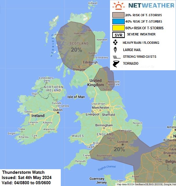
Upper low will drift NE over northern France and SE England during Saturday, reaching the Low Countries tonight. Shallow low pressure will be over Scotland.
Two areas for potential thunderstorms today, albeit isolated in nature. Upper low and associated mid-level cold pool glancing SE England through the day, will steepen lapse rates with surface heating, which is forecast, with help of surface breeze convergence, to support the development of scattered heavy showers over S England and southern E Anglia, some of these could turn into weak thunderstorms, but isolated.
The other area is across the Highlands of Scotland, where residual relatively warm/moist airmass that arrived with theta-w plume crossing NW over the North Sea last few days will become unstable with surface heating today. Orographic lift and breeze convergence is forecast to support heavy showers and scattered thunderstorms as a result. A risk of localised flooding with these, as they are likely to be slow-moving.
Issued by: Nick Finnis
Issued by the Netweather forecast team whenever there is a risk of storms or severe convective weather, these discussion based and in depth forecasts will highlight the areas at risk and give an in depth description of the risk and the factors surrounding it.