Issued 2024-05-06 07:32:40
Valid: 06/05/2024 0800 - 07/05/2024 0600
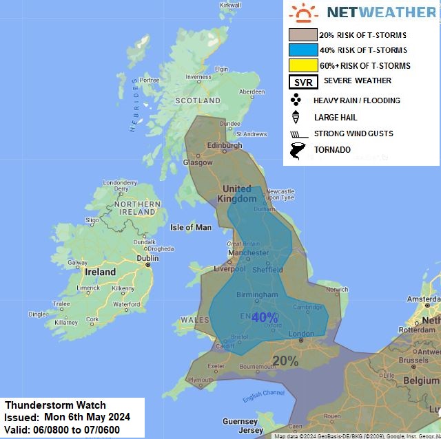
Upper low will be slow-moving across northern France on Monday, with an upper and surface trough extending north over England & S Scotland and a ridge of high pressure to the west over Ireland. Cold mid-level temperatures across much of mainland UK today (-20 to -23C at 500 hPa) will create steep lapse rates, which with surface heating and breeze convergence in slack pressure pattern, will support heavy showers and thunderstorms to develop through the day.
Risk of a storm will be fairly widespread but scattered inland across England and S Scotland, more organised rain moving in across SE England this morning may hinder surface heating, but even here, a thunderstorm or two can't be ruled out, as rain turns more showery in nature this afternoon.
As convective cells will be slow-moving - there is a risk of localised flooding where rainfall is heavy for a prolonged time. Storms may produce hail and also funnel clouds along breeze convergence.
Issued by: Nick Finnis
Issued by the Netweather forecast team whenever there is a risk of storms or severe convective weather, these discussion based and in depth forecasts will highlight the areas at risk and give an in depth description of the risk and the factors surrounding it.