Issued 2024-05-15 07:25:43
Valid: 15/05/2024 0800 - 16/05/2024 0600
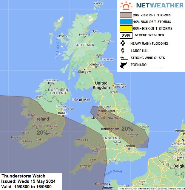
Upper and collocated surface low will be slow-moving centred just to the SW of SW England. Cyclonic flow and cold mid-level temperatures (-20C at 500 hPa across SW Britain) will yield instability with surface heating – supporting scattered heavy showers over SW England, Wales and southern Ireland, with a risk of hail and isolated lightning. Further north and east, just to the west of zone of cloud and rain along slow-moving frontal boundary lying across northern and eastern Britain, NW-SE aligned breeze convergence zone looks to set-up from NW England down to southern East Anglia – this also looks to support a corridor of heavy showers and perhaps a few thunderstorms – though lapse rates look too weak to have confidence in more than 20% risk of a storm.
Issued by: Nick Finnis
Issued by the Netweather forecast team whenever there is a risk of storms or severe convective weather, these discussion based and in depth forecasts will highlight the areas at risk and give an in depth description of the risk and the factors surrounding it.


.jpg?w=175)