
Issued 2024-05-03 07:32:48
Valid: 03/05/2024 0800 - 04/05/2024 0600
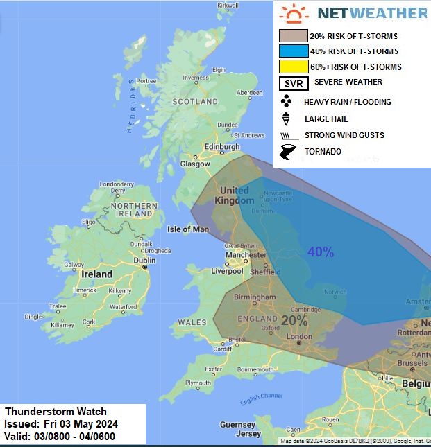
Elongated upper trough extends west-to-east from the Atlantic across France and southern Britain. Low pressure will slowly drift NW over the North Sea to the north of a frontal boundary of southern Britain - which will lift north through the day. To the north of the boundary, a high wet-bulb potential temperature (theta-w) plume will continue to advect west across central and northern Britain.
Mid-level instability is evident within axis of higher theta-w (14C+) spreading in off the N Sea across eastern England this morning, with isolated thunderstorms over N Yorks already this morning on nose of higher theta-w moving west and an area of elevated thunderstorms recently moving in across Norfolk at breakfast time, associated with an upper distubance creating lift, which may affect areas further north across eastern and N / NE of England and perhaps far SE Scotland through the day. Also, there is a chance of isolated pockets of deeper convection amongst showery rain further south associated with frontal boundary interacting with plume to the north as it slowly edges north. This may produce isolated lightning.
Issued by: Nick Finnis
Issued by the Netweather forecast team whenever there is a risk of storms or severe convective weather, these discussion based and in depth forecasts will highlight the areas at risk and give an in depth description of the risk and the factors surrounding it.


