


Issued 2024-05-16 14:02:54
Valid: 16/05/2024 1400 - 17/05/2024 0600
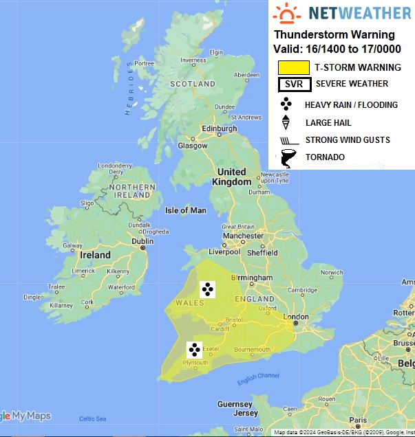
Slow-moving upper and collocated surface low just off NW France will slowly fill during Thursday. A large area of rain associated with a trough moving NW out of France/Belgium this morning will continue to move west across E Anglia, Midlands, southern N England and N Wales through the afternoon
To the south and west of the rain area, slow-moving heavy showers and well-scattered thunderstorms have developed and will continue to develop through the afternoon /early evening across parts of S England and Wales, thanks to areas of breeze convergence creating lift of warm/moist air beneath steep lapse rates towards the upper low close to the SW. There is a risk of hail and localised flash-flooding with any stronger convection.
Issued by: Nick Finnis
Issued by the Netweather forecast team whenever there is a risk of storms or severe convective weather, these discussion based and in depth forecasts will highlight the areas at risk and give an in depth description of the risk and the factors surrounding it.


.jpg?w=175)