Everything is moving fast with our UK weather. There are more low pressures to come this week bringing unsettled weather with bands of rain and brisk winds, even some hill snow.
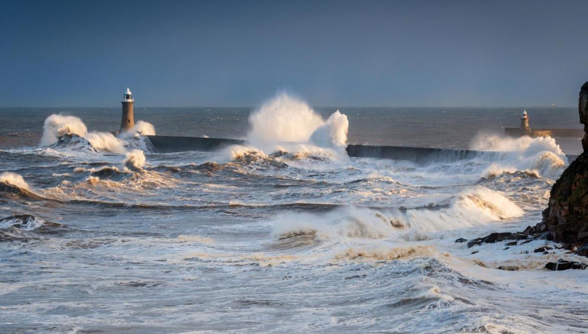
Everything is moving fast with our UK weather. There are more low pressures to come this week bringing unsettled weather with bands of rain and brisk winds, even some hill snow. It’s noticeably colder now even without the strong winds from Tuesday with flood warnings for NW England and Scotland after yesterday's heavy rain.
Today
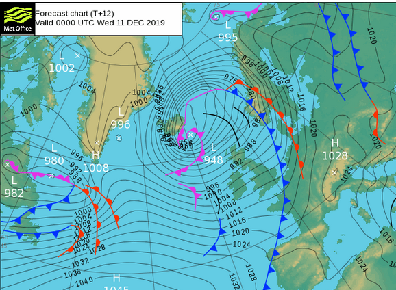
There will plenty of sharp showers from the west today, with hail and thunder. A low pressure which brought a winter storm to Iceland will just shift north of Scotland, nearer to the Faeroes and our flow will be around that. Much of England will be quite sheltered with a fair day, lighter winds and sunshine. SW England, Wales and NW England will see a crop of showers throughout the day and some of these will progress further inland. By this afternoon a few showers will be over the Midlands and a cluster working its way over southern countries of England.
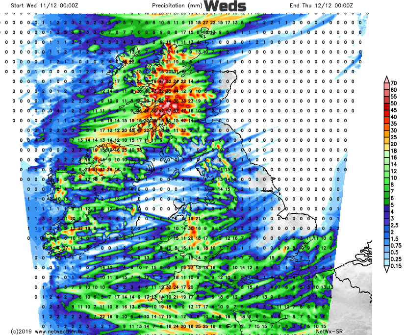
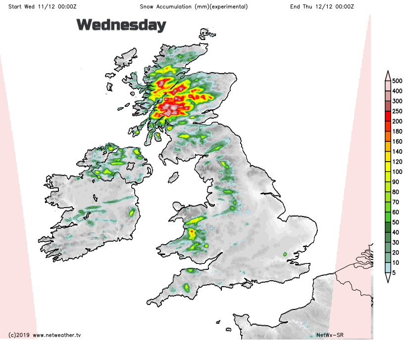
Northern Ireland and Scotland will have showers from the west with brighter skies and sunny spells in the east. There will be snow over the hills, settling for the Scottish mountains. Derry has already seen snow this morning. It remains windy for Northern Ireland and Scotland today. Not as bad for the central Belt but for the Islands there will be SW gales , even up to Storm force winds with high seas for Shetland, closer to the low centre. It will feel cold in the breeze with air temperatures around 3 to 6C, up to 8C for London.
By this evening there will be a scattering of rain showers around the M25 and more rain/sleet/hill snow showers for western Britain, more of Scotland and Northern Ireland. Under the clearing skies temperatures fall near to freezing.
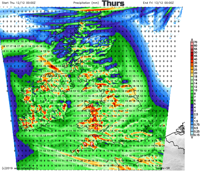
By Thursday there will be a new low pressure sliding in from the Atlantic. This will bring early rain to Northern Ireland , SW England and Wales in the morning as the Polling places open for the General Election. Then a spell of wet and windy weather moves right across the UK, for all but the far north of Scotland. If you are popping out to vote you may have to watch the radar.
Yesterday
There were lorries blown over along the A1 in SE Scotland on Tuesday. The Edinburgh Christmas market had to be closed, flooding further west resulted in rail disruption and overhead power cables down. There are still issues today. Falling tiles and masonry in Edinburgh thanks to the wild conditions. This was not a named storm though, no Amber warning (no Storm Brendan yet).