Cloud & showery rain across some northern & western areas much of the weekend, the south and northwest mostly dry & bright. Dry early next week, before turning unsettled from mid-week.
Low pressure will remain close by to the east over the weekend, which means it will stay fairly unsettled with a lot of cloud around with rain at times and it will stay chilly too. Southern England least likely area to see rain and will probably staying dry and bright for much of the weekend, elsewhere it won’t be a complete washout like we saw last Saturday, but there’ll likely be some rain at some point. Early next week will offer a respite from the recent incessant rain, as a ridge of high pressure builds in, bringing mostly dry and bright weather by day and cold frosty nights. However, mid-week onwards it looks to turn unsettled again, more particularly across England and Wales, with rain or showers, though there are signs that it will turn milder later in the week.
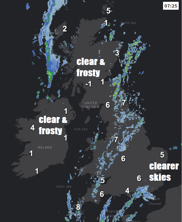
For now, a gloomy and, in places, damp start to the weekend across much of Britain with a band of showery rain feeding in across the north and west of England, east Wales and eastern Scotland this morning. Clearer skies across much of Scotland and N. Ireland overnight and to start the morning means a cold and frosty start here, lowest temperature -5.1C at Altnaharra.
Northern and western England, Wales and coastal eastern Scotland will remain mostly cloudy throughout today thanks to a slow-moving weather front, with further showery outbreaks of rain at times here. After a few early showers, drier and brighter conditions will move in across SE England and East Anglia and stay for much of today, perhaps extending west into the Midlands and central southern England. Some dry and bright weather across Scotland and Northern Ireland too away from the east coast of Scotland and later the west coast – where another front moving in from the west will bring cloud and rain by early evening.

Temperatures reaching 8-10C across England, Wales and N. Ireland, a chillier 5-7C across Scotland. Winds lighter today though, so not feeling quite a cold, feeling pleasant in any sunshine.
A slow-moving front across central areas and also a front moving across the northwest will bring cloud and further outbreaks of showery rain across most of the north and west overnight. Southern England, parts of the Midlands and East Anglia staying mostly dry with clear spells, allowing temperatures here to fall into low single figures and locally close to freezing allowing a frost, central parts of Scotland could also see some clear spells allowing a local frost to form, temperatures holding up under the cloud across Wales, northern and western areas of England.
On Sunday, a set of weather fronts lying across Wales, central and northern England will move very little through the day and will bring cloudy skies and further showery outbreaks of rain in these areas. To the south and north of these areas, which will be SE England along with much of Scotland away from the southeast and Northern Ireland – it will be mostly dry and bright or sunny. Temperatures reaching 8-10C across England, Wales and N. Ireland, 6-7C across Scotland.
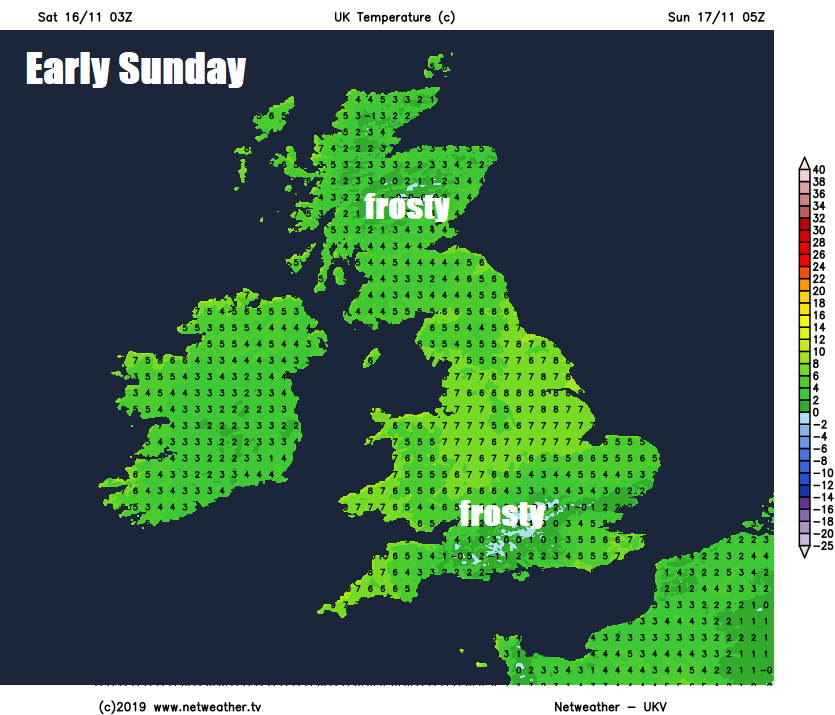
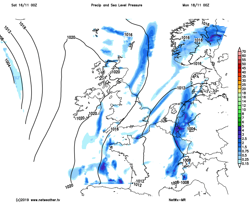
High pressure will build eastwards across Britain on Monday, so mainly dry for many with sunny spells after a cold and frosty start in the north. On the chilly side though thanks to a northerly breeze, which will be strongest towards the east, temperatures reaching 5-8C at best.
High pressure to start the week bringing fine and dry conditions, giving way to low pressure and unsettled conditions from mid-week.
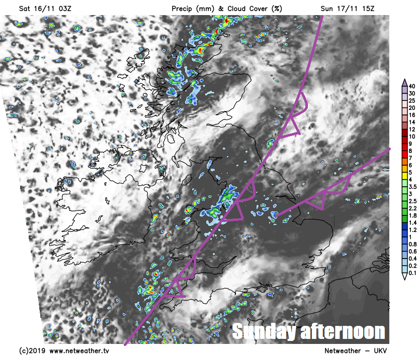
Frost more widespread Monday night into Tuesday morning, leading into another mostly dry and bright day across the UK with sunny spells, though more in the way of cloud arriving and a southeasterly wind picking up across southern and southwestern areas, with some showers moving in across SW England, Wales and perhaps further east across southern coasts by evening. This change towards the southwest will herald a gradual change from mid-week spreading north and east across many areas by Friday, as low pressure over the Atlantic begins to move in close to the southwest. So showers or longer spells of rain becoming more widespread towards the end of the week, particularly across England and Wales. Not great news for those areas drying out from recent flooding, though it is uncertain for now which areas will be affected by more troublesome heavier and persistent rain.