
Slow-moving low pressure and fronts will bring rather stagnant conditions over the weekend, often cloudy with some rain in places, some brightness in the south and northwest. Staying chilly.
Low pressure has been slow-moving over the near continent over the last few days, bringing slow-moving fronts that brought further persistent rain across England and Wales yesterday in areas where it’s least needed. Generally cloudy skies and further showery rain is likely today across parts of England and Wales thanks to slow-moving fronts and a similar theme will persist across northern and western areas over the weekend, but it will become drier across southern areas. A dry and chilly start to next week, but from mid-week it will turn increasingly unsettled from the west, but it will, at least, turn milder across all parts.
It’s another cold start this morning, though much of England and Wales is frost-free thanks to cloud cover, apart from across the west of Wales, Northern Ireland and western Scotland - where clearer skies have allowed temperatures to fall close to or below freezing in some spots. The Met Office have a yellow warning out for ice until 10am this morning across parts of Northern Ireland.
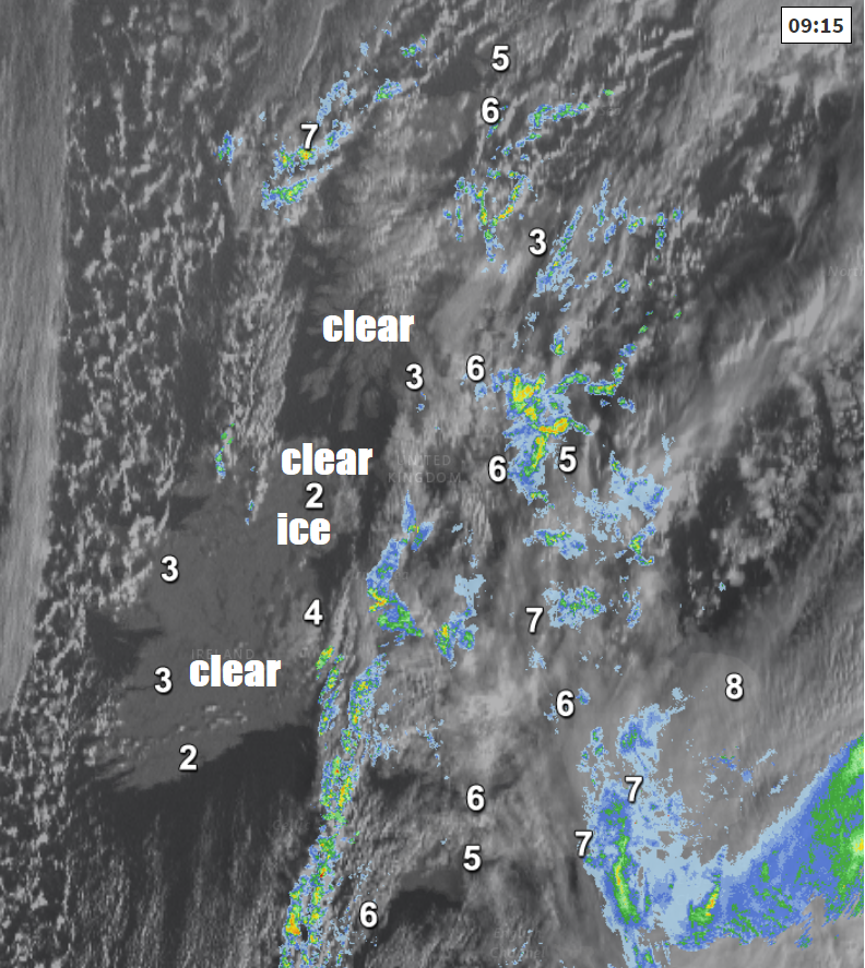
For the morning commute and school run, as well as ice to watch out for in the west, there are a few showers affecting eastern Scotland while thicker cloud further south across England is bringing some outbreaks of rain across northern and southeast England, with a few spots of rain further west too. The rain across northern and eastern England will tend to clear westwards across western parts of England and Wales through the morning, while becoming more showery, allowing drier and brighter conditions to follow from the east. Showers continuing across eastern Scotland, mostly dry with sunny spells for western Scotland and N. Ireland after the frosty start.
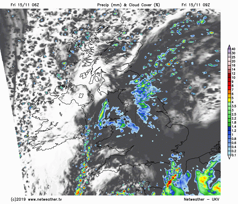
Into the afternoon, these drier conditions with sunny spells moving across the east in the morning extending west across much of England and Wales, western Scotland and N. Ireland staying dry and bright too. However, there will be further showers affecting eastern Scotland and NE England, while thicker cloud and outbreaks of rain return across East Anglia and SE England by the evening.
A brisk northeasterly breeze across England and Wales, particularly across northern England and Wales, making it feel on the chilly side when you factor in that temperatures will reach 7-10C at best.
An area of low pressure over northern France will bring rain across SE England and East Anglia into the evening, this rain will then spread north and west across England and Wales overnight, perhaps drier conditions with clearer spells following across SE England and East Anglia by the end of the night. Scotland and Northern Ireland mostly dry with clear spells and turning cold, with a frost forming locally, particularly in the Highlands. A few showers continuing across eastern Scotland.
A damp and gloomy start to Saturday morning across much of England and Wales, outbreaks of rain affecting parts of Wales, northern and western England and likely lingering into the afternoon, with the cloud and patchy rain extending north and west across much of Scotland after a bright and frosty start in the west, though NW Scotland staying dry and bright. Dry with sunny spells towards SE England and East Anglia in the morning and these conditions extending further west across central and southern England and perhaps east Wales. Temperatures reaching 5-9C generally, perhaps 10C in the far west.
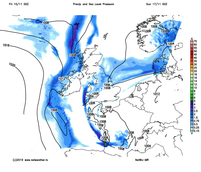
Quite a slack weather pattern continues into Sunday, with low pressure slow-moving over the near continent while high pressure tries to build in from the west with two stubborn fronts, one across the north and one across central parts. So, there will be a lot cloud around again on Sunday, with some patchy outbreaks of rain across Scotland, northern England and Wales. On the chilly side, temperatures reaching 7-9C.
It looks like next week will start off with a dry theme, with a ridge of high pressure bringing mostly dry, fine and bright conditions by day both Monday and Tuesday, cold overnight under clear spells, with a risk of frost, more widespread early Tuesday. However, by mid-week, a large area of low pressure over the Atlantic will move closer for the rest of the week, bringing increasing showers from the southwest across southern and western areas on Wednesday, dry and bright in the north and east. Showers or longer spells of rain extending north and east across most areas Thursday and Friday and becoming windier too, but with a southerly wind direction – it will turn milder with nights frost-free.


