


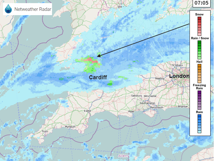
A look at this morning's snowfall in SW Britain and the forecast for the rest of the week for any more #UKsnow
Parts of the Cotswolds and Wales woke up to snow this morning with SE Ireland and Dartmoor having seen flakes on Weds 13th. There have been a few mountain coverings this November, for the Scottish Highlands (down to -8.1C overnight) and the Welsh mountains but this was the first snow of the season falling to lower levels, settling on people's cars and being experienced close up rather than in the distance. Will it snow?
Whether that fills you with excitement or dread, winter has yet to begin.
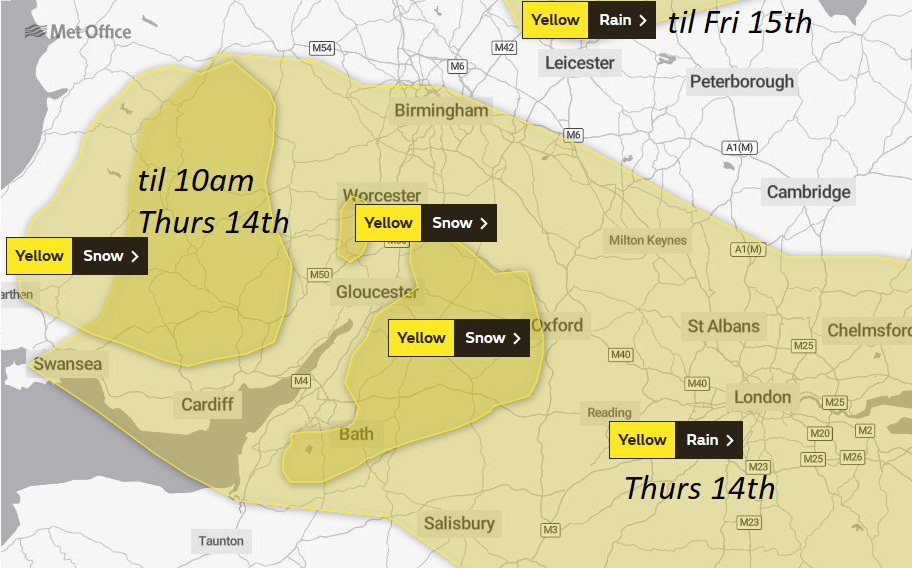
Met Office - "Some snow affecting higher roads in Wales and some western parts of England."
Hill snow had been mentioned in the yellow warning of rain from the UK Met Office. The frontal band was giving flooding concerns but with the cold air there was always the risk of a little snow. These snow warnings lapse at 10am once the main movement of people and traffic is over. Remember warnings are impact based, so there may still be flurries and a bit more wet snow during the day.
Looking at a forecast chart for this afternoon you can still see areas of rain/snow (sleet) and hill snow north of the rain band. Also wintriness over the high ground of Exmoor and Dartmoor. There is a brisk NE wind bringing a tuck of cold air down, making the day feel cold.
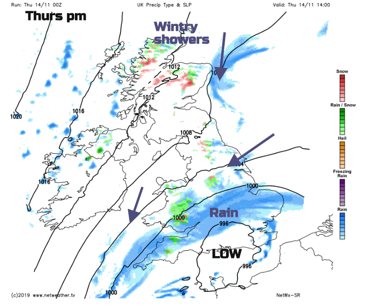
These winds, a cold north or NE wind will bring wintry showers off the North Sea, into NE England and parts of Scotland. That dig of cold air could bring settling snow to the Scottish Borders, Cheviots, north Pennines for Thursday night.
The frontal band continues to bring rain across parts of England and Wales, more in today's Front Page article. This brings the risk of flooding but also with the cold night air the chance of more hill snow, even again a little snow to lower levels this evening in the same warned areas.
A frontal band from the Atlantic on Sunday could bring hill snow to Wales and western Scotland but there aren't any signs this week for much more snow. The only snow signal comes from low pressure whirling in off the Atlantic with more rain, coming up against cold air and giving a small spell of snow, a bit like this morning. Nothing widespread or significant showing just yet.


