


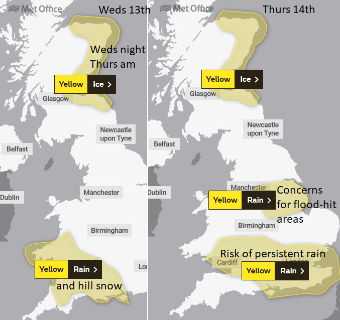
Warnings for Ice and hill snow being mentioned along with the heavy rainfall. Many parts of Britain are sodden with high river levels and lingering surface water so more rain is unwelcome.
Ice has now been added to the list of warnings with hill snow being mentioned along with the heavy rainfall. Any extra rain for parts of the East Midlands, Lincolnshire and Yorkshire will have high impacts after the recent disastrous flooding. And many parts of Britain are sodden with high river levels and lingering surface water.
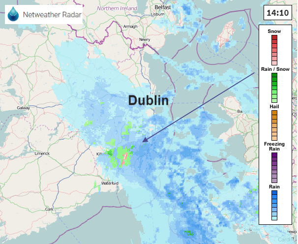
There has already been snow reported for the hills of SE Ireland and wintriness appearing for the Welsh mountains and Dartmoor. Chose Weather/Prec. Type On button to change the display from intensity of rainfall to type of precipitation.
As a new low pressure brings heavy rain and a little hill snow to SW Britain later on Wednesday there are flooding concerns for Thursday into Friday as bands of rain rotate and linger around the low over England and Wales. There are still variations between the models of where exactly theses bands will affect, with gaps inbetween. So weather app or pure model output should be viewed with caution in this situation, as a band my just be a few miles north or south and bring a quite different day. Keep an eye on the radar and flood advice/warnings for your location.
There is a Met Office warning for Ice for Wednesday night for NE and eastern Scotland. "Icy patches in the east may give difficult driving conditions overnight and Thursday morning."
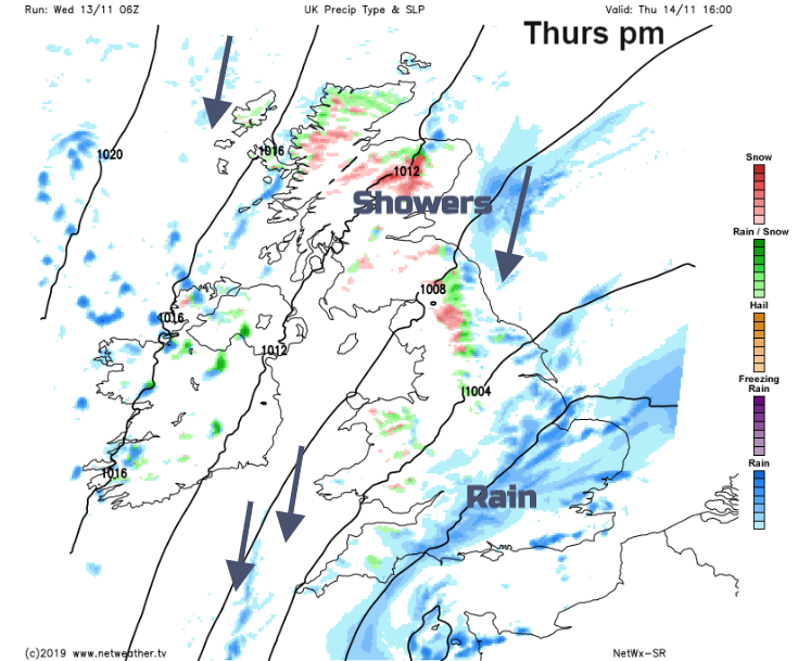
Drawn in around the low will be a brisk NE wind which will bring showers to NE and eastern England with snow over the higher ground inland, the Pennines and North York Moors and also for northern Scotland and the Grampians. A cold northerly wind will eventually set in later on Thursday making the day feel much colder. If you haven't already, do find your winter coat and accessories.
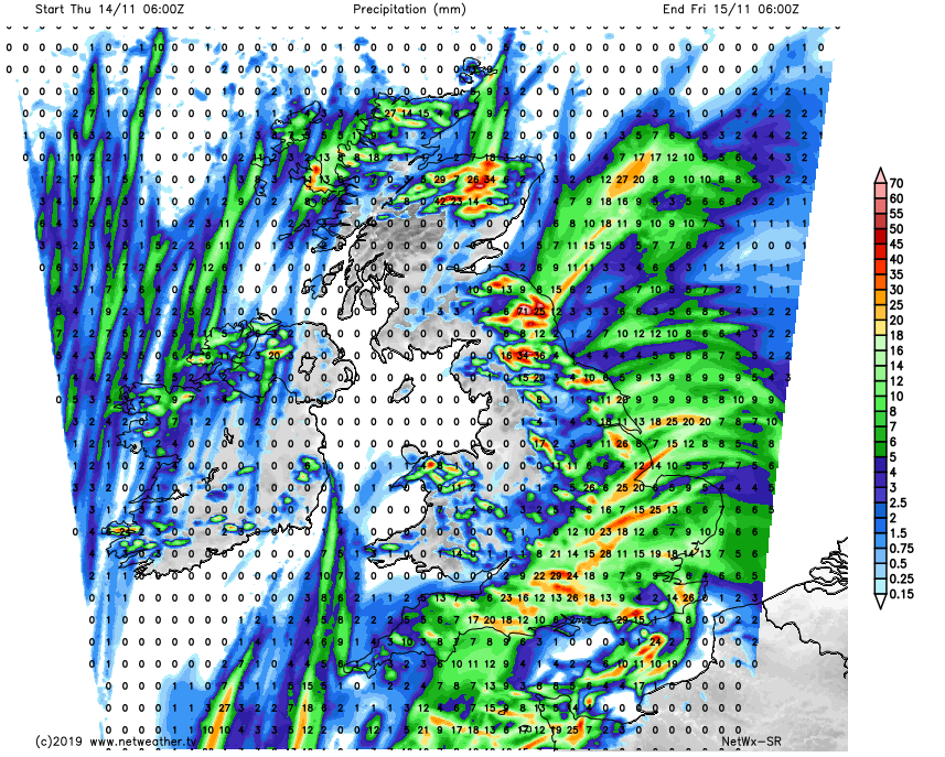
The small area marked for heavy rain and flood risk over Lincolnshire, East Midlands and South Yorkshire have a warning lasting into Friday as the bands of rain nudge north potentially over the worst-hit flood areas. There could be around 25mm of rain, an inch. It's not the same set up as last week but it's just unwanted extra water.


