Bit more frost about this week with persistent rain on Thursday for eastern England, more for SE Scotland and flooding concerns. UK rain on Saturday then chilly for Sunday.
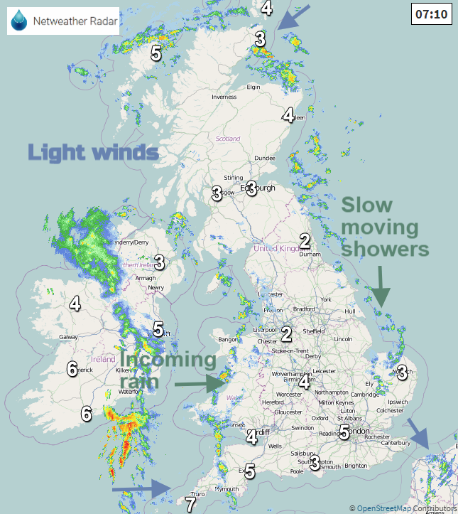
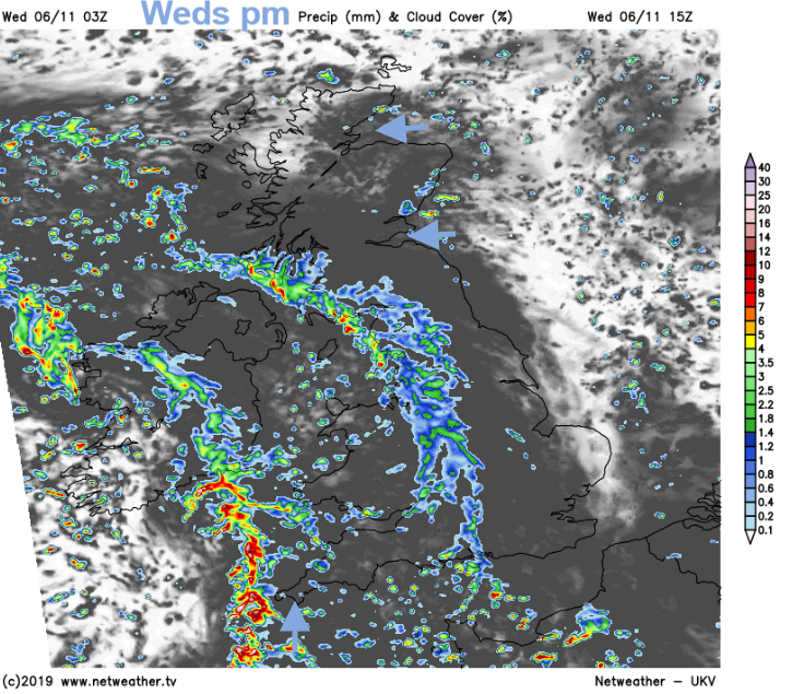
It’s been clear, cold and calm in many places overnight with temperatures below freezing and some frost. There has been a slow feed of showers from the north for coastal fringes, clipping North Sea coasts, through the Irish Sea and for the far north of Scotland. An Atlantic low pressure is heading in from the west with the rain already appearing this morning which will bring more cloud and move over western Britain today.
There has been a lot of rain recently, particularly for England and Wales and eastern Scotland. There are still buckles in the Jetstream near to the UK and at the surface the low pressures take their time to move over the British Isles. This results in more prolonged rainfall, higher totals and often flooding.
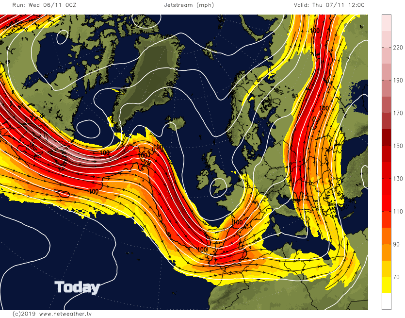
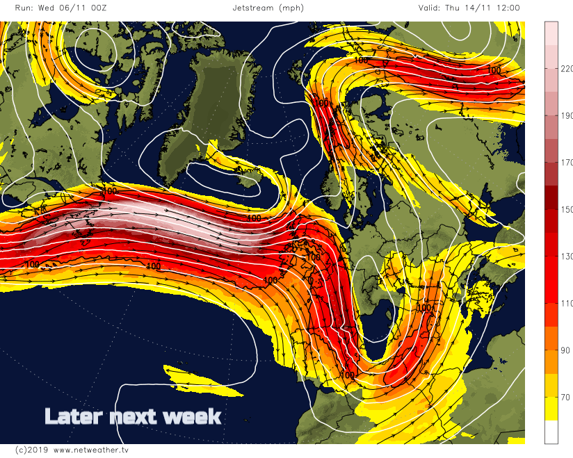
When a strong zonal jet just barrels across the Atlantic way up in the atmosphere we can get the deep intense low pressure, which moves across the UK fast but can bring damaging winds and storms. There are more signs of this for later next week, so mid-November.
Today
With light southerly winds temperatures for southern Britain will be from 7 to 10C. Northern Ireland with hardly any breeze this afternoon stays around 8 C. Wales, central Britain into southern Scotland will be around 7C and northern Scotland stays cool at 5 or 6C with an easterly wind. Clusters of showers lurk in the Moray Firth and the Firth of Forth but there will be bright and sunny spells for eastern England today. Bands of showers continue to move over Ireland to western Britain today although there will be some bright spells ahead for western Scotland in the easterly wind. There will be some sharp downpours and heavier showers from the SW later in the day.
There will be heavier rain for Cornwall and Pembrokeshire, into Devon early evening as the winds pickup so worth bearing this in mind for the evening commute home. This band moves over south Wales towards Cardiff in the evening over the Isle of Wight and Southampton later.
For Wednesday night it will be cold for Scotland and western Ireland but mild for East Anglia. By Thursday morning the frontal band will be lying west-east over Britain with a band of cloud and fair weather to the north and south but still a scattering of showers.
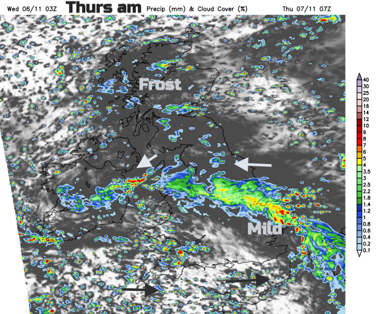
As the low centre moves south towards France the winds to the north of the rain band back to a cool north-easterly. The rain band edges across northern England and north Wales, bear this in mind if just looking at a Weather app. If the rain band is just slightly north or south from the forecast output your weather could change a lot. Keep an eye on the actual position of the rain band on the radar.
It doesn’t look very nice for northern England, especially North Sea coasts and over higher ground later on Thursday as the winds pick up and the rain sets in. High rainfall totals are showing for the North York Moors and the Pennines.
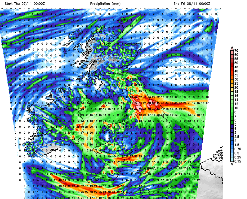
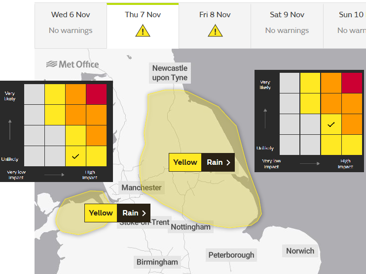
Environment Agency - Widespread surface water and river flooding is possible but not expected on Thursday and Friday as rain falls on already wet ground across parts of the north of England, the Midlands and Lincolnshire. Local flooding is also possible more widely across the Midlands, East Anglia and the north of England. Properties may flood and there may be travel disruption.
Thursday night will be colder as a north wind takes hold for Friday. The rain eases with many places having a quiet weather day and then another nippy night with frost in places.
Then a frontal band will move right across the UK on Saturday bringing rain to all with blustery winds. The rain won’t reach SE Britain until Saturday evening though.
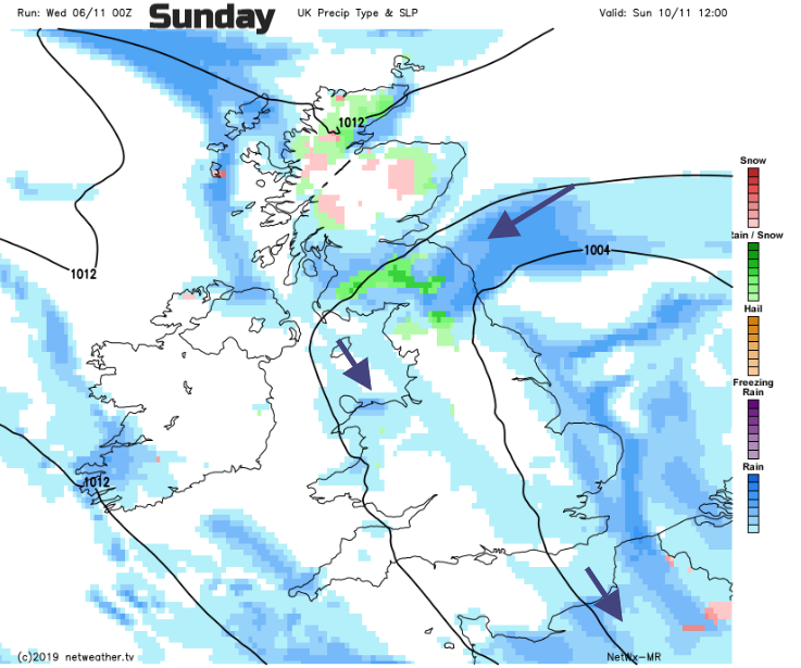
Sunday looks a bit more unsettled than on previous forecast with small areas of rain or showers and some wintriness over northern hills on a chilly day. For any Sunday Remembrance services, it will feel cold. Same for Monday 11th but with lighter winds.