


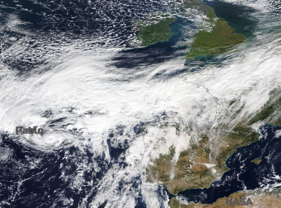
There is some respite in the October rains even though rivers are still at flood level. It's cold, although the start of November looks much milder. And cool water Pablo, so close to Europe.
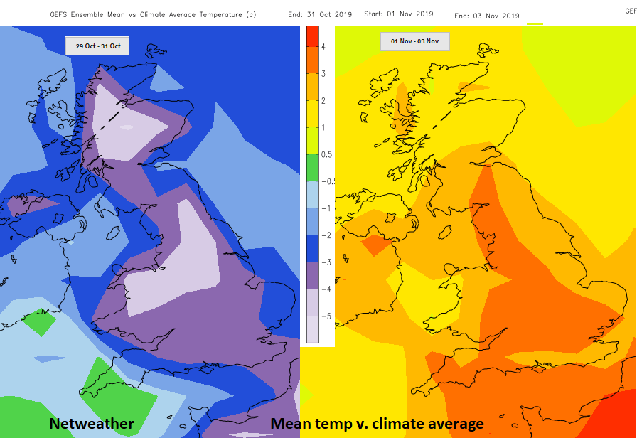
After days of rain and widespread flooding, there will be drier but chilly weather for much of the UK. Frost and fog by night but blue skies and sunshine by day. There is a band of rain lurking near to the far SW of England and showers (some wintry) over northern Scotland but the start of November looks much milder as rain from the Atlantic reappears.
It started raining last Friday and in places didn't stop all weekend. Wales, the Midlands, SW England and northern England were soaking and covered in flood alerts and warnings. Flood defences were put in place with water reaching levels not seen in several years. As all that rain continues to drain down from the hills the River Severn remains very high. Residents in Monmouthshire have been asked to evacuate their homes on Monday.
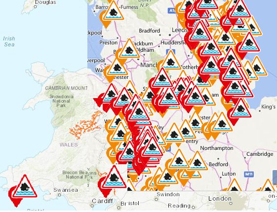
"Recent heavy rain across South Wales is causing the river level on the Wye in Monmouth to rise and will continue to rise for the next few hours. The rain may have subsided, but some river levels are still rising as peaks move downstream. " Natural Resources Wales
Hurricane Pablo.
You had to be quick to see this one, it formed all of a sudden on Sunday 27th Oct and has now weakened to a Tropical Storm. As it strengthened to a Cat1 hurricane, it was the farthest east on record and significantly further north than most hurricanes.
The Shipping forecast "The general synopsis at midday: Low South Utsire 1003 losing its identity by midday Monday. Tropical storm Pablo 170 miles southwest of Fitzroy, expected ex-Pablo 130 miles northwest of Fitzroy 997 by same time" Issued at: 17:25 (UTC) on Sun 27 Oct 2019.
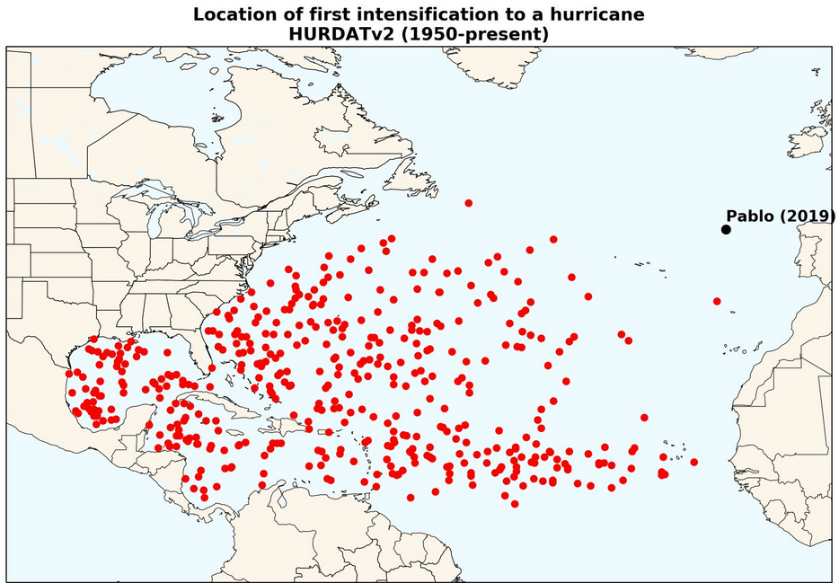
A cyclone reaching hurricane status this close to Europe is unnerving and has not been recorded in modern records, dating from 1950. The NHC discussion for Pablo talking about it reaching hurricane status - "The intensification has occurred while Pablo is over sea surface temperatures of 19-20C" others saying even cooler than that. Textbooks would talk about waters 26+C providing the warmth and energy for a hurricane to form. This was not the case.
What was present was very cold upper-level air which supported convective instability, even with SSTs only in the high teens. The moist, thermodynamically unstable atmosphere also had low shear so the upwards cyclonic structure wasn't disturbed, warm-core formed and the winds intensified.
Pablo has now weakened to a Post Tropical cyclone. - "Cold waters of 16C and increasing shear caused the deep convection near Pablo's center to dissipate early this morning, and the cyclone now consists of a swirl of low- to mid-level clouds and showers. This lack of deep convection has caused Pablo to now become post-tropical." NHC.
Pablo isn't going to affect the UK directly but it is now getting mixed up in a larger low pressure out in the Atlantic which will bring more rain to SW Britain although there is some uncertainty about amounts on Tuesday into Wednesday.


