Ex tropical systems have brought some blustery winds and rain for the middle of the week. There will be extra warmth on Thursday thanks to ex-Gabrielle, then more settled for the weekend.
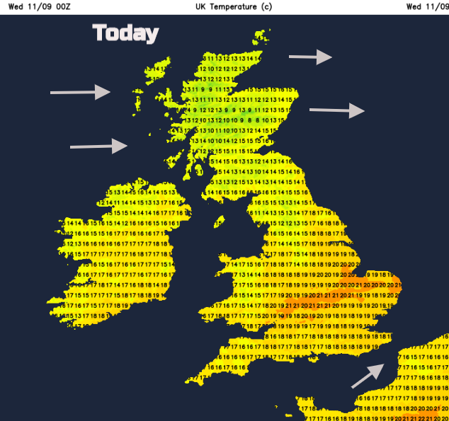
A bit of warmth midweek. 22C in London on Tuesday, there will be similar highs today for the East Midlands. Then mid 20sC forecast on Thursday as the second tropical system of this week heads our way.
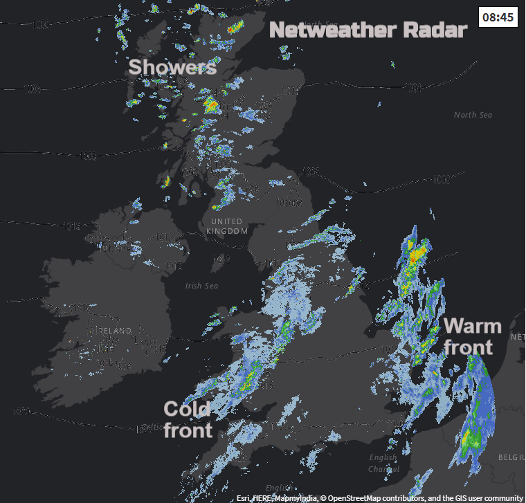
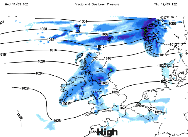
Today’s blustery winds and outbreaks of rain, which arrived on Tuesday evening in the far NW, are from a low pressure near Iceland which includes remnants of Hurricane Dorian tropical energies. This devastating cyclone hit the northern Bahamas, clipped the Carolinas and only transitioned from its tropical phase just before arriving over eastern Canada. An extratropical low resulted which moved across the far north of the Atlantic, over colder waters with weather fronts which are moving across the UK today. It’s not a hurricane any more.
So for anyone who caught glimpse of a headline such as:
Daily Express- UK weather: Violent 70mph winds to slam into Britain as ex-hurricane Dorian makes landfall. THE UK will be hit by ferocious winds as ex-Hurricane Dorian nears the British Isles. By Amalie Henden
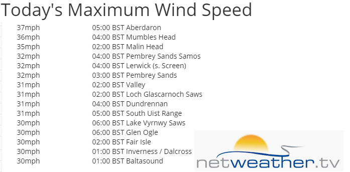
It is a blustery day with spells of rain then brighter skies and a few showers from the NW. There was a 71mph gust up by Glenshee, so a sudden temporary higher burst of wind. For the mean wind speeds, away from the mountain tops:
It has been a mild start and the warm then cold front will continue to move and fade south-eastwards with all the associated cloud. The winds ease off for Wales and SW England this afternoon but Kent keeps a squeeze of the southeasterlies and northern Britain and Northern Ireland stay blustery with westerly winds. A scattering of showers appear from the west, mainly for western Scotland but there will be a lot of fine, bright weather about.
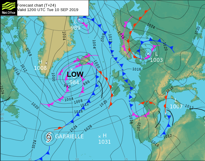
High pressure builds up from the south but ex- tropical Storm Gabrielle is caught up in the flow towards the UK. This will bring a spell of wet or damp weather across the UK on Thursday. Snowdonia, Cumbrian Fells, the Trossachs, Islay and Arran will see some higher rainfall totals but for many areas not much at all. Scotland sees a spell of rain on Thursday morning, damp weather should be clearing Northern Ireland at lunchtime and more cloud for England and Wales in the afternoon and evening.
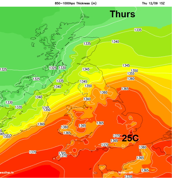
Caught up in this once tropical system will be some warmer air, and Greater London could see 24 or 25C on Thursday. As the open wave moves away over the North Sea, it takes the warm air with it and a bit of a chill will take hold for Thursday night.
That is the theme through the weekend, for most chilly nights. High pressure takes hold over the UK and will bring a lot of settled, fine even sunny weather with light winds. The only exception will be the far north/NW of Scotland where weather fronts will slide past with blustery winds and rain. Friday brings a few showers, Saturday more persistent and heavier rain and then on Sunday the front could sink a bit further south during the day, into central Scotland, later perhaps Northern Ireland. Otherwise, a fine autumnal, harvest weekend with light winds, patchy fog, sunshine and an early nip in the air.