A bit mixed and unreliable this week. Wednesday looks blustery, very windy in the far NW and there is a band of rain heading SE later today. Cooler air will follow, feeling more like autumn.
The start of September has been cooler and more unsettled. With brisk winds and rain from the west as several weather fronts and their low pressure rattle in from the Atlantic. It will be noticeably nippier by night this week.
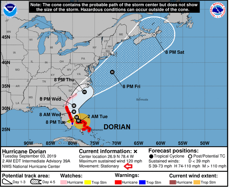
Across the Atlantic, Hurricane Dorian has battered the northern Bahamas as a Category 5 hurricane. Still a major hurricane today, the storm has barely moved devastating Abaco and Grand Bahama with catastrophic winds and terrible storm surge. The imagery of the eye just stationary over the islands for hours is sickening. South-eastern states of the US including eastern Florida are on alert for what happens next.
For the UK, it is a mild feeling day with temperatures in the southeast into the low 20sC. There is still a moderate SW wind but not as blustery as Monday in the north. Some sheltered spots in Northern Ireland and Scotland could manage the high teens but for most, it will be around 15 or 16C. Same for Wales, eastern Powys could see 18c but 14 or 15C for most.
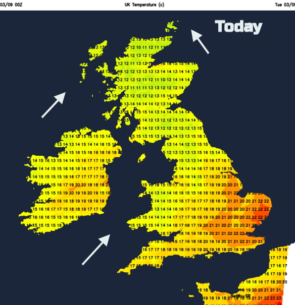
There is a lot of cloud about today and dampness or patchy rain from the west. A series of weather fronts move in, but later today there will be a more defined cold front pushing its way SE. So, before that, the UK is in the warm sector although the breeze and outbreaks of rain hold the temperatures back in northern and western areas.
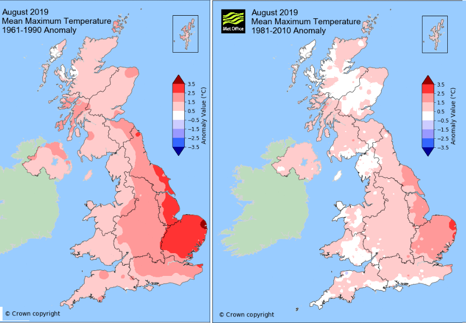
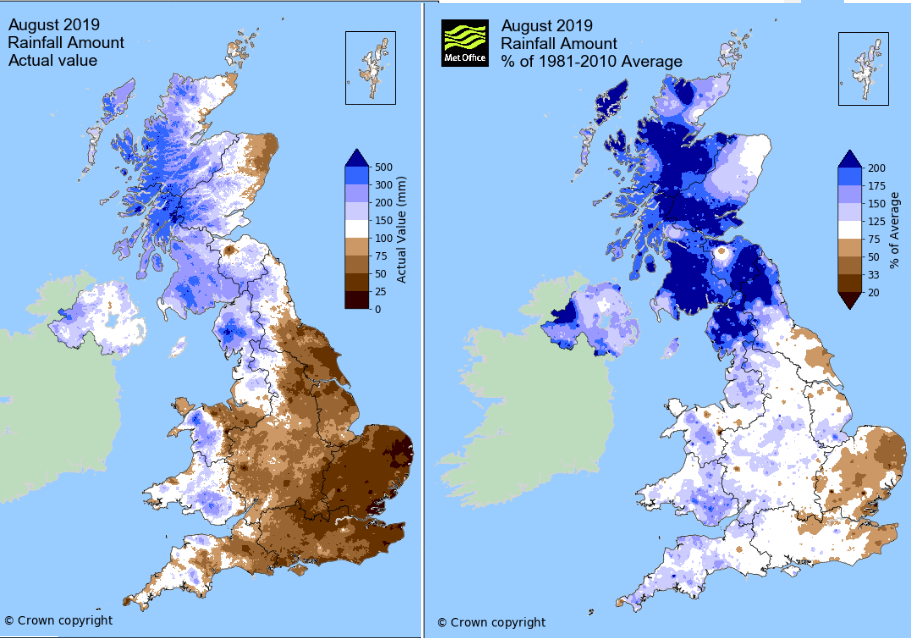
The data for August 2019 is out from the Met Office, and the charts comparing it against recent climate figures. August temperatures show it was warm for eastern England
SE and eastern England escape the rain today with sunny spells appearing. Cumbria will have a damp morning and Wales will see rain from the west and become damp this afternoon. The cold front rain will work its ways SE, from Scotland and Northern Ireland this afternoon and evening, into northern England and Wales and reaching SE England and East Anglia for Wednesday morning
The August rainfall figures show a very wet picture for Scotland in August 2019, wet also for Cumbria and parts of Northern Ireland. It was drier for eastern England, particularly the east of Norfolk and Suffolk.
Behind this early rain for the SE on Wednesday, will be cooler air, it will be clear and sunny. The bent back occlusion will be curling in from the far NW bringing rain to Argyll and Northern Ireland and this then spread through the Central Belt on Wednesday morning. In the sunshine, London could still reach 21c, the sun is still strong enough, but most places will begin to feel fresher.
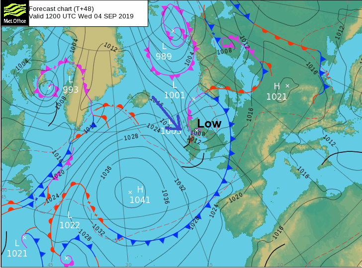
As the same low pressure heads away towards Norway, there will be a tuck of strong winds, coastal gales for the Western Isles and gusts over 50mph. These strong winds will be affecting western Scotland and Northern Ireland. England and Wales will start with a fresh westerly wind but there will be a dig of cooler winds from the NW later in the day and by evening rush hour strong winds for exposed routes and coasts of Scotland, mostly in the north and west, for Northern Ireland, through the North Channel and Irish Sea into NW England and Wales.
Turning colder in the north with a scattering of showers. Wednesday night looks chilly and clear with a touch of frost for the Grampians,
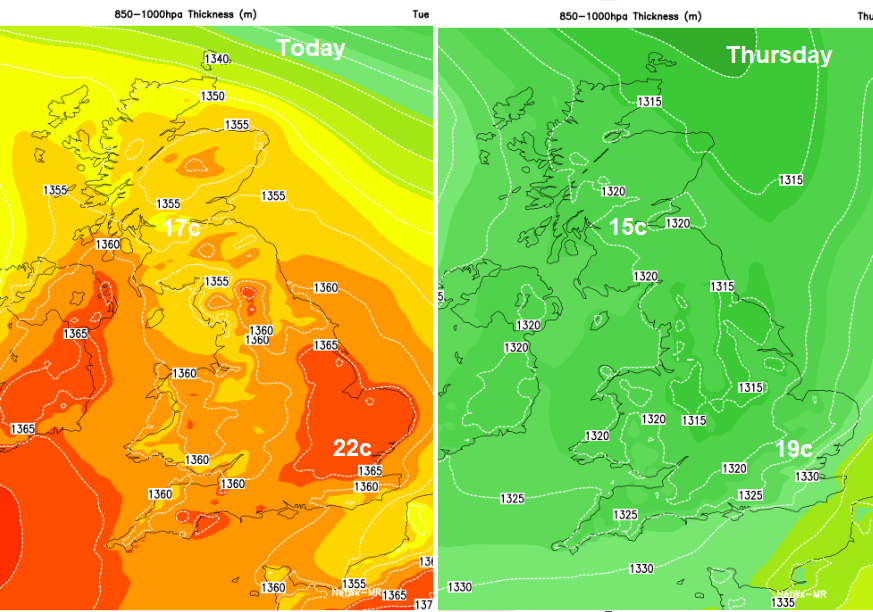
It does mean a clear, sunny but nippy start on Thursday for most before a warn front topples in from the far NW, already wet for the NW Highlands first thing.
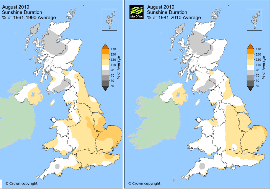
The August sunshine figures show plenty of sunny skies for eastern England particularly east Anglia again, showing their warm, sunny and dry month. This current westerly flow is bringing a similar story with rain, mostly for northern and western UK and slightly higher temperatures and more sunshine in the south and east.
More information about Hurricane Dorian here and discussion on the Netweather forum.