Blustery winds, a nip in the air and some cool nights to come this week. Shorts and summer dresses just, but a jumper, in the bag at least. A look at Hurricane Dorian too, devastating N.Bahamas.
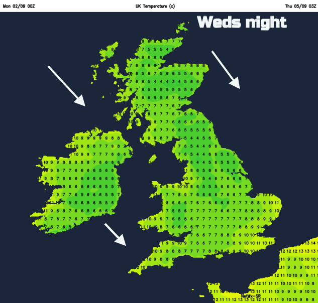
Overall this week, the start of September is looking rather cool, temperatures overnight fell to 0.0 in Aberdeenshire with an air frost. There has been a nip in the air over the weekend, a bit of a change and the spiders are heading inside. With winds from the west or NW this coolness continues although on Tuesday as SE Britain reaches into the low 20sC it will still feel pleasant in the sunshine.
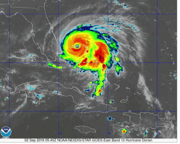
Category 5 Hurricane Dorian moving across the Bahamas
High pressure is lurking to the south or SW trying to build up over the UK but the Atlantic keeps barrelling in low pressure resulting in blustery winds and rain particularly for the north and west. Behind these lows, a pull of colder air reaches us with some more nippy nights.
Midweek, a low on Wednesday could bring gales in the north even severe gales around the far NW coasts. Meteorological autumn started on 1st September and this week will certainly feel more like autumn than summer.
Back to School
Days will vary, even weeks. Scottish schools have been back for several weeks now but for all the pupils and teachers back this week and parents waving them off, it is looking cooler.
Monday
Southern Britain has a fine start this morning, but cloud will increase with some damp weather for western Wales by home time. Up to 21C for SE Britain, so feeling okay today but 15 to 19C elsewhere. Northern Ireland has rain and clouds already and this continues through the day, moving in from the west. 17c in Belfast but feeling cooler with only 14 to 16C for most of N.Ireland and fresh westerly winds.
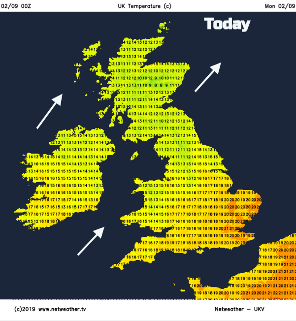
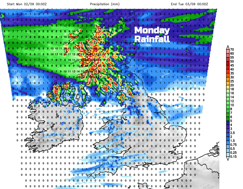
For northern Britain, there is already rain from the west and increasing cloud. Eastern areas will always have more sheltered and drier spells, but the cloud and a little rain will spread across Scotland and northern England at times on the brisk W to SW winds. Temperatures vary from 12 to 17C on the Moray coast.
The rainfall totals forecast shows the drier conditions for Fife and NE England.
Tuesday
Not a bad morning although there will be some patchy rain still for western Scotland. Not as heavy as today. A sequence of fronts scuttle in from the west over N.Ireland, Scotland bringing more rain as the day goes on. There will be damp weather for Wales and NW England into the Pennines by the afternoon as a warm front moves up through Scotland. Away from the rain, Northern Ireland, Scotland and northern England will feel a bit warmer with temperatures in the high teens thanks to the warm sector. SE and southern England will again see high teens and low 20sC with sunny spells.
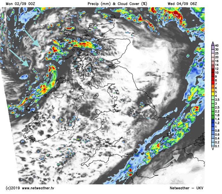
Later on Tuesday the cold front pushes across the UK, bringing a wet start to the SE on Wednesday. This is short lived as the rain band moves away eastwards but could bring a wet walk to school and commute. Wednesday looks to turn windy and cooler, as the NW wind digs down and brings in hefty showers with hail and thundery. SE England, although still seeing temperatures of 19C will have sunshine but brisk winds.
Across the other side of the Atlantic is Hurricane Dorian, a “catastrophic” category 5 hurricane which has been creeping across the northern Bahamas.
This expected slow motion will likely be devastating to the Great Abaco and Grand Bahama Islands since it would prolong the catastrophic winds, storm surge, and rainfall over those areas. The timing of the northwest or north turn is very critical in determining how close Dorian will get to the Florida peninsula on Tuesday and Wednesday. NHC
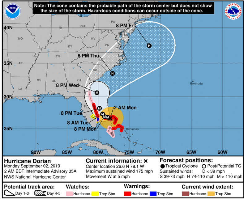
The path looks to move up the eastern seaboard but offshore, however hurricane preparations have been going on in Florida since last week and Georgia and the Carolinas will also be watching this major hurricane closely as news begins to trickle out from the Bahamas.
More chat and discussion in the Hurricane thread on the Netweather forum