The UK weather hasn't been doing very well this August. There are bright, drier interludes but we have rain today, showers this weekend and blustery winds, gales in the NW
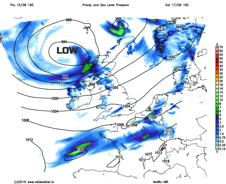
After a relatively fine Thursday, today’s weather will be dominated by a low pressure away to the NW which will stay near to northern Scotland throughout the weekend. This means the UK will have blustery winds, hefty showers from the west and spells of rain. After this weekend-coinciding spell of unsettled weather, there are signs that the UK weather should change next week, becoming drier and more settled, finally in August.
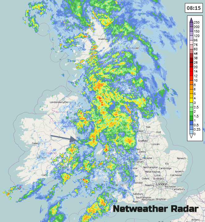
There is a Met Office rain warning out today for Wales, around Gt.Manchester and SW England. The frontal rain has moved in overnight for Ireland and Scotland then across the Irish Sea, with strengthening winds. There is some warm air caught up in this system, drawn up on the brisk southerly winds. So, although it will be a blustery winds with rain there will be a different feel to the air after the brisk westerly flow of Thursday. Ahead of the rain there will be a little fine breezy weather before showery bursts reach SE Britain and the main rain band plods over more England and Wales this morning, clearing Scotland and Northern Ireland but leaving scattered showers with the sunny spells. Temperatures behind the frontal rain could reach 20C but feeling cooler underneath the wet weather.
“Heavy rain may also coincide with peak travel times during the afternoon and early evening leading to difficult driving conditions on major routes. The heaviest rain is most likely over high ground, where some places may see 60-80 mm. Strong winds are also expected with 30-40 mph gusts likely around exposed coasts and hills.” Met Office
It will be a very wet day for Wales and western England, with plenty of rain up on the hills and moors. If you are out for the day, or even this week as the winds continue, do consider the local forecast.
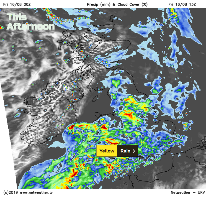
The main frontal bands of rain will clear away over the North Sea by Friday night, leaving clearer skies and a cooler feel. Heavy showers will continue for western Scotland.
Saturday
There will be organised bands of heavy showers moving across Scotland during Saturday, then a brighter interlude before more head in from the west. The winds will be blustery and from the SW but in the afternoon, there will be strong winds for Northern Ireland and the west coast of Scotland, with southerly gales through the Minch by Saturday evening. At times conditions will be squally so Highland walkers should take note. There will be other lines of showers working their way across Ireland and then Britain but with plenty more fair, bright even sunny weather. Temperatures will be a subdued, mid-teens to low 20sC for eastern and SE England
Sunday
After another cool night in the north, there will be light winds for England to start Sunday. The SW wind soon picks up once more becoming fresh for many and it will again drive in showers from the west. There should be a lot of fine, bright weather for Britain, inland and for eastern areas. The low pressure centre will be moving across northern Scotland so lighter winds here to end the day.
Even as the low clears, Monday looks blustery with more showers from the west but hopefully, high pressure will build in next week and bring a change to our August weather, as there is a Bank Holiday weekend coming up.