
Changeable weather continues for the rest of this week and through the weekend, tomorrow the only fine day in a whole lot of cool and unsettled days ahead, featuring rain or showers.
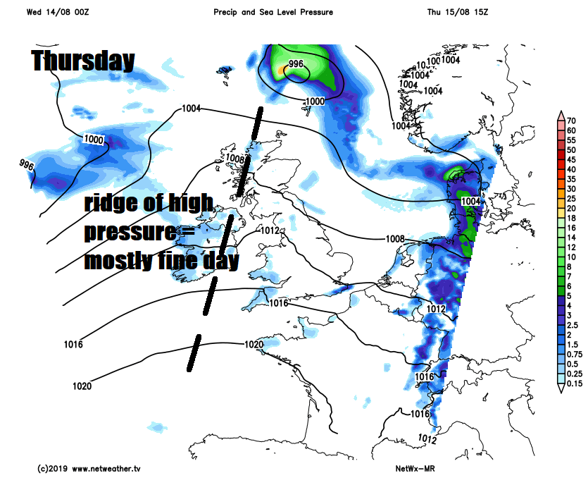
Most of the UK will be rather cloudy today, with some rain at times spreading from the west, turning heavy at times across the south and west, as frontal systems move in off the Atlantic. A brief ridge of high pressure will build in to bring a drier and sunnier day for most on Thursday. Then the weather goes downhill again on Friday, as active frontal systems moving east ahead of deep area of low pressure to the northwest brings a spell of wet and windy weather followed by showers. The weekend will continue cool, unsettled and windy, thanks to a deep area of low pressure hanging around close to the north of Scotland, with sunny spells and blustery showers across many parts.
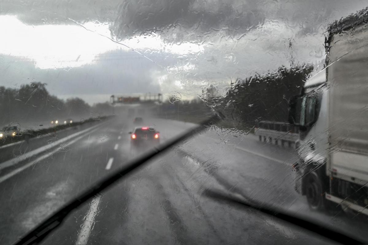
For now, it’s a cloudy and wet commute for many this morning, and outbreaks of rain will continue to spread eastwards across many areas this morning. After some dry and bright conditions across the far southeast of England early on, rain will reach here from the west too. Northern and northeastern Scotland have a dry and bright start too, quite chilly to start the day with temperatures falling into single figure overnight, but rain already across the south and west of Scotland will spread up here through the morning.
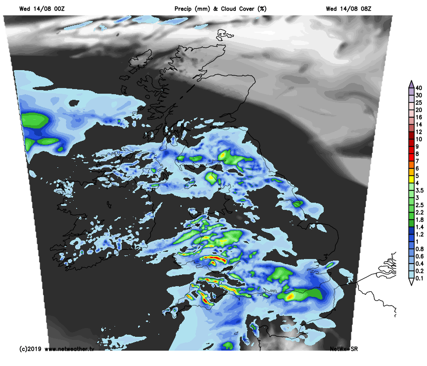
The morning outbreaks of rain across many areas will gradually clear from the west through the afternoon, though perhaps not East Anglia and far SE of England until early evening, some drier and brighter spells following from the west, but this could trigger some thunderstorms – particularly across east Wales, NW England, the Midlands and across to Lincolnshire. A separate area of heavy and perhaps thundery rain will also spread in across western Scotland and N. Ireland by the evening, as an area of low pressure moves in.
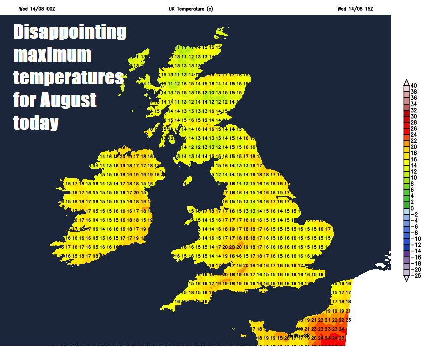
Maximum temperatures today rather disappointing for mid-August, 15-18C in the north, 18-20 in the south.
Outbreaks of heavy and perhaps thundery rain spreading northeast across western and northern Scotland this evening, before clearing in the early hours to clear conditions with a few showers overnight. Further south, any thunderstorms across central areas will die out to leave most areas with a dry night with clear spells, though a few showers are possible still in the west.
A better day for all on Thursday, as high pressure builds in, perhaps a cloudy start towards the west with a few showers, but sunny spells will develop across most areas, best of the sunshine towards southeast England. Most will have a dry afternoon, but the odd light shower can’t be ruled across northern areas in the afternoon. Temperatures reaching 15-18C across Scotland and N. Ireland, a little warmer than today across England and Wales, reaching 19-23C.
All change again as we head through Friday, as a deep area of low pressure barrels in towards northwest Scotland, so becoming windy across all areas, with outbreaks of heavy rain and gusty winds spreading east across all areas through the day. Perhaps a dry and bright morning across SE England and East Anglia before rain arrives here and lingers during the afternoon, while rain clears east elsewhere through the afternoon to be replaced by brighter, showery but still windy conditions. Temperatures below par for mid-August, reaching 16-19C generally, perhaps may squeeze 20C in the far west where we see some sunshine in the afternoon.
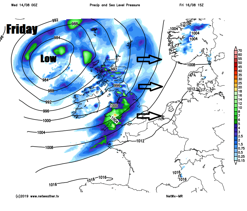
Saturday and Sunday look to stay unsettled, windy and cool unfortunately, as deep low pressure remains close to the north of Scotland. Early rain clearing the far southeast of England Saturday morning, then sunny spells and blustery showers moving quickly through on a strong westerly wind, most of the showers in the north and west, drier towards the southeast. Sunny spells with blustery showers more widespread on Sunday, heaviest across the northwest, with hail and thunder possible.
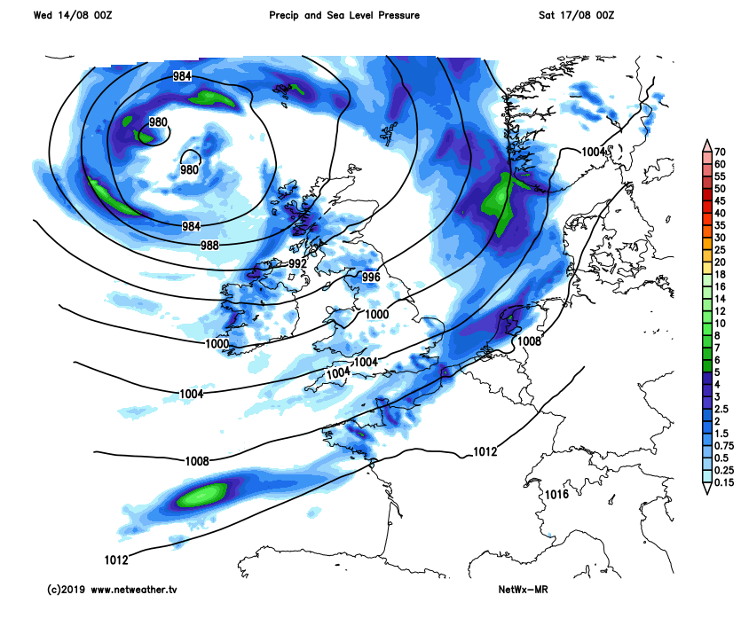
Some uncertainty for next week, low pressure looks to be close by to start next week, so breezy and cool with sunny spells and further showers on Monday and Tuesday, but from mid-week – we may see high pressure build, to bring a drier and more settled second half of the week, but the weather models diverge on this idea for now.


