


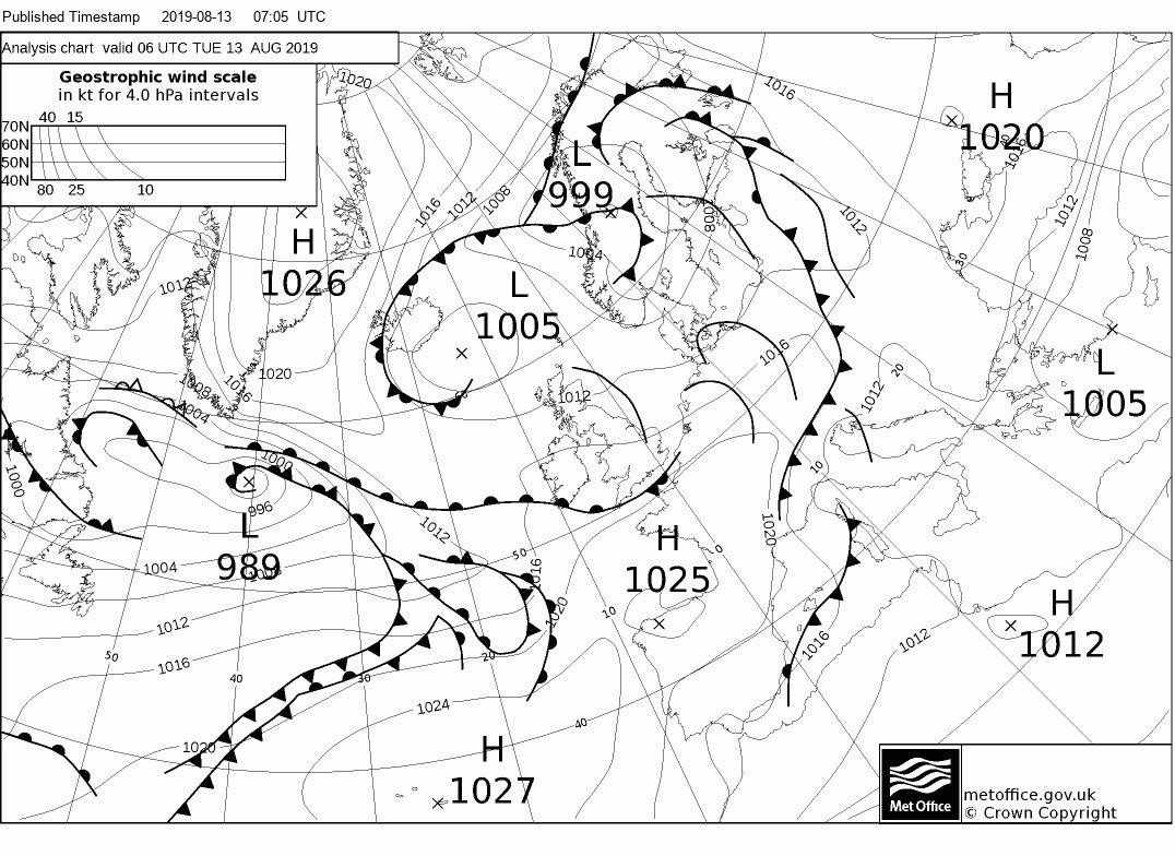
A strong jet stream close by over the coming days will bring changeable conditions this week and beyond, with spells of rain, windy conditions at times and generally cool for August.
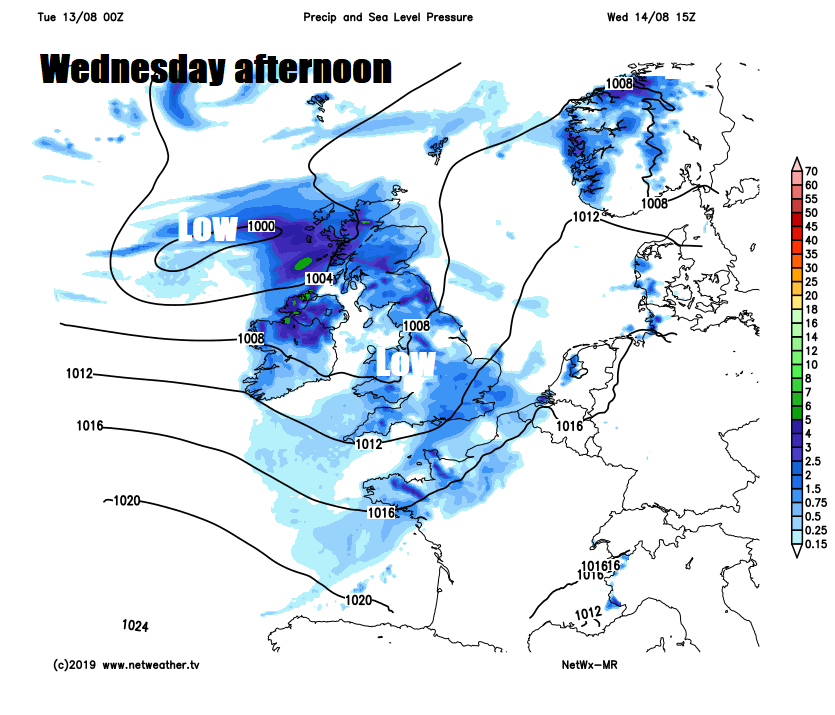
The weather will remain changeable and on the cool side for the rest of the week and beyond through the weekend, thanks to a strong jet stream close by. Many places will stay dry with sunny spells today, there will be showers, but fewer then yesterday. The weather goes downhill on Wednesday, as one low moves across the south bringing heavy and persistent rain to England and Wales, while another low further north brings rain to Scotland later in the day. Thursday is looking mostly fine, as a brief ridge of high pressure builds, but downhill again on Friday, turning windy with heavy rain moving in from the west after a dry start. The weekend continuing in a similar vein, windy and cool with spells of showery rain moving from west to east.
Low pressure in charge for much of this week, bringing cool & changeable conditions with rain or showers at times.
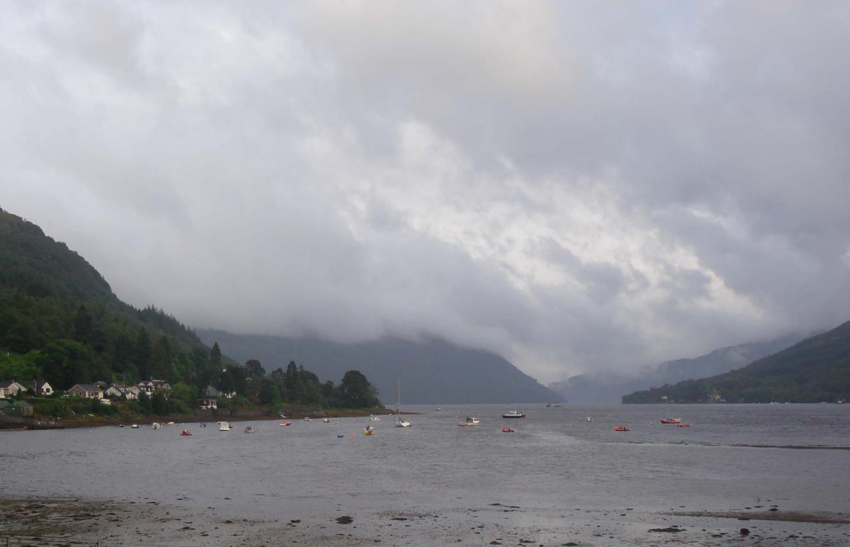
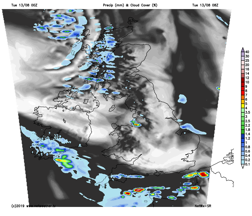
For now, it’s a mostly dry and bright or sunny start for many, chilly across northern areas and across Ireland, with temperatures dipping into single figures, as low as 4C at 6am at Eskdalemuir in southern Scotland. There is more in the way of cloud with some showers around western coasts of the Scotland and NW England, thicker cloud across southern coastal counties of England – which is bringing outbreaks of rain for the morning commute across Cornwall, south Devon, Channel Islands, coastal Dorset and as far as Hampshire.
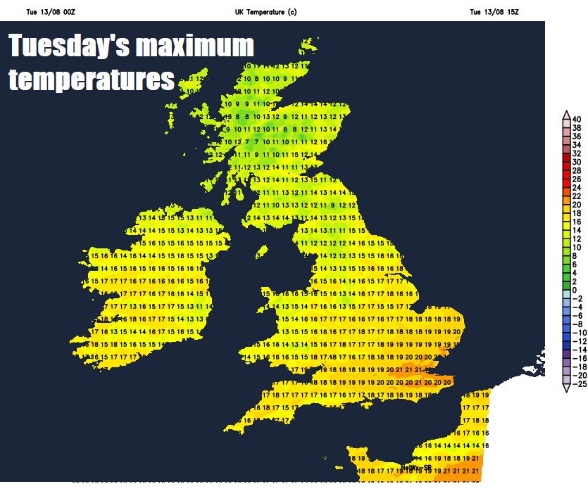
A warm front will bring cloudy skies with patchy rain through much of the day across SW England, but elsewhere it’s looking like a largely fine day with sunny spells, the cloud will build to bring some isolated showers, these most likely across Scotland and northern England, but the odd one can’t be ruled out elsewhere. Temperatures reaching 15-19C in the north, 19-21C in the south. Slightly below par for what we should expect in early August.
Any showers generally dying out overnight to leave most northern and eastern areas dry with clear spells. Showers will spread northeast across the Republic of Ireland and Northern Ireland to affect coastal areas of NW England and western Scotland by the end of the night, while a low moving into the southwest approaches spreads outbreaks of rain northeast across the West Country, Wales, west Midlands and central southern England in the early hours.
A frontal system will continue to move eastwards across southern Britain tomorrow, spreading outbreaks of rain, locally heavy and persistent, east across much of England and Wales during the morning, though NE England probably staying dry. Brighter conditions with showers following from the west in the afternoon as the rain clears eastern England by the evening. Scotland and N. Ireland bright but with scattered showers before cloud thickens from the west bringing persistent and heavy rain to N. Ireland and western Scotland by the evening. A cool day, temperatures reaching 15-18C in the north, 18-19C in the south.
A mostly dry day on Thursday, as a ridge of high pressure builds in, perhaps a cloudy start with a few showers at first in the east, but sunshine increasing from the west to bring a mostly dry and sunny afternoon. Temperatures ranging from 17C in the north to 22C in the south.
Persistent and heavy rain accompanied by gusty winds will spread northeast across northern and western areas Friday morning and remaining wet and windy through the afternoon, mostly dry morning across central, southern and eastern England before rain reaches here in the afternoon.
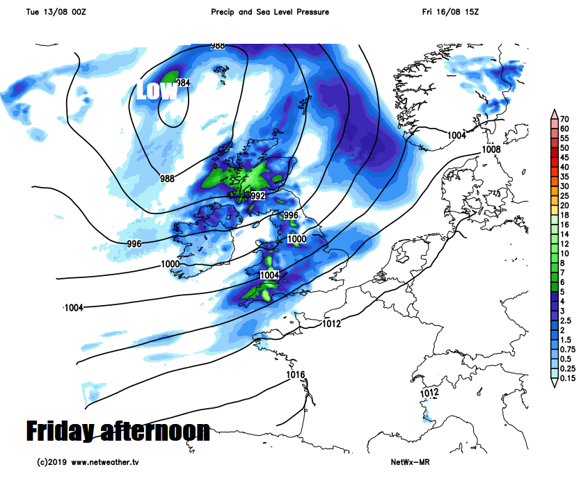
Staying unsettled, cool and windy through the weekend, with a deep area of low pressure stuck close by to the north of the UK, driving showers or longer spells of rain across many areas, though there should be some drier and brighter interludes, particularly Sunday morning, before showers develop and spread from the west in the afternoon.


