Another warning from the Met Office to start the week, thunderstorms in the SE on Monday. There is a cool feel to the air, away from sheltered sunny spots. A scattering of showers today but plenty of bright or sunny spells too.
Summer 2019 rattles on with rather a lot of wet weather. It makes a change from extreme heat, drought conditions and potential water shortages but as we reach the middle of August we have some cool days and nights coming up and even more rain. It’s back to school in Scotland this week, will the memories of heat and sun for this summer be confined to July?
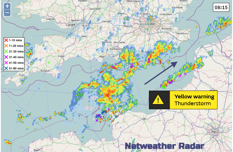
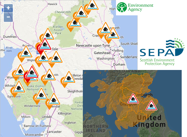
Today there are lingering heavy, even thundery showers over SE England to start Monday. These reach from the Channel Islands into the eastern Channel heading NE bringing downpours, surface water and spray to the morning rush. The threat of heavy showers and thunderstorms continue today for Hampshire across the SE into London, Essex and Kent. The Met Office has issued a yellow warning for Thunderstorms from 10am until 7pm today for SE England. There are a few more scattered showers over southern Britain but bright or sunny spells in-between. Wales has a fine start this morning as does much of Yorkshire although further north in England there is more cloud. The weekend wet weather which also affected Scotland is nearly away over the North Sea, but a few flood warnings are still in place, for central Scotland and Cumbria.
Any damp weather clinging on to NE Britain’s coasts will clear away eastwards this morning and there is welcome sunshine. Showers have already started appearing from the NW for Northern Ireland even with a fine start to the working week. Some of these showers will become heavier, even thundery this afternoon. Many areas of the UK will have a fair, bright or sunny day with a light west wind and just feeling a bit cooler. There will be a scattering of showers from the west, but it won’t be as wet as it has been (away from the showery SE corner).
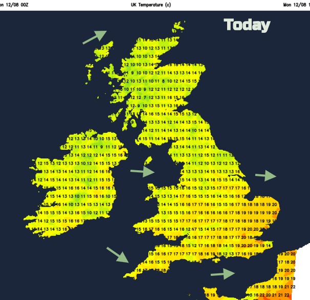
Temperatures will be in the mid to high teens for most with 20 or 21 for London or East Anglia.
There is a low pressure up by Iceland steering our cooler and later showery flow from the NW. Most of the showers fade tonight, although a cluster continues to feed in from the Irish Sea/Morecambe Bay over NW England, they just keep on coming.
Temperatures will fall down into single figures on Monday night inland and on Tuesday peaking in the high teens or 20C. There will be a moderate westerly wind so it will feel a bit cooler. Again, there will be a scattering of showers with lots of fine, bright and sunny weather across the UK for Tuesday morning. Cirrus begins to appear for western Ireland and Cornwall later in the day as a new weather system edges in from the Atlantic.
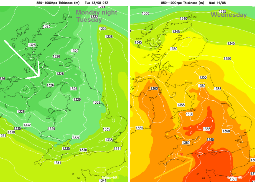
This low pressure will bring rain and blustery winds but there is some uncertainty about where the centre of the low will move across, so a deeper feature bringing heavy rain to England and Wales or a less intense low pressure heading for western Scotland with a spell of rain for more of the UK. Once that is through another low pressure looks to head in later in the week, drawing up some warmer air ahead of it for Friday. The changeable, showery conditions look to keep us on our toes throughout this week, probably throughout August. Enjoy the bright and sunny interludes whilst you can.
Convective forecast for Monday's thunderstorms from Nick Finnis