Jet stream tracking unusually far south for early August will be close by this coming week, bringing unsettled conditions with spells of rain or showers at times.
A strong Atlantic jet stream has been unusually far south for August to start this weekend, bringing a fairly deep depression swinging across northern Britain, bringing unusually strong winds to southern Britain on Saturday, with gusts of 50-60 mph along southern and western coasts and 40-50mph gusts inland. These strong winds brought trees down onto railways and roads causing travel disruption, numerous outdoor events were cancelled, while cross-channel ferries were disrupted between Dover and Calais. Also, a slow-moving band of locally heavy rain across southern Scotland and northern England yesterday brought 3 inches of rain to parts of Cumbria.
Strong Atlantic jet stream, which is unusually far south, will be close by through the coming week
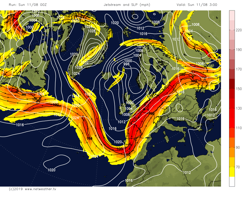
Sunday will remain on the windy side with thundery showers for the south, but not as windy as yesterday, while northern England and southern Scotland see more rain with a risk of flooding. The jet stream will remain close to the UK this coming week, bringing further low pressure systems off the Atlantic across the UK, leading to further spells of rain or showers at times.
Back to today, a generally cloudy morning across the northern half of Britain, with outbreaks of rain, locally heavy, continuing to affect parts of southern and western Scotland along with Cumbria, some showers for eastern Scotland and N. Ireland. Rain will continue to plague central and southern Scotland along with the far north of England for much of the day, this will exacerbate the risk for flooding, the Met Office have yellow warnings out for heavy rain leading to flooding. Northern Ireland and northern Scotland perhaps seeing drier and brighter conditions after morning cloud and showers.
Further south, still windy across southern areas, mostly dry and sunny for eastern areas of England this morning, but showers affecting Wales, SW England and southern coasts, showers heavy across south Wales and northern coasts of SW England. The showers in the west will drift or develop further east across the Midlands, East Anglia and central southern England into the afternoon, locally heavy with hail and thunder, a few showers also developing across SE England too, but many here escaping with a dry afternoon.
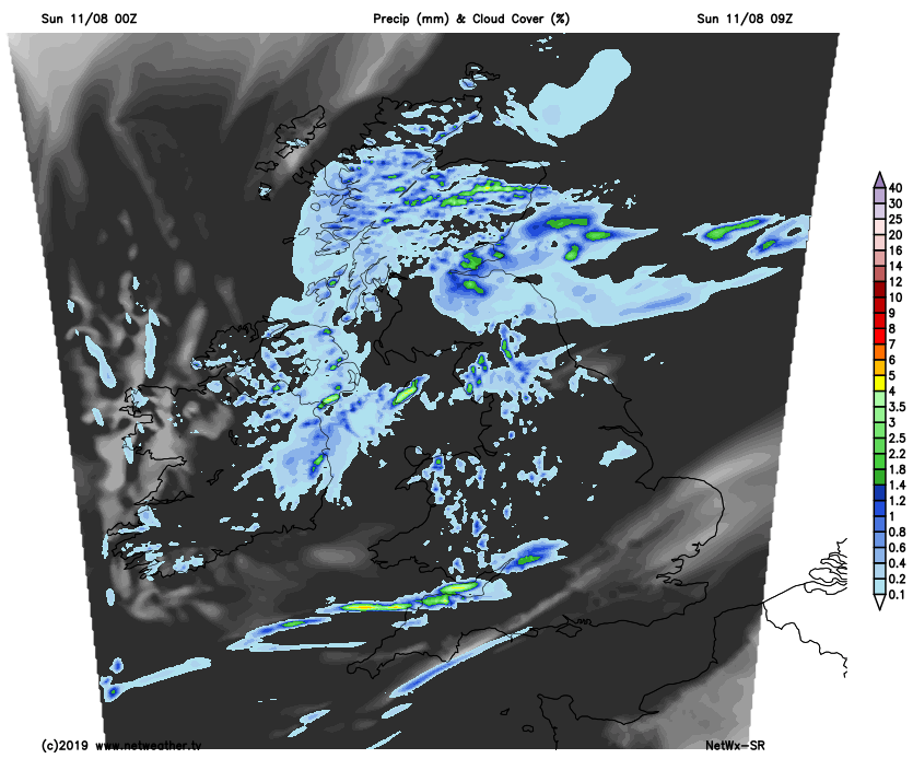
Temperatures reaching a disappointing 13-16C under the cloud and rain in the north, but where we see some sunshine further south in between the showers, temperatures should reach 19-23C.
Rain continuing into the night across southern Scotland and far north of England, before gradually clearing out into the North Sea in the early hours. Showers generally dying out inland elsewhere to leave a dry night with clear spells, but showers, locally heavy, may continue around southern and western coasts.
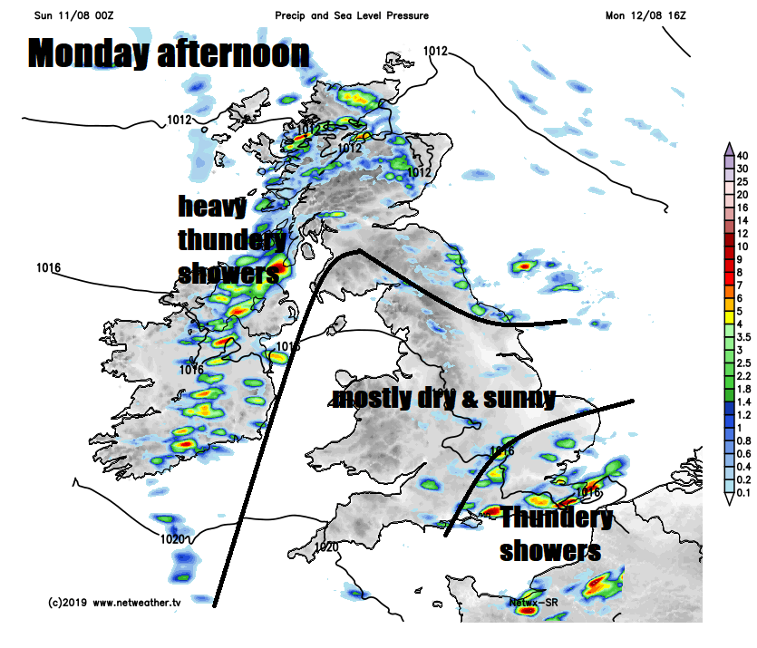
Low pressure close to the NE today pulls away east across Norway on Monday, pulling down a cooler polar flow from the northwest across much of the UK, so a cooler and fresher day tomorrow and tomorrow night will be noticeably cooler too. After a mostly dry and sunny start, showers will develop and affect mostly northern and western areas, heavy and thundery across the Republic of Ireland and Northern Ireland. Central, southwest and much eastern England seeing a drier day with sunny spells, but heavy and perhaps thundery showers may develop in the southeast, mostly to the south and east of London in the afternoon. Temperatures reaching 15-17C in the north, 18-21C in the south, so a bit disappointing to what we’ve had earlier in the summer.
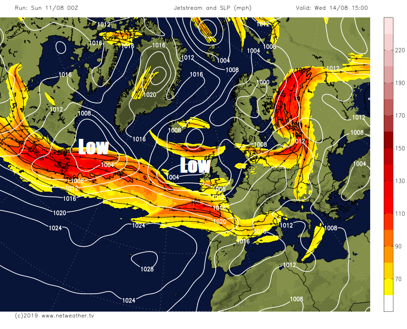
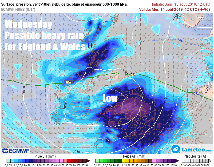
Tuesday will see further scattered showers across northern and western areas, eastern England mostly dry and sunny. A developing area of low pressure is forecast to move in across SW Britain early on Wednesday, before tracking east across southern areas during the day, bringing outbreaks of locally heavy and persistent rain across England and Wales, Scotland and Northern Ireland bright with a few showers.
A cool and showery northwesterly flow looks likely across all areas on Thursday. Then a brief ridge of high pressure looks to build in to bring a fine and sunny morning on Friday, staying dry in the east in the afternoon perhaps, but cloud, rain and strong winds may move in across the west in the afternoon.