Low pressure in charge for the rest of the week, bringing sunshine and showers, before deep low arriving in the west on Friday brings wet and windy weather for all.
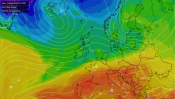
Low pressure is in charge for the rest of this week, so if it’s dry, sunny and settled weather you are after, then you may be disappointed. An area of low pressure will cross northern Britain today, bringing sunshine and showers, with thunder and hail locally, with a fresh, breezy feel in the south. Wednesday will bring another day of sunshine and showers, breezy again in the south. Thursday is probably looking the driest day of the week, but still with a few showers in places, before a rather deep area of low pressure for the time of year swings in towards Ireland on Friday, bringing a spell of heavy and thundery rain across the south Thursday night, before spreading to the north Friday morning, followed by strong winds, sunshine and heavy thundery showers, gales around coasts.
For now, most are off to a dry and sunny start across the UK, but there have been heavy showers from the word go across some western areas, showers prolonged and merging into longer spells of heavy rain across southwest and central Scotland – so some tricky driving conditions possible here for the morning commute.
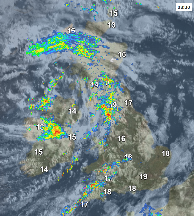
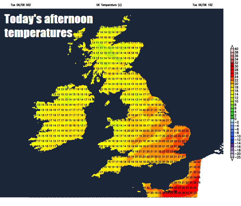
Despite the dry and sunny but breezy start for many away from some western parts seeing those showers, cloud will bubble up through the morning and into the afternoon, with showers breaking out and becoming more widespread across much of England, Wales, Scotland and Northern Ireland. Some of the showers will be heavy, with some thunderstorms developing locally too, perhaps accompanied by hail and gusty winds. Showers will be slow-moving across the north, so some places could see a lot of rain in a short-space of time leading to localised flooding. Some places may escape the showers and storms and stay dry and sunny, more particularly along southern coastal areas and the far SE of England – where the onshore southwesterly flow will keep showers building inland away.
Quite breezy across the south today, noticeably strong southwesterly wind along southern and western coasts, lighter winds in the north near the low moving through. Temperatures a little lower than recent days, reaching 20-23C across England and Wales, 17-20C across Scotland and Northern Ireland.
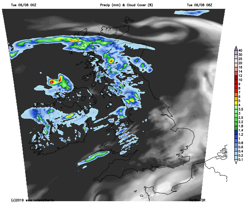
SE England should become largely dry overnight, but scattered heavy showers with isolated thunder will continue to feed in from the west elsewhere, with clear spells in between, but many places could avoid them and stay dry. Temperatures falling to around 11-14C, continuing breezy in the south.
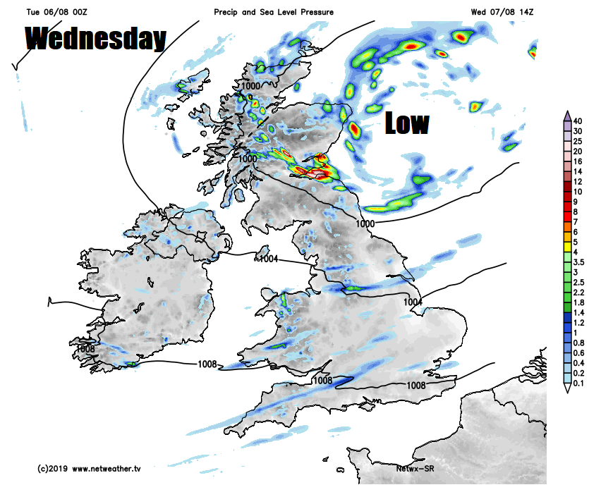
Another day of sunshine and showers, perhaps showers from the word go in places, but some will have a dry and sunny start too. But like today, the cloud will bubble up and showers will break out, mostly across the northern half of Britain where they will be most frequent and heaviest – with a risk of hail and thunder. Showers fewer and further between in the south, with more in the way of sunshine, but still breezy here, while winds will be lighter in the north. Temperatures ranging from 16-19C across Scotland and N. Ireland to 19-23C across England and Wales.
A drier day for most on Thursday, many places staying dry and fine with sunny spells during the day, though cloud will bubble across Scotland and northern England to allow a few well scattered showers to develop in the afternoon. A few showers may crop up along southern coastal counties by early evening too. Temperatures reaching 15-21C in the north, 20-24C in the south.
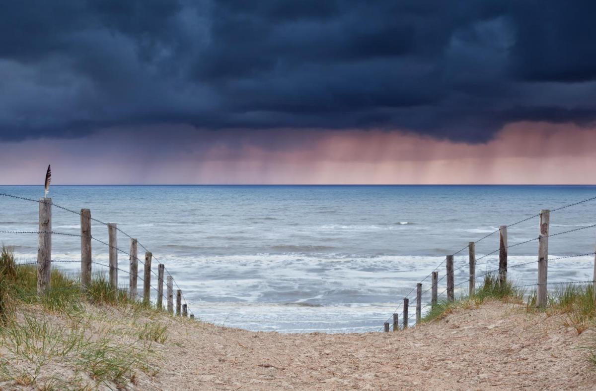
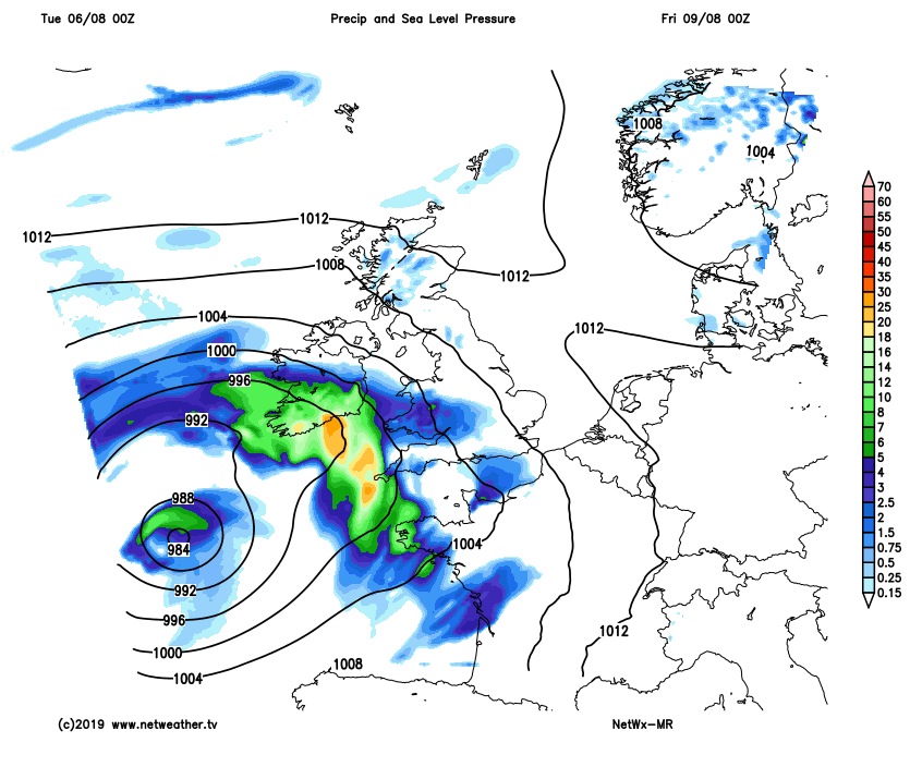
Increasingly windy with bands of heavy and perhaps thundery rain spreading northeast across England, Wales and N. Ireland Thursday night, perhaps reaching southern Scotland by dawn, ahead of a deep area of low pressure moving in across Ireland later on Friday. Outbreaks of heavy and thundery rain clearing north across the UK Friday morning, but perhaps lingering across Scotland into the afternoon and not clearing the north until late in the day. Rather windy conditions with sunshine and showers following the rain across England and Wales, most of the showers in the west, gales around southern and western coasts. So all-in-all, feeling more like autumn than high summer!
The weekend looking cool and showery, as low pressure tracks northeast across northern Britain. Tight isobars on Saturday means it will be a windy day everywhere, but at least showers will pass through quickly and there will be sunny spells too. Winds perhaps easing on Sunday, with showers perhaps fewer and more scattered.


.png?w=350)