


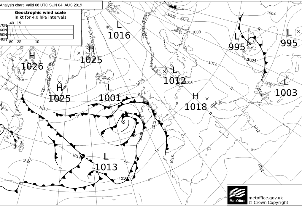
The weather for the week ahead will be dominated by low pressure. That brings the threat of further heavy rain each day, and with it the risk of further flooding.
Low pressure is going to be running the UK and Ireland's weather during the upcoming week, which means more rain, more potential flooding and more wet weather days to deal with during the school holidays.
The problem with low pressure during the summer is that the warmer the air, the more moisture it can carry, and there's more energy available within the atmosphere. So, even when fronts aren't over the UK, the risk will always be there of some heavy, showers and thunderstorms to develop.
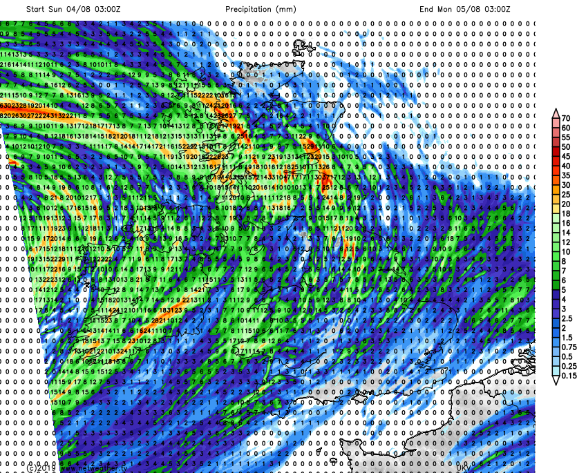
Each day this week, there'll be the potential for 20-40mm+ of rain locally, and unfortunately often the highest risk areas will be those which have already been affected by flooding. This includes Whaley Bridge.
Today (Sunday) is no different with a weather front approaching from the west bringing some more persistent wet weather for a time into western and northern Scotland, and perhaps a few other western regions. But, it's as the front moves further east, the persistent rain disappears but is replaced by localised downpours and thunderstorms. On top of that, as the initial batch of wet weather and showers moves east later, another one will be following hot on its heels into the west.
The rainfall totals for today and the first part of the night tells the story, just about all parts at risk of seeing a shower, with the midlands north at highest risk of seeing some sizeable rainfall totals, across a fairly short period of time.
Despite the rain, it'll be a fairly warm day - especially in the drier, sunnier east where temperatures will get into the mid-twenties.
Monday will begin with heavy and persistent rain slowly edging north across the northern half of Scotland and a scattering of showers elsewhere. Through the day, the rain in Scotland will clear and many of the early showers will tend to clear east. That'll leave a day with sunny spells and isolated heavy, thundery showers. These will be most frequent across the island of Ireland, the far north of England, and Scotland.
Temperatures will be warmest in the east and south, reaching 22-24c, 18-21c will be typical elsewhere.
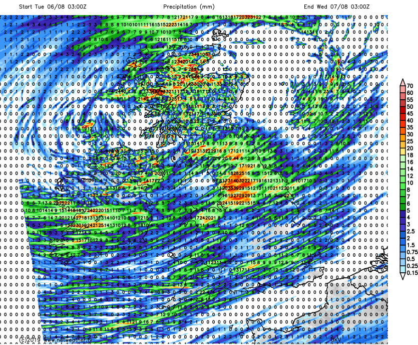
The showers and thunderstorms are liable to become more widespread again on Tuesday, with some potentially merging into longer spells of wet weather. Ireland and the northern half of Britain will see the most frequent downpours. Rain totals of 40mm plus possible in some places:
With low pressure crossing Scotland through the day, it'll be breezy, if not blustery in exposed places throughout the UK and Ireland. That'll keep the temperatures in the teens in the west, but in the more sheltered southeast, maxes into the mid-twenties are more likely.
Low pressure will be out in the North Sea on Wednesday, with west or northwest winds blowing more showers through. Central and southeastern regions may be best placed to avoid the majority of them and see the best of the sunshine.
Temperatures will widely reach 19-21c, but will close in on the mid-twenties again in the south and southeast.
We look set to be between systems on Thursday. You may think ought to provide a respite, but at this time of year, it's actually a recipe for homegrown, slow-moving showers with the atmosphere destabilising thanks to the heating the sun provides.
Shower distribution will be hit and miss and is hard to call at this stage, but the potential is there for yet more very heavy downpours and thunderstorms. With the light winds, they're not going to move quickly either, so it's yet another day with the likelihood of 25-40mm or more of rain locally.
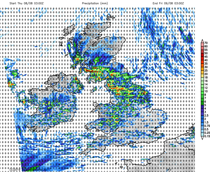
As we move toward the end of the week, timings of pressure systems start to get tricky, which in fact could make changes on Thursday too. We do look set to see an area of low pressure move up from the southwest sometime on Friday. If it arrives earlier on Friday, it may mean that Thursday will be drier in the west and south at least, as a brief ridge of higher pressure squeezes the showers away. Alternatively, it'll arrive later on Friday with that ridge bringing a brief break from the majority of showers for most on Friday before a spell of wind and rain heads up from the southwest later.
Unfortunately though, whilst the timings are uncertain, the general direction of travel is clearer. The unsettled weather continues into the weekend and next week..


