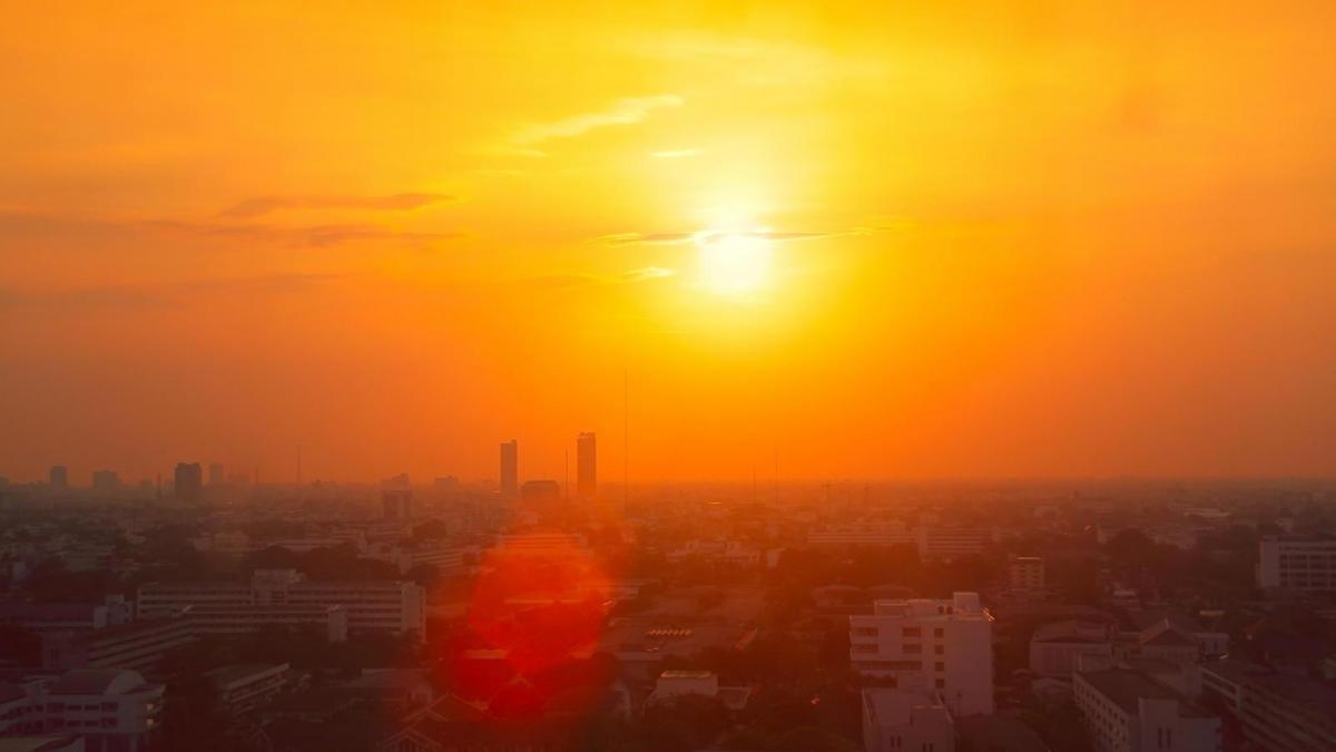
The next few days bring the potential for record-breaking temperatures, but also the threat of torrential downpours and thunderstorms.
The current set of synoptic charts are the most interesting and challenging that I have seen for many years. They have the potential to produce record-breaking high temperatures, as well as torrential downpours which in themselves, may produce locally record amounts of rainfall in a short space of time causing flash flooding. The challenge is when and where these downpours will occur, as thunderstorms are notoriously difficult to predict and hit and miss.
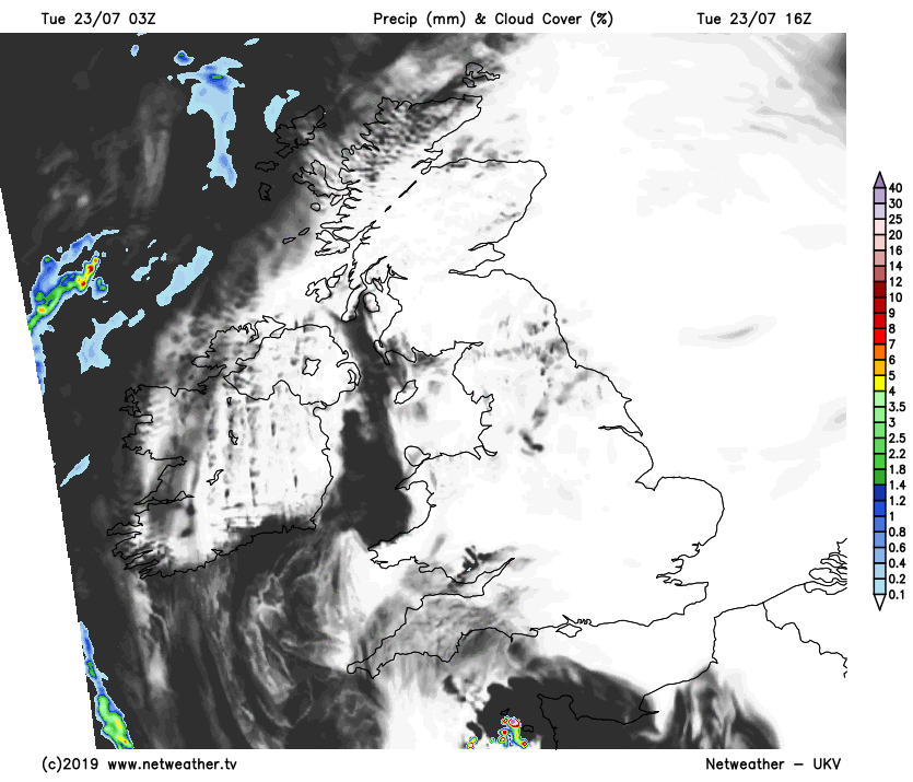
After an uncomfortable night for sleeping, some places woke to mist, patchy fog or low cloud first thing, this mostly in the South and West and across Wales. This could linger across the Isle of Man and around some Irish Sea coasts but will lift and clear from most parts through the morning. We also have a few showers across the Western Isles, but these will soon clear to the North leaving much of the country with long spells of sunshine.
| Type | Temperature |
|---|---|
| UK highest max | 38.5c (101.3f) |
| July UK max | 36.7c (98.1f) |
| UK highest min | 23.9c |
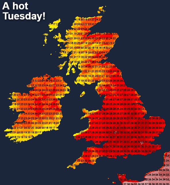
It'll become hot or very hot in humid conditions, as temperatures across England and Wales reach 26 to 32C, with 33 or 34C possible around London. Sea breezes will keep some coasts cooler, as will be the North and West of Scotland and where sea fog comes ashore.
Most places will be dry, but with the sun turning hazy later, especially in the South and South West. Here, a few sharp showers or thunderstorms may develop by late afternoon. A southerly wind lighter than yesterday becomes easterly over England and Wales later.
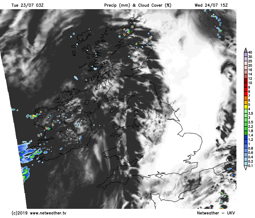
In a sticky evening and night, temperatures may not fall below 18 to 20C across parts of the Midlands and South. Inner London may not fall below 21 or 22C, with 14 to 17C more likely further North. So while it'll be an ideal evening for barbecues, you'll need to keep an eye on the sky as a scattering of heavy showers and thunderstorms spread from the South. These may give some spectacular lightning displays, most likely in the West and across some central parts, before moving North to affect Northern Ireland and parts of Scotland later in the night. The extent of these storms always causes problems as they are 'hit and miss' and therefore, not everywhere will see them. A mostly light South Easterly breeze will be gusty around any storms.
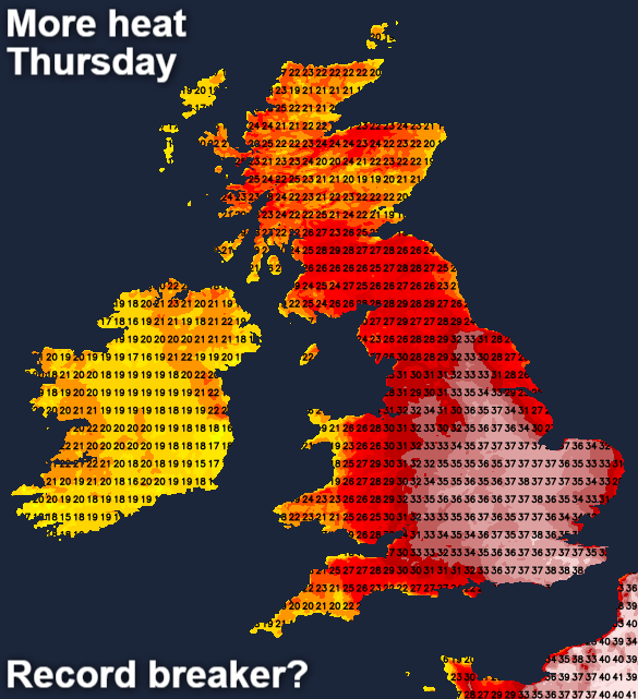
Parts of Scotland begin grey and misty on Wednesday, with showers and a few thunderstorms about. These will fade and move away to the North, allowing some sunshine to come through, especially towards Dumfries and in the South. Northern Ireland also sees conditions improving with some sunshine in a somewhat fresher day here. Across England and Wales, it remains very humid, with any remaining showers in the North soon clearing. This'll leave sunny spells but as it becomes hot again, a few showers or storms could break-out later.
Top temperatures 18 to 24C over Scotland and Northern Ireland, but a hot or very hot and humid 26 to 32C again over England and much of Wales.
It'll be another very humid evening and night over England, Wales and South East Scotland, with a few showers and probably the odd thunderstorm about, but most places should stay dry. Mist, patchy fog and some areas of low cloud may also form overnight in a light East or South Easterly breeze. Temperatures are unlikely to fall below a very 'sticky' 18 to 22C across England and Wales, with 13 to 16C more likely further North and over Northern Ireland.
Thursday will be the final day of the heatwave, with fresher air moving in from the West on Friday, probably preceded by more heavy showers and thunderstorms. By the weekend temperatures will be closer to normal everywhere, but it won't be entirely settled with some rain at times.