Temperatures will rise into the mid-twenties this week. But it won't all be sunshine and heat, as thundery downpours get in on the act too.
Heat and humidity will be mentioned frequently during next week. But as is so often the case when it comes to a British Summer, they won't be the only weather watchwords in use. That's because there'll also be some heavy rain, and thunderstorms to contend with, including today.
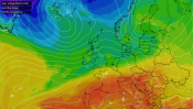
Our weather will be turning hotter, but ultimately staying quite unsettled, thanks to high pressure our east and low pressure to our west. They're going to do a great job of pumping up hot air from the south across the country. But there'll only be a short window where the high is ideally placed to keep fronts and less settled conditions away from our shores.
To start, high pressure is to our south. So today and into Monday, there'll be rain moving in to affect much of Ireland (north and south) and the northwest of Britain. Some of that rain is going to be heavy and potentially thundery too. During tomorrow, as the high starts to edge further north, the wet weather will become limited to the far northwest, chiefly western Scotland.
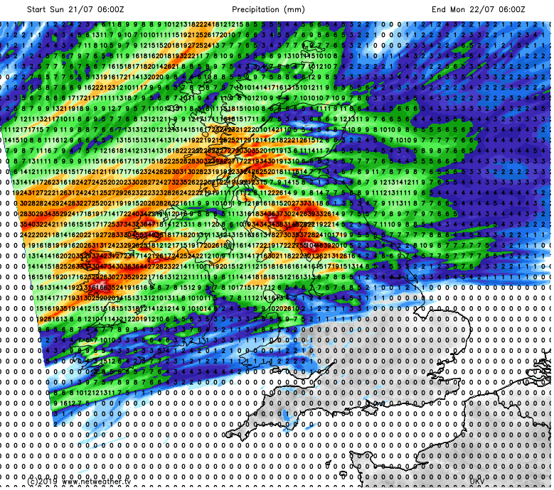
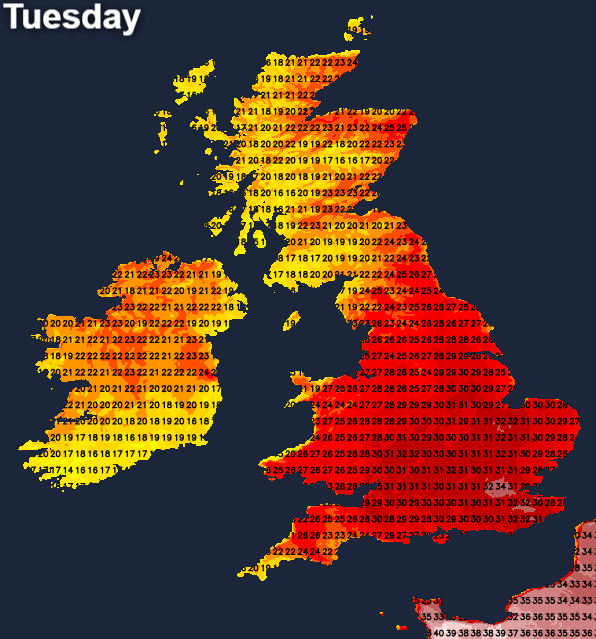
Into Tuesday the stars briefly align with fronts likely to just about be kept at bay. This will allow much of the UK and Ireland to enjoy plenty of dry, often sunny and very warm, if not hot weather. But even with the fronts from the low pressure out in the Atlantic, its proximity may well be enough to fire up some thunderstorms and torrential rain - running up from the southwest into the afternoon and evening.
That could leave a bit of a messy picture behind with a fair bit of residual cloud, and still a few showers and storms on Wednesday. The high at this point will have slipped a tiny bit further east. That'll let the low push a weak weather front in from the west, bringing some fresher air across Ireland and into western Britain. It'll feel sweltering and humid in eastern and central areas though, especially the southeast.
By Thursday, it's still hot and sultry in eastern and central regions. But the front will continue to try to push further east, with the threat of heavy rain and thunderstorms moving erratically east too. By the latter part of the week, low pressure looks likely to move ever closer, pushing a cold front right across the country. That's likely to mean a further risk of storms in the southeast into Friday, along with some wet weather accompanied by blustery winds further north and west.
There is quite a lot of uncertainty from Thursday onward though, so stay tuned through the week for further updates on this.
The heat will peak during Tuesday, Wednesday and Thursday. Maxes will reach up into the low-mid thirties across southern, central and eastern parts of the country. Western regions will see a shorter window of heat with temperatures hitting the high twenties on Tuesday before they subside.
The record temperature for the UK is 38.5c recorded in 2003. It's unlikely to fall this week, but not entirely out of the question. Some models do show temperatures nearing 37-38c in the southeast on Wednesday or Thursday but most peak at around 35c. Regardless though, it's going to be a very hot week, and with high humidity as well it'll feel oppressive.
Across the channel, France is going to be very hot again, perhaps not as hot as it was at the end of June when their temperature record was hammered with a reading of 46c. But Paris, as an example, could beat its record of 40.4c.


.png?w=350)