It's a big day in the sporting calendar and barring an outside risk of a shower or two it'll stay dry for most. A change to less settled weather does arrive next week though.
It's a big sporting day today, with Wimbledon, Silverstone and Lords all having very good prospects of staying dry. There has been some showery rain moving over both Lords and Wimbledon this morning, but they're now dry again and should stay that way. There will be some isolated showers about during the remainder of the day, and although it's a very low risk, Silverstone is perhaps the most liable to see one this afternoon. It may spice things up a bit should it happen, but the likeliest outcome is a dry race.
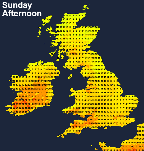
Elsewhere today, it's dry and fine for the vast majority. There is that isolated shower risk, with eastern parts initially, then central and perhaps also southwestern parts most liable to catch one. After a fairly cloudy start, it'll thin and break through the day with temperatures generally rising to a warm enough 18-22c, with the warmest temperatures in the west.
This evening and overnight, most parts stay dry but still with the risk of a shower here and there, especially near to eastern coasts.
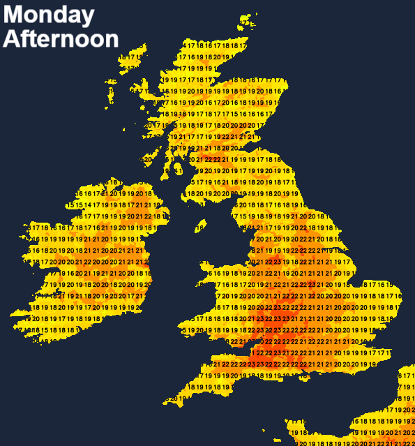
Monday follows with a very similar day to today, so plenty of sunny spells once any early morning low cloud burns away. There will be the risk of a few showers - this time western and perhaps also central regions with the highest chance, but they'll be few and far between. Temperatures will be on a par with today in eastern and central parts, but further west it's expected to be a touch warmer with highs reaching 25c or so in a few spots.
Into Tuesday, we'll see changes just starting to take place, as we being to head downhill toward a less settled spell of weather. What that initial change does is get rid of the onshore breeze which has North Sea coasts and eastern Britain in general cooler of late. That means the east gets in on the warmer act, with temperatures widely heading up into the low-mid twenties. Low pressure will be nearing the northwest at this point though, with the ridge of high pressure which has been over the UK slowly being squeezed away to the south. That brings a less stable atmosphere and a more widespread risk of showers - these generally in the north and west but just about anywhere could catch one.
Wednesday then sees a spell of wind and rain moving in from the northwest, with sunshine and relatively widespread showers ahead of it. It'll still be very warm with sunny spells away from the showers for most of England though.
The changeable weather then continues into the latter part of the week, more showers likely on Thursday and the threat of some more persistent rain moving in from the southwest during Friday.