


Dry & warm for most this weekend, though risk of showers for central areas today. Dry & fine start next week, before turning unsettled from the west.
For some this past week there’s been some downpours, particularly in the north, for others it’s stayed dry most if not all week – especially in the south. However, this weekend high pressure will build in, so for most it will be dry, settled and warm where we have sunshine, though there will still be a few showers around, more especially today down the spine of Britain. However, as we head through next week, we will see a change in our weather, the week starts off fine and dry, but by Tuesday high pressure retreats to allow Atlantic fronts in from the west bringing more unsettled and cooler conditions for the rest of the week, with rain or showers at times, though there will be some drier and sunnier weather at times, especially towards the south and east.
For now, many are off to a cloudy start this morning, there are even some scattered showers across northern and eastern Scotland, large parts of southern England and bits of the Midlands have, however, got off to a sunny start with blue skies.
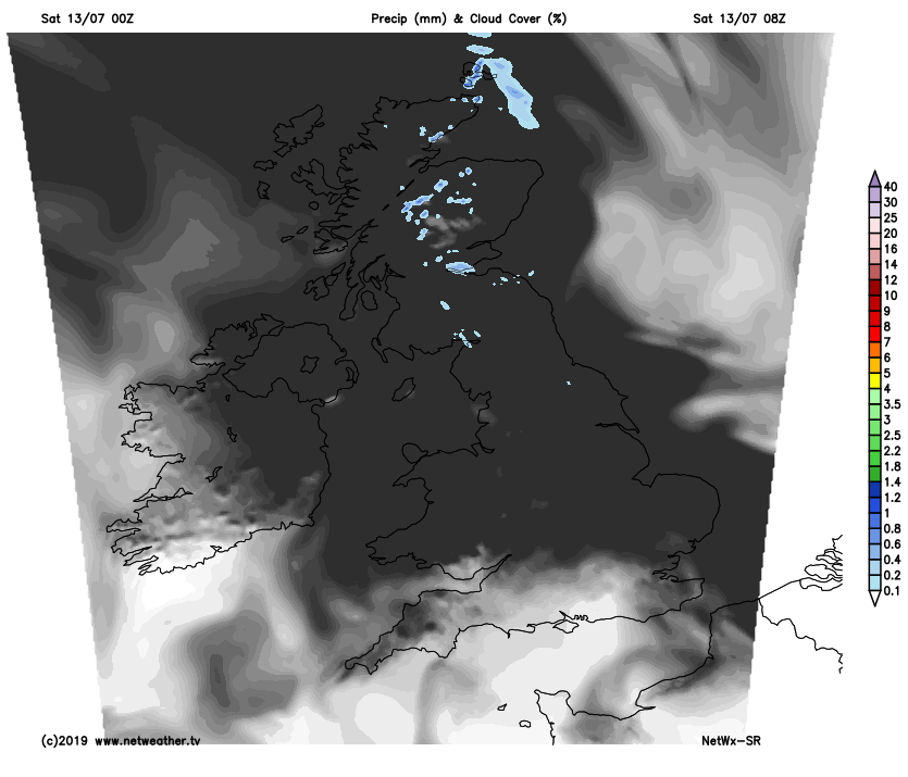
As we go through the morning and into the afternoon, the cloud will tend to break to allow sunny spells to develop if you haven’t already got them and for many it will stay dry and with sunny spells and variable amounts of cloud spilling southeast on the northwesterly breeze. However, showers are expected to develop or continue across eastern Scotland, also developing this afternoon across the Pennines and into parts of the Midlands, with a few isolated showers possible further south towards the Home Counties and London too, but an outside chance of affecting Wimbledon. But for most it will stay dry all day.
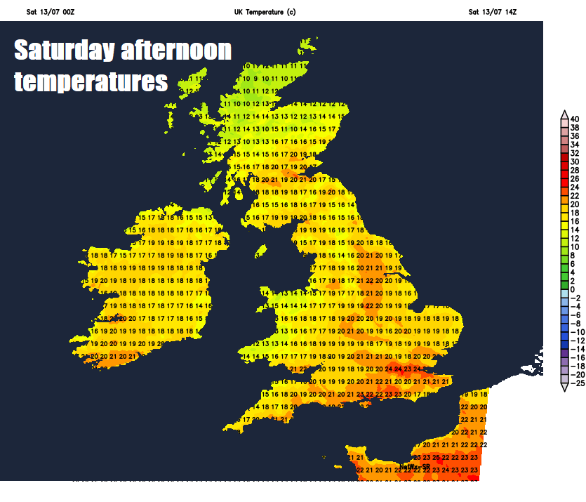
Pleasantly warm in the sunshine today, temperatures reaching 20-24C across England and Wales, though cooler along North Sea coasts where there maybe more stubborn cloud, temperatures reaching 16-20C across Scotland and N. Ireland.
A few showers may linger across central and eastern areas of England this evening and into the first part of the night before gradually fading away, otherwise for many it will be dry overnight with clear spells and patchy areas of cloud. Temperatures falling to around 10-12C in the north, 12-15C in the south.
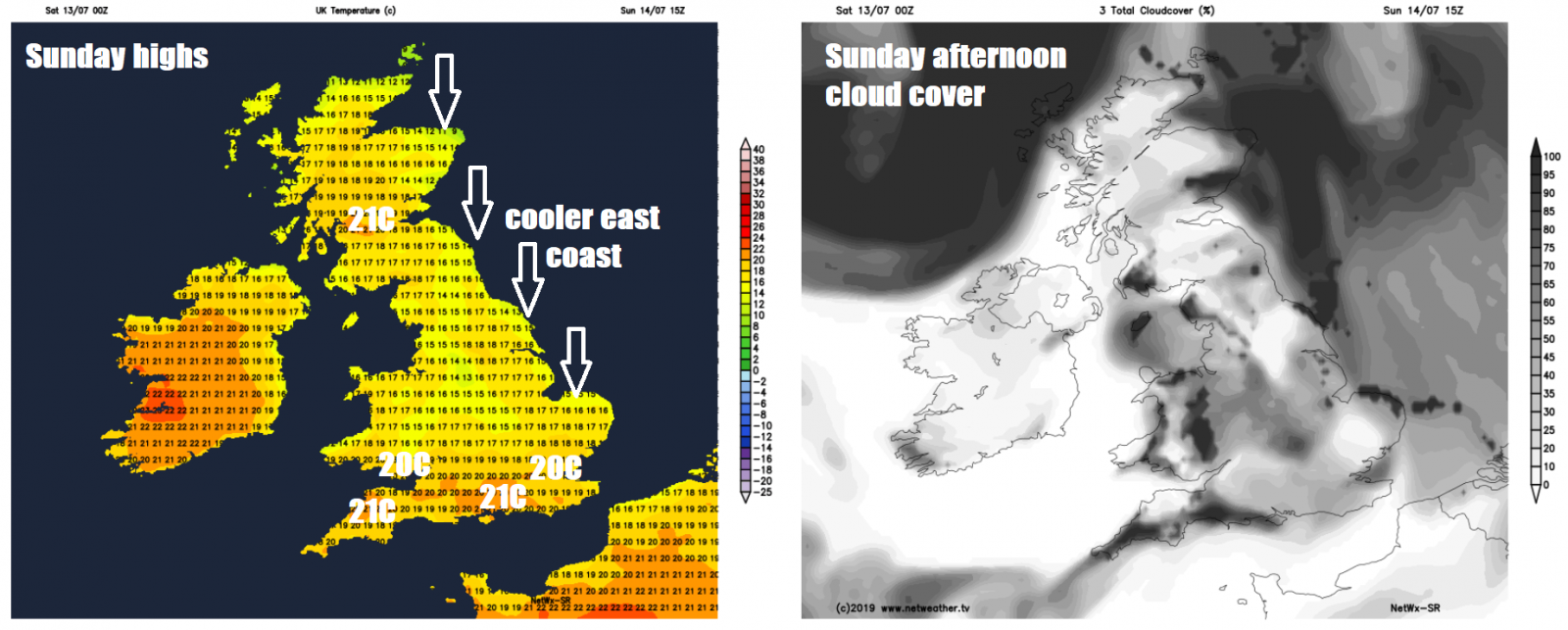
Sunday perhaps off to a rather cloudy start again for many, however, like this morning the cloud should break up to allow sunny spells to develop with many staying dry for much of the day. More of a northerly breeze, so eastern coasts not quite as warm and also cloudier than further west. Just the outside chance of a shower popping up across the south and west. A little cooler than recent days generally in the northerly flow, temperatures reaching 20-22C inland and towards the south and west, but pegged back to 17-18C across eastern coastal areas. It should remain dry for the British Grand Prix at Silverstone, southeast Midlands and the Cricket World Cup at Lord’s in London.
The dry and settled theme will continue for most on Monday, with high pressure slap bang over the UK, with sunny spells and variable cloud, lighter winds along North Sea coasts meaning not so cool here, most areas reaching the low twenties Celsius, a few spots in the south reaching 25C.
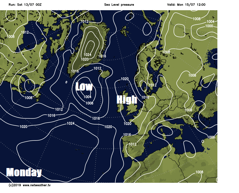
A change from the west as we head through Tuesday though, as high pressure is squeezed towards Scandinavia by low pressure pushing in from the Atlantic, with southwesterly wind picking up and weather fronts bringing showery rain mainly to northern and western areas, SE England and East Anglia probably staying dry, sunny and quite warm, perhaps reaching 25C.
Low pressure moving in close to the northwest on Wednesday will spread cloudy skies and outbreaks of showery rain across much of the north and west during the day – where it will be breezy too. Eastern and parts of southern England perhaps escaping with a largely dry, bright and warm day.
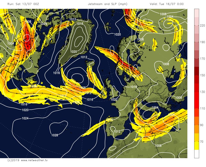
The jet stream will shift into a more southerly track across southern Britain from mid-week, so we could see an area of low pressure cross southern England bringing heavy and persistent rain Thursday into Friday, with showers further north, but too far away to be certain on this outcome for now.


