


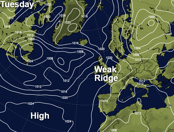
Some of our best summers occur when the Azores high frequently extends a ridge across our shores. This is the case at the moment, but unfortunately, the ridge is weak, allowing Atlantic systems to encroach.
Some of our best summers occur when the Azores high frequently extends a ridge across our shores. This is the case at the moment, but unfortunately, the ridge is weak, allowing Atlantic systems to encroach occasionally.
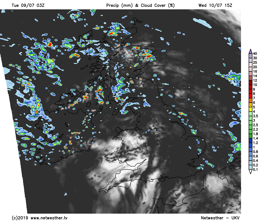
These are already affecting northern areas giving bursts of rain, some of which is heavy over Scotland and Northern Ireland. The rain will be on and off through the day and could well cause interruptions at the World Cup Cricket at Old Trafford. Although across northern England much of the rain is lighter and patchy, with the odd heavier shower breaking out through the afternoon.
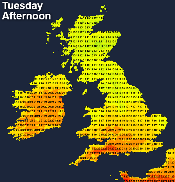
There's also a lot of cloud further South with some light showers over eastern England, but it's drier here generally. There's even some sunshine in the South West, but in a mixed day, it'll often be cloudy with the best of the sunny intervals over South Wales and the West Country. Through the day the emphasis over central and southern parts will be on dry weather, but the Midlands and North Wales will see a few showers. The odd sharper shower could also develop in the East later this afternoon, with Wimbledon too possibly catching a shower. Winds generally will be light, with top temperatures 20 to 24C in the South and 14 to 19C in the North.
We keep the North/South split into the evening and overnight, with Scotland, Northern Ireland and mostly the far North of England seeing further showery outbreaks locally heavy. Further South there'll also be a few showers mainly East of the Pennines into the evening. But skies will break to give a few clear intervals, mostly in central and southern parts. Here it'll be mainly dry although, towards morning, western areas may see a few showers. It'll be a mild night in light winds, with a few short-lived mist or fog patches in rural regions around dawn, as temperatures fall mostly to between 10 and 14C.
Scotland and Northern Ireland remain cloudy on Wednesday with further showers. There'll be brighter, drier intervals, but some of the showers will be heavy giving thunder during the afternoon. In a mixed day across England and Wales with best of the sunshine will be in the South, but cloud amounts will vary. There'll also be a greater risk of catching a shower which could turn heavy in the East later perhaps with thunder. Wimbledon could be affected, but the showers will be 'hit and miss' with some places mostly in the South and South West staying dry.
It'll become very warm in some central and southern parts where you see the best of the sunshine, with top temperatures across England and Wales in the range 20 to 25C. Over Scotland and Northern Ireland however, 14 to 18C is about the best you can expect in a mostly light or moderate South Westerly breeze.
Little change is expected into the evening with showers dotted about, some heavy and thundery over Scotland and eastern England at first. The showers will continue over Scotland after dark but should become lighter and fewer over England and Wales for a time. This'll allow skies to break and where these occur for any length of time. Light winds may encourage a few mist or fog patches to form in rural areas towards dawn, but these will be short-lived. During the early hours, Northern Ireland may see further bursts of rain moving in that could be heavy. It'll be another mild night though when temperatures generally shouldn't fall below 10 to 15C.


