Cloudier & cooler north next few days, with rain spreading south and turning showery. The south sunny and warm, hot in the southeast tomorrow, perhaps 26-27C.
Thursday and Friday will see a north-south split in weather fortunes, with Scotland and N. Ireland cloudy and cooler today - with rain affecting Scotland, while most of England and Wales dry, sunny and warm. Similar in the south again tomorrow – perhaps a little warmer, reaching 26C in the southeast, the north will see cooler and cloudier conditions with patchy rain spreading south. A cold front with cloudier skies and a few showers will reach the south on Saturday, cooler but sunnier conditions following further north. Sunday’s looks to start sunny, but cloud will increase with a few showers in the east.
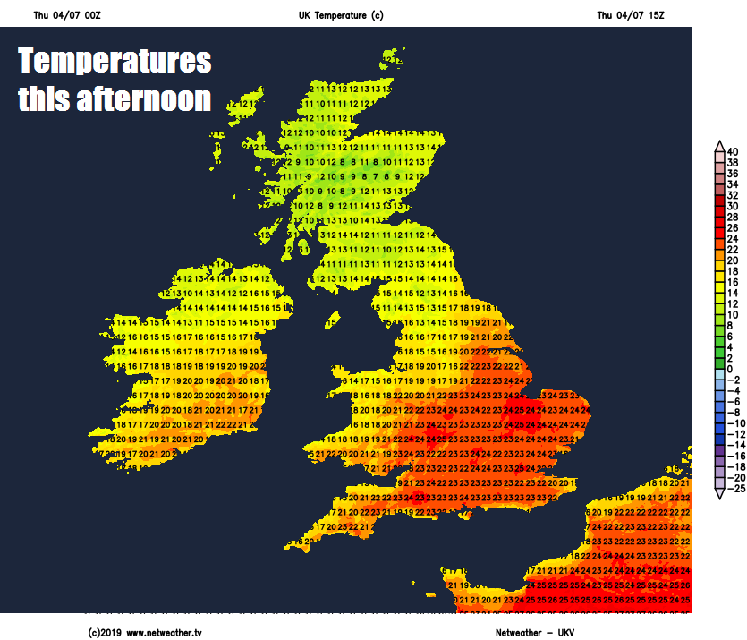
Back to today, north of a line from Liverpool to Hull will be on the cloudy, breezy and cool side today. Some sunny spells possible across far north of England, southern Scotland and N. Ireland – where it will stay mostly dry too, but for northern Scotland – thicker cloud will produce outbreaks of rain, which will be heavy and persistent towards the northwest, patchy across the northeast. Temperatures here reaching 14-16C where cloud persists, perhaps up to 19C where the sun comes out.
Further south across much of England and Wales it will be another fine day with blue skies and warm sunshine, temperatures widely reaching the low-to-mid-twenties, 24C in Manchester, Birmingham and Hull, 25C in London.
Persistent rain easing across NW Scotland as it reaches the central belt in the evening and southern Scotland overnight and becomes more showery in nature. Increasing cloud over northern England, clearer spells further south, otherwise staying largely dry across England and Wales tonight.
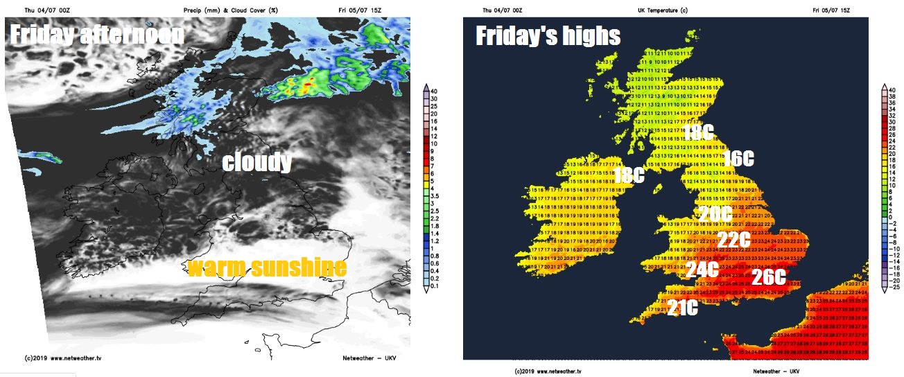
Friday sees weakening fronts drop down towards northern England and N. Ireland, bringing cloudier skies, showery outbreaks of rain and a freshening northwesterly breeze here and further north across Scotland through much of the day. Further south, another fine and sunny day, if anything, even warmer across the south, thanks to light winds, highs of 26-27 possible for the southeast, generally 20-24C away from far north of England, N. Ireland and Scotland – where highs of 14-19C will be more typical.
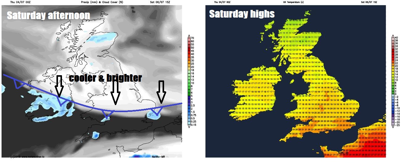
A cold front will start to push down across northern areas Friday night, with some showery rain along it, clearer but cooler conditions following. The front then continues south across England and Wales on Saturday, bringing a band of cloud and the odd showery burst of rain reaching southern areas by the afternoon. Cooler, drier and sunnier conditions following on further north, though a few showers possible for northern Scotland. Temperatures reaching 13-17C across Scotland and N. Ireland, 17-22C across England and Wales, though cooler towards North Sea coasts where there’ll be a brisk northerly wind.
Sunday looks like seeing a dry and sunny start for many, then turning cloudier through the day, with a few showers developing towards eastern areas, the west stay mostly dry with the best chance of sunshine into the afternoon. Temperatures ranging from 16-17C in the north to 20-22C in the south.
High pressure looks like building in across the UK from the west early next week, so most places fine, dry and sunny by day and becoming warmer across the south. Cloud and rain could affect the far northwest though. Through the week there are signs that more unsettled and breezier conditions will spread eastwards across most parts by Thursday, but a long way off to be certain.