Fresher, less humid conditions but with showers for all parts Thursday, drier on Friday & Saturday. Turning increasingly warm or hot & humid into next week.
The southeast corner of England saw some lively thunderstorms earlier this week, as warm humid air over the near continent moving north clashed with cooler air aloft moving in from the west. The unstable and humid air over eastern England has gone as cold front moving in from the west introduces cooler and fresher conditions for the rest of the week. A few showers are likely today, but high pressure will build in on Friday and hold fast into the weekend, bringing dry and fine conditions, though low pressure returns to the west on Sunday – threatening western areas with thundery showers by then. The good news is it will continue to warm up into the mid-to-high 20s next week, but with it a risk of thundery downpours.
Coastal areas of East Sussex, Kent and coastal areas of East Anglia were treated to a spectacular lightning display last night, as some strong thunderstorms tracked northeast, leaving homes without power, but also producing locally torrential rain and hail, leading to flooded roads. Lenham in Kent seeing 42mm of rain.
Thursday
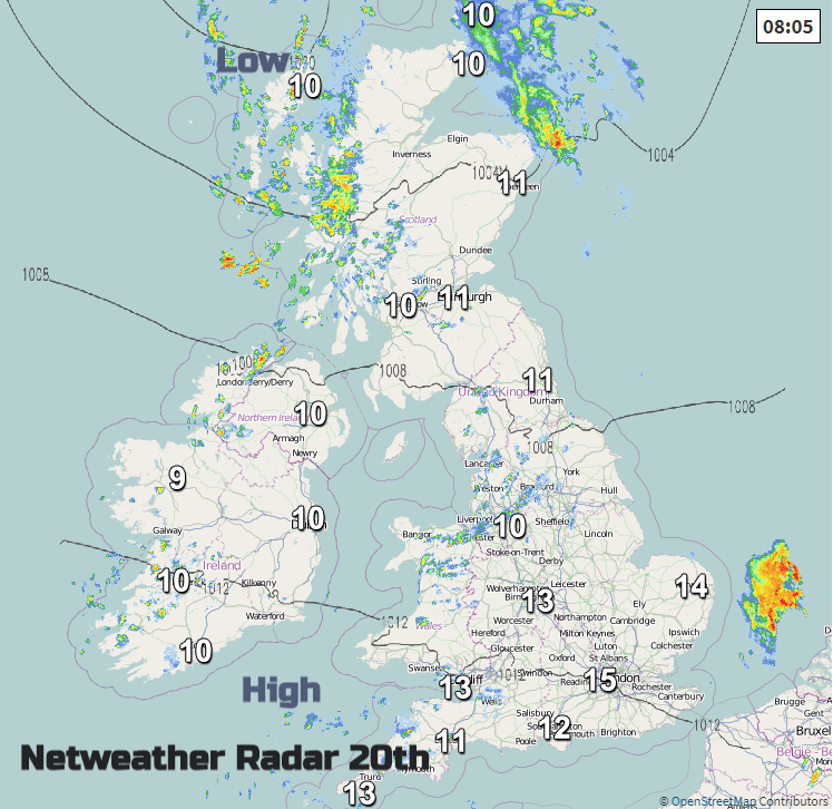
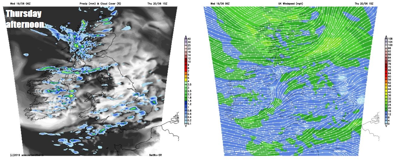
A fresher and sunnier day for all on today, however, there will be showers blowing through on a stiff westerly breeze, but some good spells of strong June sunshine between the showers. Some places only seeing one or two showers in the east. The showers will be heaviest and most frequent across the northern parts, where they could turn thundery. Temperatures ranging from 13-17C across Scotland and N. Ireland to 16-19C across England and Wales.
Friday is the Summer Solstice and in a timely manner for a change, high pressure will build in from the south during the day, so although there will be some showers at first affecting mostly northern and northwestern parts, many places will be or become dry and fine through the day. Just a few showers may keep going in the far northwest. Temperatures reaching a reasonable 14-18C in the north, 17-21C in the south and with lighter winds it will feel warmer too.
High pressure will build from the south Friday and into Saturday, before low pressure gains influence in the southwest on Sunday:
High pressure still in charge taking us into Saturday, so most places staying dry and fine with decent sunny spells, with any showers confined to the far north, temperatures up a notch on Friday’s – reaching 18C in the north to 22C in the south. Sunday may start dry and fine for many, however low pressure out to the west will start to make its presence known by bringing in fronts across the west which will bring some heavy and thundery rain. Eastern areas likely staying dry, bright and warm, with a southeasterly flow lifting temperatures as high as 22-24C in the south.
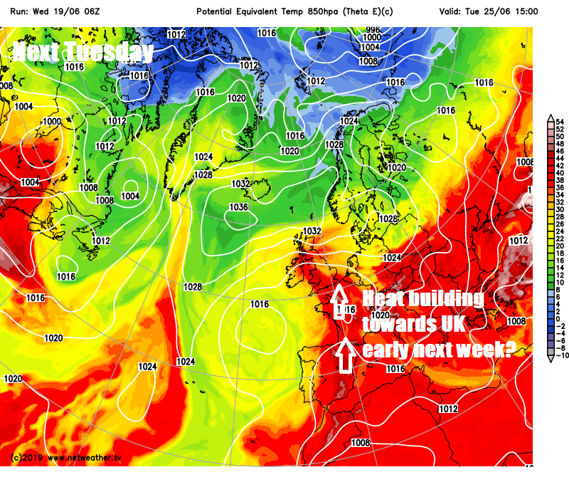
With low pressure indicated by the models to stall out to the southwest next week and pulling in a warm and humid airmass off the near continent, it could become very warm next week, with temperatures perhaps reaching the mid-to-high 20s degrees Celsius. But with it perhaps a risk of thundery downpours too.