After a sodden week, some improvement this weekend with some sunny spells, but still some heavy showers around. Next week sees rising temperatures but more rain as well.
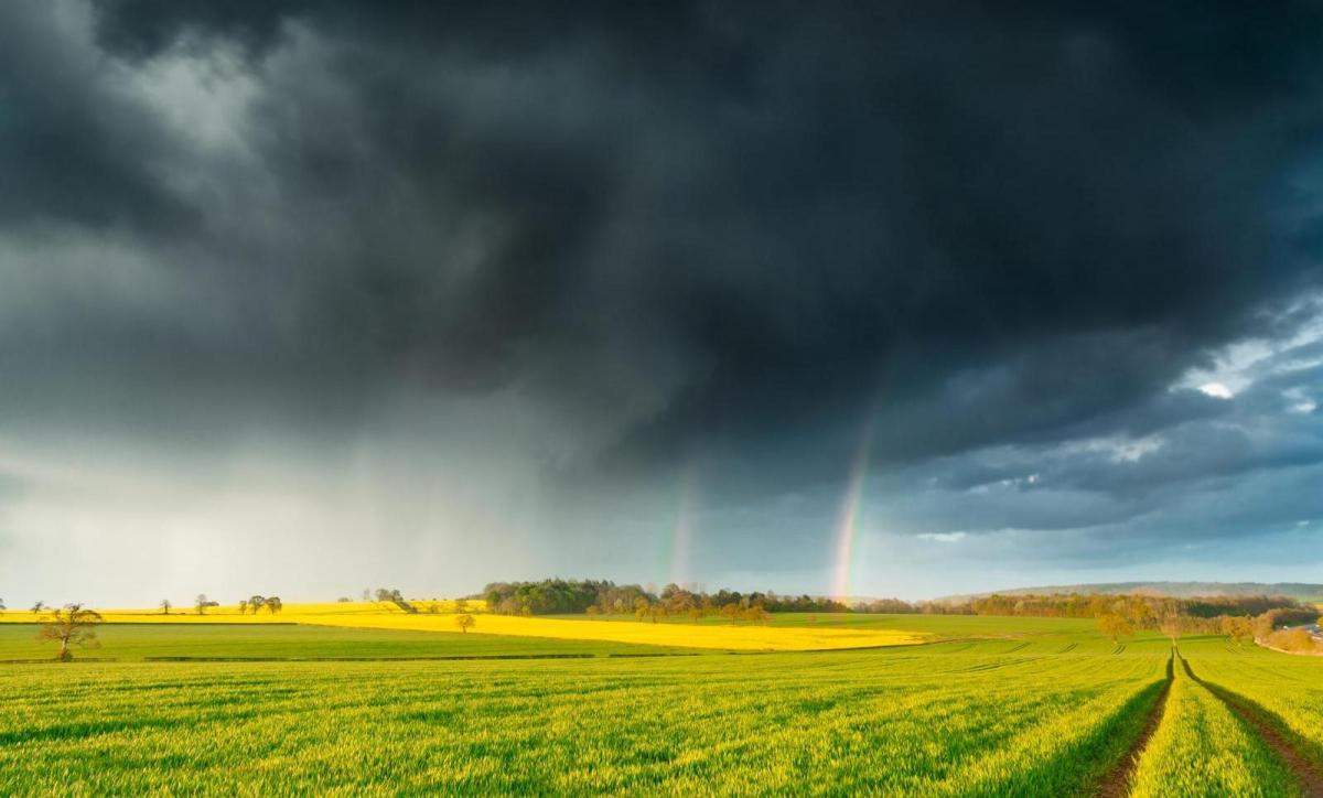
Well, that was quite the week. Torrential rain, flooding, some thunderstorms mixed in, and it's been cool as well. Not exactly the summer heatwave that certain tabloids had been promising. This weekend sees some improvement with some sunny spells, and it'll be warmer in the east. But there will still be some wet weather about, mostly in the form of showers, and some will be heavy.
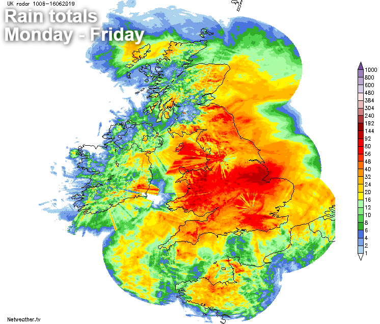
The rain totals over the past five days show the wettest areas very well. Lincolnshire has seen the broadest swathe of very wet weather, with totals comfortably over 100mm in some places. The average monthly rainfall in England in June is 61mm.
We have a couple of low pressures on the scene today. The main one, out to the northwest of the UK was responsible for a lot of the rain in the east of the country earlier in the week, having done a tour around the UK. The second one is smaller and is orbiting around the primary low. Swinging up from the southwest today, and up through the Irish channel to be in northwest Scotland tomorrow, before heading away north.
That second low is pushing a front in from the West today, bringing with it some showery rain. Through the day, the front will continue northeast, with some heavier bursts of rain developing on it. Ahead and behind it, there'll be some sunny or bright spells but with a scattering of showers getting going.
It'll be the warmest today in the east, where it may touch 20c in the southeast and East Anglia. Typically though, it'll be 15-18c in eastern areas, 13-16c elsewhere.
This evening and overnight, many of the showers will die away. But they're likely to merge into a more persistent area of rain across the north of Scotland. Sunday morning should see that rain eventually clear, leaving everyone with a day of sunshine and showers. Like today, some of those showers will be heavy and potentially thundery, but they will be reasonably well scattered. Temperatures on Sunday will be very similar to Saturday's values.
Monday, surprise surprise, will be another day of sunny spells and showery rain. But, most of these showers are likely to be across the northern half of the country, where they'll also be heaviest. Further south, there'll be some around but fewer and further between. It'll be warmer too for much of England and Wales, with the high teens likely in many spots. Eastern and especially southeastern England will be warmest with highs of 20-22c. Under the more showery skies further north though, the mid-teens will be about your lot.
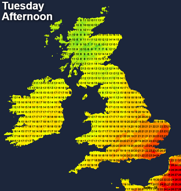
By Tuesday, even the showery north should start to see the sunny spells outweigh the showers to leave most parts dry away from the far northwest. It'll be warmer again, with highs perhaps touching into the mid-twenties in the southeast. That may trigger a thunderstorm or heavy shower later in the day though.
Wednesday sees some real model divergence at the moment, so confidence is low. There does look likely to be some thundery downpours pushing up from the south, but pinpointing those at this range is tricky. It could be the warmest day of the week in the south with maxes above 25c in some parts, but equally the cloud and wet weather could keep a lid on temperatures.
Into the latter part of the week, we're virtually back to square one, with sunshine and (some sharp) showers the main weather type.