Feeling fresh for Bank Holiday Monday with sunshine and showers. Spells of rain from the west this week but settling down and much warmer by next weekend. Improving if you are on May half term.
It’s a Bank Holiday Monday and it’s not that warm. However, by next weekend there are signs in the forecast of heat for the start of June. Hope, if you are on half term holidays this week! Today will feel quite fresh for a lot of the UK, although southern and central England will reach 18C and it will feel warm enough in sheltered sunshine. Worth keeping out of the breeze this afternoon. There are already plenty of showers from the northwest and north and the flow from the Atlantic keeps on coming all day.
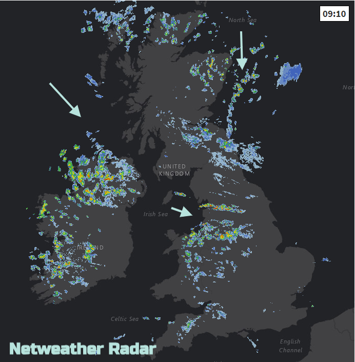
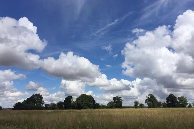
Some areas will stay dry today, others seeing lots of showers. Northern Ireland looks prone as does parts of Scotland and northern England, also Wales. You might see the sky darkening as a shower approaches, the winds pick up and it will feel cooler, then a downpour or one in the distance and back to bright sunshine. They come and they go.
It’s probably what a Bank Holiday in May would usually be like, although we had the cold early May Bank Holiday and the warm sunshine at Easter.
The showers ease off tonight, will a few lingering for Wales and eastern Britain. The westerly winds veer more to the north and there will be a touch of frost about in the far north.
Tuesday will feel cooler first thing, you can’t rely on May. Wales and Northern Ireland look drier and sunny on Tuesday. Much of western Britain should have a fine afternoon as the speckling of showers continues elsewhere. The north to NW winds ease off, apart from for Cornwall and Devon where there will be a chilly brisk wind.
So at least for those back to work, it’s not a warm sunny day that you are missing out on. For those on half term holidays, it’s not raining all day.
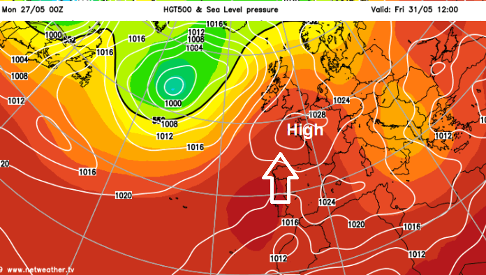
For the rest of the week, high pressure is trying to build in from the south, so that would bring more settled drier conditions. It has to work against a low in the north and then one to the west or NW.
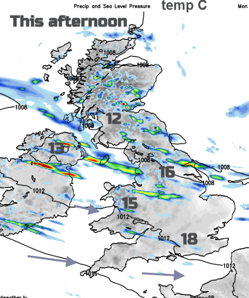
Midweek frontal bands reach in from the Atlantic bringing rain over Ireland by Tuesday night. This skirts over southern Britain on Wednesday before warmer air heads our way later in the week. It looks like there will be more rain from the west with the warmer more humid air pulled up from the SW. Temperatures begin to rise into the twenties Celsius.
The approaching rain gets further north each day, so across a large central swathe of the UK on Thursday and then Northern Ireland and Scotland by Friday.
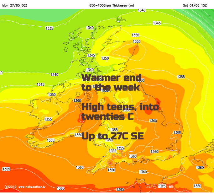
The temperatures should climb as the week progresses, high teens, well into the twenties C by Saturday and if the high in the south remains, it could be even warmer by Sunday.