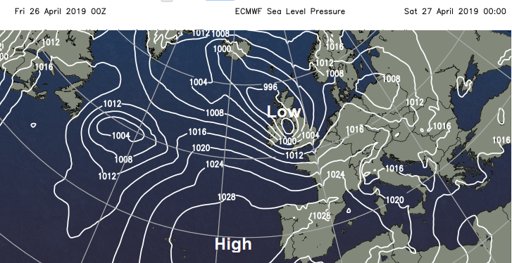
A named low pressure #StormHannah will bring strong winds and gales through Friday night into Saturday with welcome rain for farmers and growers. Feeling colder this weekend in the brisk winds.
We're well into a particularly unsettled spell of weather at the moment and a cooler one too. We also have storm 'Hannah' crossing England and Wales tomorrow, with warnings of severe damaging gales tonight and into Saturday for the South. This'll bring further welcome rain for the growers, but much of it will be of a showery nature with some getting more others, before mainly dry conditions return before the end of the month.
Although we currently have showers over southern Scotland some heavy, much of Scotland together with central and eastern areas are waking to a bright but chilly start. Here there'll be some sunshine this morning but it won't last, with outbreaks of rain already across the South West , Wales and Northern Ireland moving steadily North and East across the country. The rain becomes showery as it moves into eastern areas this afternoon, when some of showers could be heavy perhaps with thunder. Across the North East, however, much of the day should be dry, with the North and East of Scotland just seeing scattered showers. During the afternoon Northern Ireland, Wales and the South West should turn brighter, but the respite will be brief. A mostly moderate southerly wind will freshen a little through the day making it feel chilly in rain, with top temperatures 11 to 13C in the North and 14 to 16C in the South.
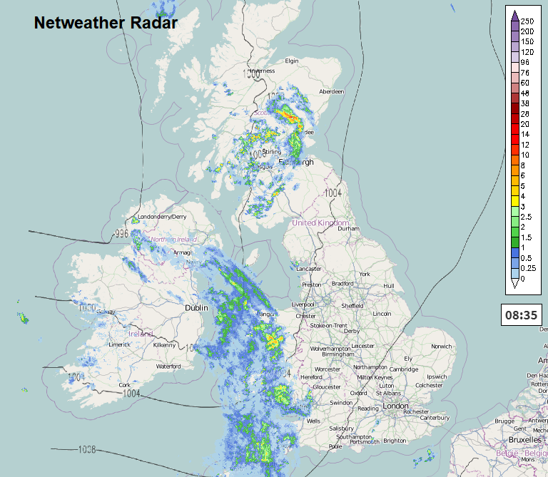
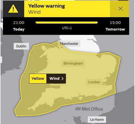
Central and eastern areas see showers into the evening, followed by a brief lull. North of the border there are further scattered showers, with southern Scotland turning wet overnight. Meanwhile Northern Ireland and western areas will have already turned wet by the evening, as storm 'Hannah' moves in. This'll bring outbreaks of rain heavy in places accompanied by a strong South East or southerly wind, which will spread to much of England and Wales overnight. Across Northern Ireland a fresh or strong North West wind later will give gales along exposed coasts, with the South West and Wales particularly Dyfed seeing a severe gale by the early hours. Damaging gusts of 60 to 65mph are possible, this spreading to parts of central southern England by morning. It won't be a cold night though, with minimum temperatures in the range 6 to 9C.
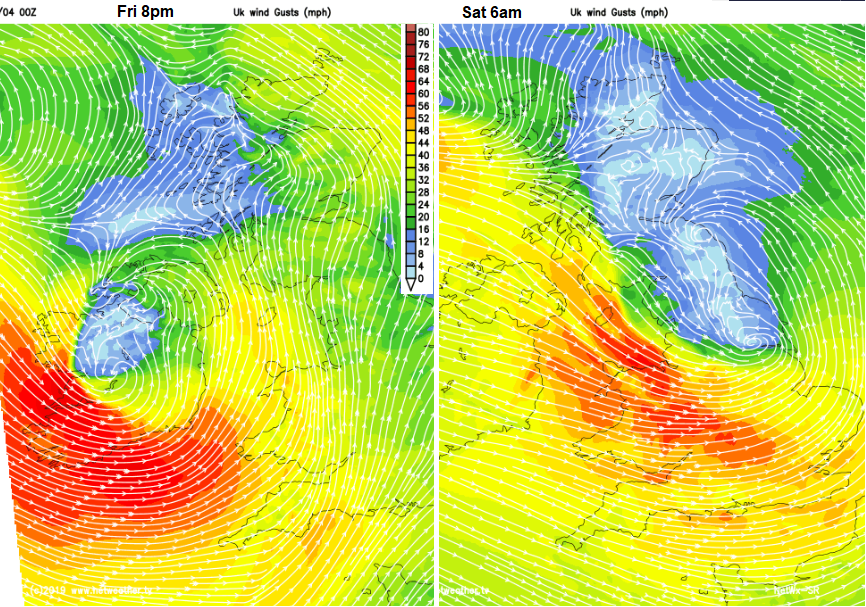
Storm 'Hannah' will dominate Saturday over much of England, Wales and at first Northern Ireland, in a very unsettled start to the weekend. There'll be showers and longer spells of rain heavy in places, accompanied by gusty winds. Across the South a Westerly gale could give damaging gusts of up to 70 mph for a while, along English Channel coasts and across the Isle of Wight. Over Scotland and the far North of England winds should be somewhat lighter, but there'll be showers here too some prolonged, but also a few sunny intervals. Later Northern Ireland should become brighter as a North West or Westerly wind begins to decrease in a cool day for late April across the country, with temperatures generally getting no higher than 10 to 12C.
The evening brings further showers to Scotland that should begin to clear from the West overnight. Eastern parts of England could also be quite wet for a time into the evening, in a blustery and quite cold North or North Westerly wind. As storm 'Hannah' begins to 'fill' and move away into the North Sea however, the weather will be improving overnight from the West, with Northern Ireland in particular seeing clearing skies towards morning. As skies clear and a cold North Westerly wind decreases, some sheltered rural parts of Northern Ireland and Wales could see a touch of grass frost by dawn, when temperatures should be mostly in the range 2 to 6C.
Chat about Storm Hannah on the Netweather community forum.