


A look at where our warm air is coming from over the next few days, the top temperatures expected for quite a stunning Easter Weekend.
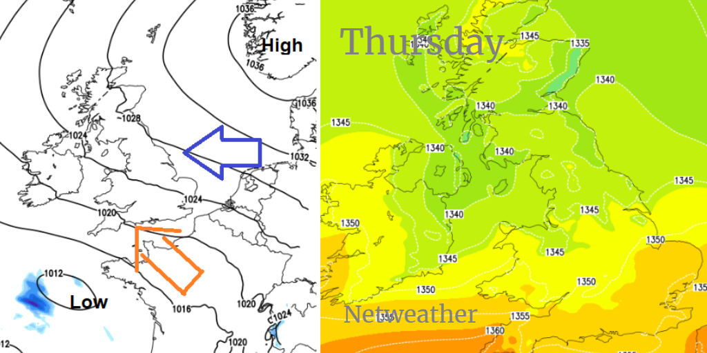
You've probably already heard that this Bank Holiday weekend is going to be warm with plenty of dry and sunny weather. Temperatures on Thursday have already reached into the high teens and low twenties Celsius. There has still been a cool easterly flow off the chilly North Sea into eastern Britain and the Irish Sea over Northern Ireland, but it has already been fine and bright and that looks set to continue.
Good Friday
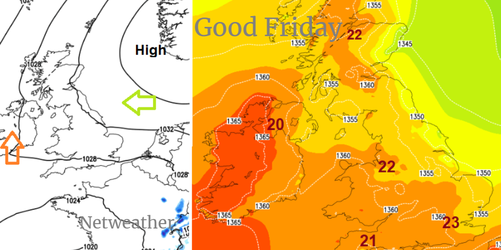
Warmer air reaches up through Ireland and western Britain as the easterly wind starts to ease. High pressure over Scandinavia keeps our UK weather steady and dry.
Saturday
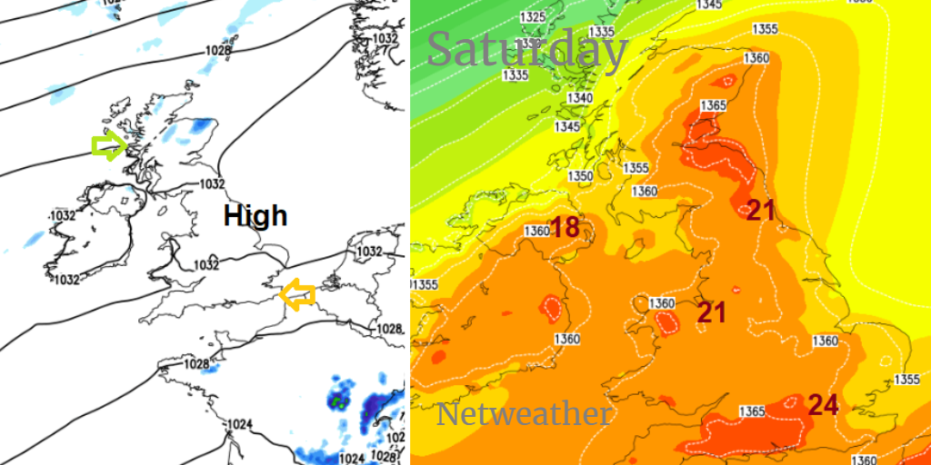
Temperatures could reach into the mid twenties this weekend as the winds fall light. There will be plenty of blue skies and sunshine, warmth and fine weather. Tree pollen levels will be moderate to high, air pollution levels have already been rising and do remember your sunscreen. A weekend outdoors in the sunshine could be a shock to bare skin after the winter months. A few showers are appearing on the charts from the far NW, so if your weather app is showing a shower symbol, it is from this risk. Lines of showers over Northern Ireland Saturday afternoon and northern Britain by the afternoon but well scattered and missing most people. Just not completely dry.
Easter Sunday
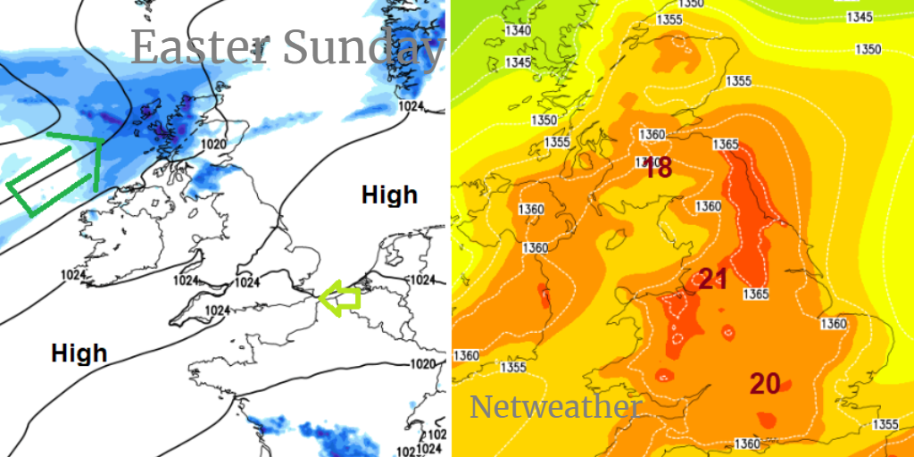
Still the risk of more cloud and patchy rain into NW Scotland on Sunday, maybe affecting Northern Ireland and more of Scotland during the day. Still fine elsewhere.
Easter Monday
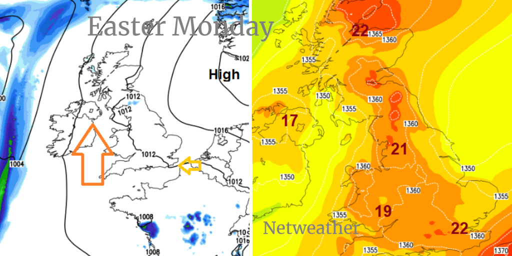
it now looks like the high pressure pushes any frontal bands away to the west, bringing another fine, sunny and warm day to the UK for Easter Monday. Northern Britain and Northern Ireland look blustery with a moderate to fresh SE wind.
Very little rain across the UK, even into next week as the above average temperatures remain for the end of April. May might be a different tale so enjoy this Bank Holiday for now.


