


Cloudy and chilly start to the new week, with some rain in the south and west by Tuesday, but drier, sunnier and warmer from mid-week and into the Easter Weekend.

After a frosty and sunny start for many today, there will be more in the way of cloud building in compared to yesterday and, if anything, it will be even colder than yesterday in the easterly wind. Monday will again be chilly, but dry with some sunshine for most, away from the far west – where we could see some rain. Tuesday is looking a rather cloudy day, with some rain across the south and west, but it will be milder away from the northeast as winds switch to a southeasterly. Mid-week onwards high pressure over Scandinavia will re-assert itself, bringing a return to sunnier weather, but with the flow off the near continent rather than NE Europe, unlike this weekend, temperatures will be on the rise as we head towards and into the Easter Weekend, with temperatures reaching the high reens.
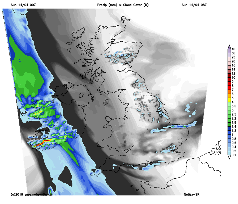
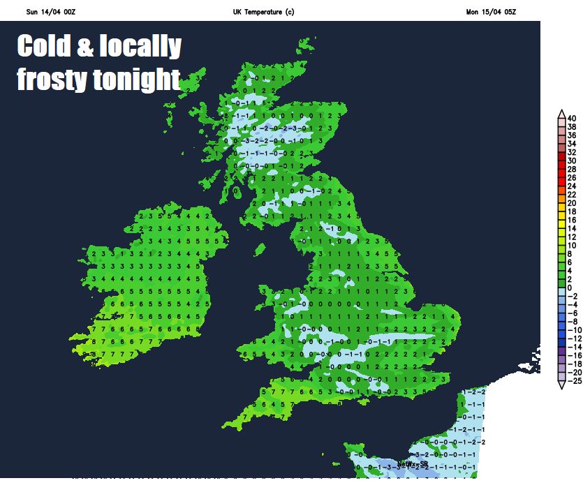
For now, it’s another cold start to Sunday, frosty for many, temperatures lowest across central and southern parts of England, as low as -3C in a few spots in the Midlands at 7am. After a dry, bright or sunny start for many, cloud will build through the day across many areas, thick enough across the east this afternoon to produce a few showers, the best of the sunny spells away from eastern coastal areas. Thicker cloud across the far west too in association with a weather front over Ireland, which will produce some patchy rain across Cornwall along with Pembrokeshire and western parts of Northern Ireland later. But for most it will stay dry and fine today.
Unseasonably cold for the time of year though in the cool easterly breeze, which will be strong in the west, temperatures reaching 7-8C at best along the east coast, 9-10C elsewhere.
Cloud today will tend to break to allow clearer skies to develop across many areas tonight, which will allow a widespread frost to develop again, though mostly from the Midlands north. Windy in the far west where there will also be cloudier skies and some rain over Ireland and SW approaches of the Atlantic threatening Cornwall and Pembrokeshire.
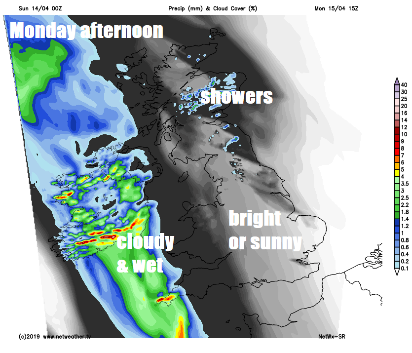
Mostly dry with sunny spells for many on Monday, away from eastern coastal areas – where it will be cloudier with a few showers and across the far west where thicker cloud will bring some patchy rain to Devon, Cornwall, west Wales, Ireland and Northern Ireland through the day. Another chilly day, though not as cold as today, temperatures reaching 9-12C generally, though milder in the southeast with 13-14C possible here.
Some subtle changes in the pressure patterns as we head through the rest of the week. Low pressure will continue to stay to the west and south and high pressure to the east, but with a southeasterly flow off the near continent rather than from the east out of a cold NE Europe, there will be a rise in temperatures through the rest of the week.
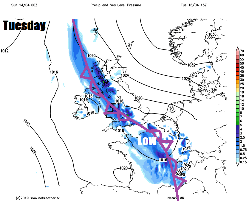
Tuesday looks generally cloudy, as a diagonally-aligned occluded front slides slow east across England and Wales, bringing a band of increasingly patchy rain in across western Scotland, Wales, Midlands and parts of southern England through the day. Best chance of some sunshine will be in the northeast. Compensation for the cloud will be that it’s milder – temperatures reaching 11-15C.
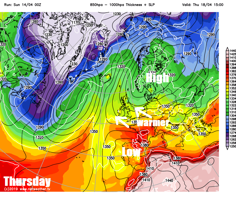
Wednesday to Friday see high pressure that’s been over Scandinavia for a while extends back west again. Wednesday could be cloudy with a few showers across the south, due to low pressure over the near continent, otherwise most parts turning sunnier and staying dry for the rest of the week. With the southeasterly flow off the near continent too, it will be warmer than of late, temperatures rising into the mid teens widely, perhaps high teens locally, with most areas frost-free overnight too.
The long Easter Weekend, for now, looks to be dominated by high pressure close to the northeast, so settled, dry and sunny most likely the weather and pleasantly warm too, with temperatures in the mid-to-high teens.


