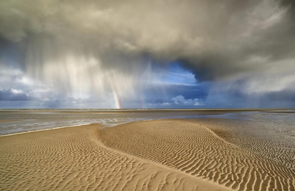
After a very wet, windy and for Scotland, wintry Saturday, Sunday brings a day of sunshine and showers. Next week, with the jet stream moving north, high pressure will build from the south.
After the wet, stormy weather of yesterday, Sunday brings much brighter conditions with some sunshine for all.
For much of the Midlands, East Anglia and the South East it's a fine start, but elsewhere we have a scattering of blustery showers. A few especially over Northern Ireland are heavy at the moment, with all parts at risk of catching a shower through the day, some falling as hail or sleet in places possibly giving a crack of thunder.
There'll also be some snow on hills as far south as the Peak District, with snow falling at lower levels over parts of Scotland and in the North at first. Such is the nature of showers however that some places will miss them, with parts of central, southern and eastern England most likely to stay dry where the showers will be few and far between.
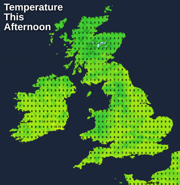
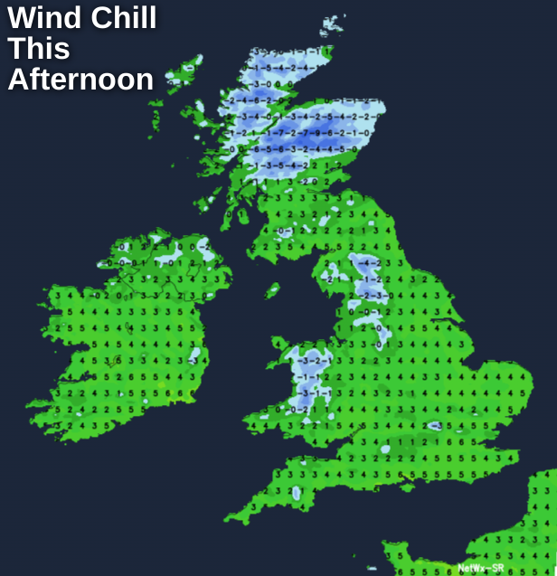
Although not as blustery as yesterday a raw North Westerly wind will still be gusting to 45 or 50 mph over exposed North Sea coasts of East Scotland at first, before moderating a little through the day. As a result, it'll be colder especially over England and Wales, with top temperatures only 4 to 7C over Scotland and 8 or 9 locally 10C further south.
There’ll continue to be a scattering of locally wintry showers mostly across eastern parts into the evening, but as pressure steadily rises, the showers will fade overnight. A raw North West wind will also decrease, before ‘backing’ South Westerly across Northern Ireland. Here there'll be cloud, milder air and further showers moving in, that'll be 'knocking on the door' of the Western Isles and other more western areas by morning. Elsewhere clearing skies will lead to a slight frost particularly in rural areas, with icy patches forming on any untreated surfaces left wet by showers, as temperatures fall mostly to between –2 and +3C.
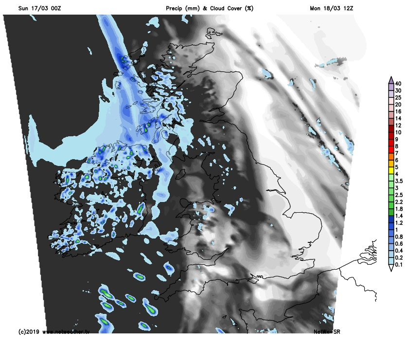
After a frosty start in places, the new working week begins fine with sunny spells across the bulk of England, Wales and Scotland. It’ll also be mainly dry once residual locally wintry showers have cleared from Norfolk and the East coast. Western parts will see more cloud, with patchy rain across Northern Ireland, spreading to West Scotland parts of North West England and West Wales through Monday.
 Despite the sunshine further East it’ll continue to feel chilly in a mostly moderate or fresh West or South Westerly wind, with maximum temperatures mainly in the range 8 to 11C but locally 12C in the South and across sheltered parts of Down and Armagh.
After dark eastern parts should see clear spells and with lighter breezes, it may turn cold enough for a ground frost as temperatures fall to 2 or 3C and perhaps close to freezing in some rural areas. Later in the night though it'll tend to cloud over from the West lifting temperatures again but it should stay dry. Elsewhere it’ll be milder, with the temperature not falling below 7 or 8C in a moist mostly moderate or fresh South West wind that’ll bring a good deal cloud. This’ll be thick enough to give further mainly light rain or drizzle, chiefly across Northern Ireland, the North and West of Scotland and in the West, where it’ll turn misty with patches of hill and coastal fog perhaps forming by morning.
It’s been a very wet and windy March so far, but we’re in for a change, as the Jet Stream takes a more northerly track into the new working week.
This’ll allow pressure to continue to rise from the South bringing drier, quieter conditions particularly to England and Wales, while the North and West of Scotland seem likely to remain somewhat unsettled and at times windy. It’ll probably be rather cloudy across England and Wales for a while though, before spring really arrives later in the week to give some rather warm afternoons, but also cold nights with mist, patchy fog and slight frosts.